Cedar Rapids - The Eastern Iowa
Airport details
| Country | United States of America |
| State | Iowa |
| Region | K3 |
| Airspace | Chicago Ctr |
| Municipality | Cedar Rapids |
| Elevation | 869ft (265m) |
| Timezone | GMT -6 |
| Coordinates | 41.88469, -91.71080 |
| Magnetic var | |
| Type | land |
| Available since | X-Plane v10.40 |
| ICAO code | KCID |
| IATA code | CID |
| FAA code | CID |
Communication
| The Eastern Iowa ATIS | 124.150 |
| The Eastern Iowa CTAF | 118.700 |
| The Eastern Iowa UNICOM | 122.950 |
| The Eastern Iowa Clearance DEL | 125.450 |
| The Eastern Iowa Ground Control | 121.600 |
| The Eastern Iowa Tower | 118.700 |
| The Eastern Iowa Approach/Departure | 119.050 |
| The Eastern Iowa Approach/Departure | 119.700 |
| The Eastern Iowa Approach/Departure | 134.050 |
| The Eastern Iowa Approach/Departure | 118.700 |
Approach frequencies
| ILS-cat-I | RW09 | 109.3 | 18.00mi |
| ILS-cat-I | RW27 | 111.3 | 18.00mi |
| 3° GS | RW09 | 109.3 | 18.00mi |
| 3° GS | RW27 | 111.3 | 18.00mi |
Nearby Points of Interest:
Podhajsky-Jansa Farmstead District
-Lustron Home No. 02102
-Iowa Wind Mill and Pump Company Office and Warehouse
-Lesinger Block
-West Side Third Avenue SW Commercial Historic District
-Dows Street Historic District
-Peoples Savings Bank
-C.S.P.S. Hall
-Ely School House
-Witwer Grocery Company Building
-Mays Island
-First Avenue Bridge
-Evans Manufacturing Company Building
-Bohemian Commercial Historic District
-Lattner Auditorium Building
-Shores-Mueller Company
-Iowa Building
-Harper and McIntire Company Warehouse
-Highwater Rock
-Security Building
-Cedar Rapids Central Business District Commercial Historic District
-Cedar Rapids Post Office and Public Building
-Bethel African Methodist Church
-Glenn M. and Edith Averill House
-Linn County Courthouse
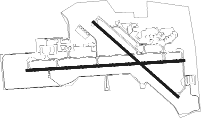
Runway info
Runway 9 / 27  | ||
| length | 2615m (8579ft) | |
| bearing | 91° / 271° | |
| width | 46m (150ft) | |
| surface | concrete | |
| displ threshold | 0m (0ft) / 130m (427ft) | |
| blast zone | 61m (200ft) / 61m (200ft) | |
| Runway 13 / 31 | ||
| length | 1889m (6198ft) | |
| bearing | 128° / 308° | |
| width | 46m (150ft) | |
| surface | concrete | |
| blast zone | 61m (200ft) / 61m (200ft) | |
Nearby beacons
| code | identifier | dist | bearing | frequency |
|---|---|---|---|---|
| CID | CEDAR RAPIDS VOR/DME | 3.3 | 272° | 114.10 |
| IOW | IOWA CITY VOR/DME | 22.3 | 165° | 116.20 |
| IIB | WAPSIE (INDEPENDENCE) NDB | 35.7 | 337° | 206 |
| DDD | CITY DME | 40 | 133° | 116.50 |
| ALO | WATERLOO VOR/DME | 50.6 | 314° | 112.20 |
| OTM | OTTUMWA VOR/DME | 58.3 | 216° | 111.60 |
Instrument approach procedures
| runway | airway (heading) | route (dist, bearing) |
|---|---|---|
| RW09 | BEIGE (87°) | BEIGE CUKLA (9mi, 82°) 2500ft |
| RW09 | CUKLA (91°) | CUKLA 2500ft |
| RW09 | GUERN (68°) | GUERN HELAB (14mi, 64°) 2600ft CUKLA (5mi, 1°) 2500ft |
| RW09 | VINTY (130°) | VINTY FEMIT (10mi, 166°) 3500ft CUKLA (5mi, 181°) 2500ft |
| RNAV | CUKLA 2500ft FONER (6mi, 91°) 2500ft OPHAW (3mi, 91°) 1440ft KCID (3mi, 90°) 903ft JUTUS (12mi, 91°) 2700ft JUTUS (turn) | |
| RW13 | BEIGE (87°) | BEIGE JOVOS (12mi, 64°) 3000ft PAYLO (5mi, 54°) 3000ft |
| RW13 | CID (92°) | CID PAYLO (9mi, 324°) 3000ft PAYLO (turn) 3000ft |
| RW13 | VINTY (130°) | VINTY PAYLO (9mi, 132°) 3000ft |
| RNAV | PAYLO 3000ft COLNZ (6mi, 128°) 2500ft KCID (5mi, 129°) 909ft (5482mi, 115°) 1120ft MORSE (5474mi, 295°) 3000ft MORSE (turn) | |
| RW27 | ANOSA (240°) | ANOSA SORPE (10mi, 219°) 2700ft JUTUS (5mi, 181°) 2700ft |
| RW27 | IOW (345°) | IOW CIBNO (18mi, 31°) 2700ft JUTUS (5mi, 1°) 2700ft |
| RW27 | JUTUS (271°) | JUTUS 2700ft |
| RNAV | JUTUS 2700ft WAVUM (6mi, 271°) 2700ft KCID (6mi, 271°) 909ft (5482mi, 115°) 1112ft CUKLA (5493mi, 294°) 2500ft CUKLA (turn) | |
| RW31 | CID (92°) | CID MORSE (14mi, 119°) 3000ft MORSE (turn) 3000ft |
| RW31 | IOW (345°) | IOW HAVLI (9mi, 20°) 3000ft MORSE (5mi, 20°) 3000ft |
| RW31 | SOLUM (279°) | SOLUM MORSE (8mi, 234°) 3000ft |
| RNAV | MORSE 3000ft SHEWY (6mi, 308°) 2500ft KCID (6mi, 306°) 891ft (5482mi, 115°) 1120ft PAYLO (5489mi, 295°) 3000ft PAYLO (turn) |
Disclaimer
The information on this website is not for real aviation. Use this data with the X-Plane flight simulator only! Data taken with kind consent from X-Plane 12 source code and data files. Content is subject to change without notice.