Carroll - Arthur N Neu
Airport details
| Country | United States of America |
| State | Iowa |
| Region | K3 |
| Airspace | Minneapolis Ctr |
| Municipality | Carroll County |
| Elevation | 1204ft (367m) |
| Timezone | GMT -6 |
| Coordinates | 42.04667, -94.78870 |
| Magnetic var | |
| Type | land |
| Available since | X-Plane v10.32 |
| ICAO code | KCIN |
| IATA code | CIN |
| FAA code | CIN |
Communication
| Arthur N Neu AWOS 3 | 118.025 |
| Arthur N Neu CTAF/UNICOM | 122.800 |
Nearby Points of Interest:
Chicago & Northwestern Passenger Depot and Baggage Room-Carroll
-Marsh Rainbow Arch Bridge
-St. Patrick's Catholic Church, Cedar
-Gen. Cass and Belle Smith House
-Peter and Mary Smith House
-Lake City Public Library
-Lake City Community Memorial Building
-Jefferson Square Commercial Historic District
-Greene County Courthouse
-George H. Gallup House
-Lakeside Park Historic District
-Nishnabotna River Bridge
-Audubon County Court House
-Calhoun County Courthouse
-Irwin Consolidated School
-Sac City Monument Square Historic District
-Sac County Courthouse
-Carey House, Denison, Iowa
-William A. McHenry House
-Clarence D. Chamberlin House
-Crawford County Courthouse
-John D. Bush House
-Hans J. Jorgensen Barn
-George Rewerts House
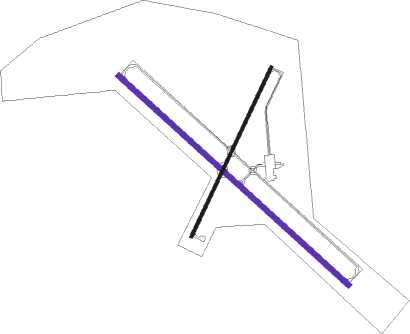
Runway info
| Runway 13 / 31 | ||
| length | 1677m (5502ft) | |
| bearing | 128° / 308° | |
| width | 30m (100ft) | |
| surface | concrete | |
| displ threshold | 154m (505ft) / 0m (0ft) | |
Runway 3 / 21  | ||
| length | 1007m (3304ft) | |
| bearing | 38° / 218° | |
| width | 18m (60ft) | |
| surface | concrete | |
Nearby beacons
| code | identifier | dist | bearing | frequency |
|---|---|---|---|---|
| EFW | JEFFERSON NDB | 19.9 | 94° | 391 |
| FO | BARRO (FORT DODGE) NDB | 35.3 | 46° | 341 |
| FOD | FORT DODGE VORTAC | 40.3 | 41° | 113.50 |
| OVR | OMAHA VORTAC | 67.8 | 227° | 116.30 |
Instrument approach procedures
| runway | airway (heading) | route (dist, bearing) |
|---|---|---|
| RW13 | AMABE (128°) | AMABE 3000ft |
| RNAV | AMABE 3000ft FOFEP (7mi, 128°) 3000ft ZIDRI (3mi, 128°) 1900ft KCIN (2mi, 128°) 1243ft (5619mi, 114°) 1453ft COHGI (5610mi, 294°) 3000ft COHGI (turn) | |
| RW31 | COHGI (308°) | COHGI 3000ft |
| RNAV | COHGI 3000ft DOXNO (7mi, 308°) 3000ft YUGVU (4mi, 308°) 1860ft KCIN (2mi, 309°) 1243ft (5619mi, 114°) 1453ft AMABE (5627mi, 294°) 3000ft AMABE (turn) |
Disclaimer
The information on this website is not for real aviation. Use this data with the X-Plane flight simulator only! Data taken with kind consent from X-Plane 12 source code and data files. Content is subject to change without notice.