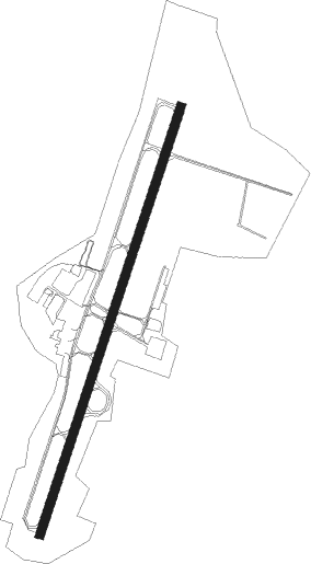
Clarksburg - North Central West Virginia
Airport details
| Country | United States of America |
| State | West Virginia |
| Region | K6 |
| Airspace | Cleveland Ctr |
| Municipality | Bridgeport |
| Elevation | 1215ft (370m) |
| Timezone | GMT -5 |
| Coordinates | 39.29719, -80.23000 |
| Magnetic var | |
| Type | land |
| Available since | X-Plane v10.40 |
| ICAO code | KCKB |
| IATA code | CKB |
| FAA code | CKB |
Communication
| North Central West Virginia ATIS | 127.825 |
| North Central West Virginia CTAF | 126.700 |
| North Central West Virginia UNICOM | 123.000 |
| North Central West Virginia Ground Control | 121.900 |
| North Central West Virginia CLARKSBURG Tower | 126.700 |
| North Central West Virginia CLARKSBURG Approach/Departure | 119.600 |
| North Central West Virginia CLARKSBURG Approach/Departure | 121.150 |
Approach frequencies
| ILS-cat-I | RW21 | 109.3 | 18.00mi |
| 3° GS | RW21 | 109.3 | 18.00mi |
Nearby Points of Interest:
Governor Joseph Johnson House
-Waldomore
-Shinnston Historic District
-Clelland House
-Anna Jarvis House
-Templemoor
-Adaland
-Daniel Bassel House
-Lost Creek Baltimore and Ohio Railroad Depot
-Grafton Downtown Commercial Historic District
-J.N.B. Crim House
-High Gate
-Watters Smith Memorial State Park
-Colonial Apartments
-Fairmont Normal School Administration Building
-Thomas W. Fleming House
-Fleming-Watson Historic District
-Fairmont Downtown Historic District
-Robert H. Mollohan-Jefferson Street Bridge
-Shaw House
-Jacobs-Hutchinson Block
-Marion County Courthouse
-Masonic Temple (Fairmont, West Virginia)
-Dunbar School
-Whitescarver Hall
Nearby beacons
| code | identifier | dist | bearing | frequency |
|---|---|---|---|---|
| CKB | CLARKSBURG VOR/DME | 3.1 | 221° | 112.60 |
| MGW | MORGANTOWN VOR/DME | 23.1 | 55° | 111.60 |
| EKN | ELKINS VORTAC | 23.7 | 161° | 114.20 |
| RQY | RANDOLPH CO. (ELKINS) NDB | 29.7 | 137° | 284 |
| VV | CAMOR (CONNELLSVILLE) NDB | 41.7 | 40° | 299 |
| AIR | BELLAIRE VOR/DME | 51 | 321° | 117.10 |
| IHD | INDIAN HEAD VORTAC | 57.2 | 52° | 108.20 |
| AGC | ALLEGHENY (PITTSBURGH) VOR/DME | 59.5 | 11° | 110 |
| HLG | WHEELING VOR/DME | 59.8 | 341° | 112.20 |
| CFX | CADIZ NDB | 67 | 320° | 239 |
Instrument approach procedures
| runway | airway (heading) | route (dist, bearing) |
|---|---|---|
| RW03 | BENZO (57°) | BENZO JITUK (10mi, 90°) 3900ft |
| RW03 | EKN (341°) | EKN JITUK (16mi, 308°) 3900ft |
| RW03 | MGW (235°) | MGW JITUK (35mi, 226°) 4000ft JITUK (turn) 3900ft |
| RNAV | JITUK 3900ft OPEXE (3mi, 28°) 3400ft NULNE (4mi, 28°) 3200ft ZODPA (3mi, 28°) 2060ft KCKB (3mi, 26°) 1233ft (4952mi, 116°) 1624ft FONTZ (4948mi, 296°) 3800ft FONTZ (turn) | |
| RW21 | EKN (341°) | EKN FONTZ (35mi, 358°) 4400ft FONTZ (turn) 3800ft |
| RW21 | MGW (235°) | MGW FONTZ (13mi, 256°) 3800ft |
| RW21 | TEDDS (172°) | TEDDS FONTZ (11mi, 133°) 3800ft |
| RNAV | FONTZ 3800ft JIREV (7mi, 209°) 2900ft HEPUG (3mi, 208°) 2020ft KCKB (3mi, 210°) 1284ft (4952mi, 116°) 1424ft JITUK (4956mi, 296°) 3900ft JITUK (turn) |
Disclaimer
The information on this website is not for real aviation. Use this data with the X-Plane flight simulator only! Data taken with kind consent from X-Plane 12 source code and data files. Content is subject to change without notice.