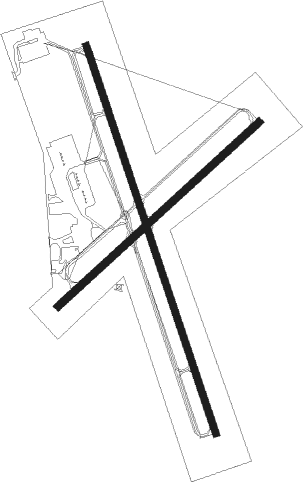
Clarksville - Outlaw Fld
Airport details
| Country | United States of America |
| State | Tennessee |
| Region | K7 |
| Airspace | Memphis Ctr |
| Municipality | Clarksville |
| Elevation | 548ft (167m) |
| Timezone | GMT -6 |
| Coordinates | 36.63020, -87.42005 |
| Magnetic var | |
| Type | land |
| Available since | X-Plane v10.40 |
| ICAO code | KCKV |
| IATA code | CKV |
| FAA code | CKV |
Communication
| OUTLAW FLD ASOS | 134.575 |
| OUTLAW FLD CTAF/UNICOM | 122.800 |
| OUTLAW FLD CAMPBELL Approach/Departure | 134.350 |
Approach frequencies
| LOC | RW35 | 111.7 | 18.00mi |
Nearby Points of Interest:
Forbes-Mabry House
-Samuel Rexinger House
-Clarksville Methodist Church
-Northington-Beach House
-Johnson-Hach House
-Madison Street Historic District
-Tip Top
-Oak Top
-Lafayette Methodist Church
-Jefferson Davis State Historic Site
-Western State Hospital
-Madison Street Methodist Church
-Hopkinsville L & N Railroad Depot
-Hopkinsville Commercial Historic District
-Latham Confederate Monument
-Sanford Wilson House
-McReynolds House
-Allensville Historic District
-Bell Witch Cave
-Fort Donelson National Battlefield
-Cadiz Downtown Historic District
-Cadiz Masonic Lodge No. 121 F. and A.M.
-Mansfield Cheatham House
-Robertson County Courthouse
-Cheatham County Courthouse

Nearby beacons
| code | identifier | dist | bearing | frequency |
|---|---|---|---|---|
| CKV | CLARKSVILLE VOR/DME | 0.6 | 138° | 110.60 |
| HXW | SCREAMING EAGLE TACAN | 4.7 | 288° | 114.90 |
| CK | SNUFF (CLARKSVILLE) NDB | 6.3 | 162° | 335 |
| CK | SNUFF(FT CAMPBELL (CLARKSVILLE NDB | 6.4 | 162° | 335 |
| FK | AIRBE(FT CAMPBELL/HOPKINSVILLE NDB | 6.4 | 3° | 273 |
| EU | MUREY (MURRAY) NDB | 42.2 | 276° | 368 |
| CCT | CITY DME | 45.7 | 12° | 109.80 |
| BNA | NASHVILLE VORTAC | 46.2 | 124° | 114.10 |
| BW | NOORA (BOWLING GREEN) NDB | 47.5 | 75° | 236 |
| GHM | (CENTERVILLE) DME | 47.8 | 182° | 111.60 |
| BWG | GREEN DME | 50.2 | 73° | 117.90 |
Instrument approach procedures
| runway | airway (heading) | route (dist, bearing) |
|---|---|---|
| RW17 | GNSHP (200°) | GNSHP HITUD (8mi, 245°) 2600ft |
| RW17 | HITUD (164°) | HITUD 2600ft |
| RNAV | HITUD 2600ft JIKOB (6mi, 163°) 2300ft KCKV (5mi, 164°) 594ft (5281mi, 113°) 823ft VALER (5279mi, 293°) 3000ft VALER (turn) | |
| RW35 | HIVNA (342°) | HIVNA 3800ft |
| RW35 | VALER (357°) | VALER HIVNA (10mi, 15°) 3800ft |
| RNAV | HIVNA 3800ft ZEPLI (6mi, 343°) 2300ft YORUK (3mi, 343°) 1380ft KCKV (4mi, 341°) 599ft (5281mi, 113°) 1000ft GICEB (5271mi, 293°) 3000ft GICEB (turn) |
Disclaimer
The information on this website is not for real aviation. Use this data with the X-Plane flight simulator only! Data taken with kind consent from X-Plane 12 source code and data files. Content is subject to change without notice.