Clintonville - Clintonville Muni
Airport details
| Country | United States of America |
| State | Wisconsin |
| Region | K5 |
| Airspace | Minneapolis Ctr |
| Municipality | Clintonville |
| Elevation | 819ft (250m) |
| Timezone | GMT -6 |
| Coordinates | 44.61328, -88.73070 |
| Magnetic var | |
| Type | land |
| Available since | X-Plane v10.40 |
| ICAO code | KCLI |
| IATA code | CLI |
| FAA code | CLI |
Communication
| Clintonville Muni AWOS 3 | 120.675 |
| Clintonville Muni CTAF/UNICOM | 122.800 |
| Clintonville Muni GREEN BAY Approach/Departure | 126.300 |
Nearby Points of Interest:
Shawano Post Office
-George Peters House
-Lutheran Indian Mission
-Center Valley Grade School
-Hortonville Community Hall
-Danes Hall
-Waupaca Post Office
-Veterans Cottages Historic District
-Veterans Home Chapel
-Commandant's Residence Home
-Daniel E. Krause Stone Barn
-Citizens State Bank of Gillett
-Pipe School
-Appleton Wire Works
-College Avenue Historic District
-John Hart Whorton House
-Fox River Paper Company Historic District
-Main Hall
-L. A. Pomeroy House
-Saint Joseph of the Lake Church and Cemetery
-Cedars Lock and Dam Historic District
-Merritt Black House
-Charles W. Stribley House
-George, Sr., and Ellen Banta House
-Capt. Matthew J. Meade House
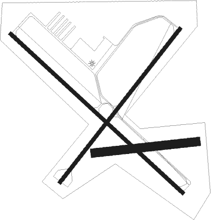
Runway info
Runway 14 / 32  | ||
| length | 1403m (4603ft) | |
| bearing | 127° / 307° | |
| width | 23m (75ft) | |
| surface | asphalt | |
| Runway 4 / 22 | ||
| length | 1165m (3822ft) | |
| bearing | 52° / 232° | |
| width | 23m (75ft) | |
| surface | asphalt | |
| Runway 09 / 27 | ||
| length | 610m (2001ft) | |
| bearing | 89° / 269° | |
| width | 52m (170ft) | |
| surface | grass | |
Nearby beacons
| code | identifier | dist | bearing | frequency |
|---|---|---|---|---|
| GRB | GREEN BAY VORTAC | 23.1 | 96° | 115.50 |
| GR | FAMIS (GREEN BAY) NDB | 23.4 | 109° | 356 |
| AQ | KOOKY (APPLETON) NDB | 27.7 | 140° | 407 |
| SG | DEPRE (GREEN BAY) NDB | 28.6 | 110° | 332 |
| OSH | OSHKOSH VORTAC | 38.1 | 164° | 116.75 |
| AUW | WAUSAU VOR/DME | 39.1 | 285° | 111.60 |
| OS | POBER (OSHKOSH) NDB | 45 | 167° | 395 |
| FAH | (SHEBOYGAN) DME | 63.3 | 134° | 110 |
Instrument approach procedures
| runway | airway (heading) | route (dist, bearing) |
|---|---|---|
| RW04 | BIPID (64°) | BIPID HIDEV (5mi, 214°) 3000ft HIDEV (turn) 3000ft |
| RW04 | EYITI (3°) | EYITI HIDEV (11mi, 309°) 3000ft |
| RW04 | IPUCO (78°) | IPUCO HIDEV (7mi, 123°) 3000ft |
| RNAV | HIDEV 3000ft ARNDT (6mi, 52°) 2500ft VUPLE (3mi, 52°) 1660ft KCLI (3mi, 52°) 878ft (5351mi, 117°) 1076ft COPUV (5343mi, 297°) 3000ft COPUV (turn) | |
| RW14 | BIPID (64°) | BIPID HURER (11mi, 315°) 3000ft ICOSI (5mi, 56°) 3000ft |
| RW14 | ICOSI (127°) | ICOSI 3000ft |
| RW14 | JEVBI (196°) | JEVBI ICOSI (16mi, 236°) 3000ft |
| RW14 | RROBB (85°) | RROBB HURER (24mi, 74°) 3000ft ICOSI (5mi, 56°) 3000ft |
| RNAV | ICOSI 3000ft COKVO (6mi, 127°) 2700ft FIMAV (3mi, 127°) 1680ft KCLI (3mi, 127°) 879ft (5351mi, 117°) 1101ft GIGKE (5343mi, 297°) 3000ft GIGKE (turn) | |
| RW22 | CHURP (115°) | CHURP ICUKE (14mi, 73°) 3000ft COPUV (5mi, 123°) 3000ft |
| RW22 | COPUV (232°) | COPUV 3000ft |
| RW22 | GRB (276°) | GRB HIVOG (14mi, 298°) 3000ft COPUV (5mi, 303°) 3000ft |
| RNAV | COPUV 3000ft KANDD (6mi, 232°) 2500ft FERVI (3mi, 232°) 1400ft KCLI (2mi, 232°) 855ft HIDEV (11mi, 232°) 3000ft HIDEV (turn) | |
| RW32 | GIGKE (308°) | GIGKE 3000ft |
| RW32 | GRB (276°) | GRB GIGKE (16mi, 257°) 3000ft |
| RW32 | RROBB (85°) | RROBB EYITI (36mi, 104°) 3000ft GIGKE (11mi, 56°) 3000ft |
| RNAV | GIGKE 3000ft ONECO (6mi, 308°) 2500ft AQETO (4mi, 307°) 1360ft KCLI (2mi, 309°) 860ft (5351mi, 117°) 1071ft ICOSI (5359mi, 297°) 3000ft ICOSI (turn) |
Disclaimer
The information on this website is not for real aviation. Use this data with the X-Plane flight simulator only! Data taken with kind consent from X-Plane 12 source code and data files. Content is subject to change without notice.