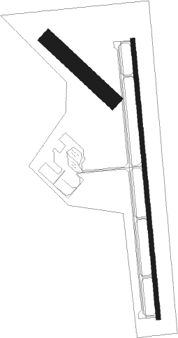
Clinton - Clinton Rgnl
Airport details
| Country | United States of America |
| State | Oklahoma |
| Region | K4 |
| Airspace | Ft Worth Ctr |
| Municipality | Clinton |
| Elevation | 1615ft (492m) |
| Timezone | GMT -6 |
| Coordinates | 35.53827, -98.93279 |
| Magnetic var | |
| Type | land |
| Available since | X-Plane v10.40 |
| ICAO code | KCLK |
| IATA code | CLK |
| FAA code | CLK |
Communication
| CLINTON RGNL AWOS | 119.225 |
| CLINTON RGNL CTAF/UNICOM | 122.800 |
| CLINTON RGNL FORT WORTH CNTR | 128.400 |
Nearby Points of Interest:
Cordell Carnegie Public Library
-Washita County Courthouse
-Provine Service Station
-Canute Service Station
-Hedlund Motor Company Building
-Storm House
-Rock Mary
-Blaine County Courthouse
-Hobart City Hall
-Downtown Hobart Historic District
Nearby beacons
| code | identifier | dist | bearing | frequency |
|---|---|---|---|---|
| BZ | FOSSI (CLINTON) NDB | 14.1 | 252° | 393 |
| BFV | BURNS FLAT (CLINTON) VORTAC | 22.5 | 222° | 110 |
| HBR | HOBART VORTAC | 40.8 | 191° | 111.80 |
| IFI | KINGFISHER VORTAC | 48 | 74° | 114.70 |
| LTS | ALTUS VORTAC | 55.1 | 201° | 109.80 |
| MMB | MITBEE (GAGE) VORTAC | 66.7 | 310° | 115.60 |
Instrument approach procedures
| runway | airway (heading) | route (dist, bearing) |
|---|---|---|
| RW17 | ODINS (254°) | ODINS GUVEC (19mi, 278°) 4000ft JENUM (8mi, 269°) 4000ft |
| RW17 | ROLLS (109°) | ROLLS KEKEC (18mi, 86°) 4000ft JENUM (8mi, 89°) 4000ft |
| RNAV | JENUM 4000ft ZEPRO (8mi, 179°) 3200ft VODUC (3mi, 179°) 2280ft KCLK (2mi, 180°) 1648ft (5841mi, 110°) 1866ft OSUCU (5842mi, 290°) 4000ft OSUCU (turn) | |
| RW35 | BFV (42°) | BFV HUVIV (8mi, 58°) 4000ft OSUCU (7mi, 89°) 4000ft |
| RW35 | LIONS (286°) | LIONS YATUN (29mi, 271°) 4000ft OSUCU (7mi, 269°) 4000ft |
| RNAV | OSUCU 4000ft RONCY (8mi, 359°) 3200ft KCLK (5mi, 359°) 1636ft (5841mi, 110°) 2400ft OSUCU (5842mi, 290°) 4000ft OSUCU (turn) |
Disclaimer
The information on this website is not for real aviation. Use this data with the X-Plane flight simulator only! Data taken with kind consent from X-Plane 12 source code and data files. Content is subject to change without notice.

