College Station - Easterwood Field
Airport details
| Country | United States of America |
| State | Texas |
| Region | K4 |
| Airspace | Houston Oceanic Ctr |
| Municipality | College Station |
| Elevation | 319ft (97m) |
| Timezone | GMT -6 |
| Coordinates | 30.58858, -96.36383 |
| Magnetic var | |
| Type | land |
| Available since | X-Plane v10.40 |
| ICAO code | KCLL |
| IATA code | CLL |
| FAA code | KCLL |
Communication
| Easterwood Field ATIS | 126.850 |
| Easterwood Field CTAF | 118.500 |
| Easterwood Field UNICOM | 122.950 |
| Easterwood Field Ground Control/ Clearance DEV | 128.700 |
| Easterwood Field Tower | 118.500 |
| Easterwood Field HOUSTON Approach/ Departure | 134.300 |
Approach frequencies
| ILS-cat-I | RW35 | 110.55 | 18.00mi |
| 2.9° GS | RW35 | 110.55 | 18.00mi |
Nearby Points of Interest:
Old Sinclair Station
-R. Q. Astin House
-Seward Plantation
-Mrs. Sam Houston House
-Thomas, Jr., and Mary Kraitchar House
-East Brenham
-Washington County Courthouse
-Brenham Downtown Historic District
-F. W. Schuerenberg House
-Wood-Hughes House
-Giddings-Stone Mansion
-Franklin Carnegie Library
-Kneip-Bredthauer House
-Burton Commercial Historic District
-Chappell Hill Circulating Library
-Main Street Historic District
-J. R. Routt House
-Isaac Applewhite House
-Burton Farmers Gin
-Calvert Historic District
-Hammond House
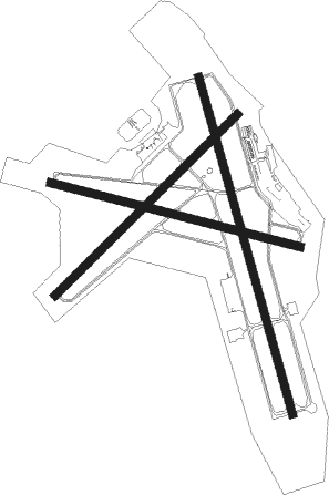
Runway info
Runway 16 / 34  | ||
| length | 2140m (7021ft) | |
| bearing | 167° / 347° | |
| width | 46m (151ft) | |
| surface | asphalt | |
| Runway 10 / 28 | ||
| length | 1570m (5151ft) | |
| bearing | 106° / 286° | |
| width | 46m (151ft) | |
| surface | asphalt | |
| Runway 4 / 22 | ||
| length | 1570m (5151ft) | |
| bearing | 54° / 234° | |
| width | 46m (151ft) | |
| surface | concrete | |
Nearby beacons
| code | identifier | dist | bearing | frequency |
|---|---|---|---|---|
| CLL | COLLEGE STATION VORTAC | 3 | 286° | 113.30 |
| CL | ROWDY (COLLEGE STATION) NDB | 5.8 | 165° | 260 |
| TNV | NAVASOTA VOR/DME | 23.9 | 134° | 115.90 |
| LOA | LEONA VORTAC | 38 | 36° | 110.80 |
| IDU | INDUSTRY VORTAC | 39.3 | 197° | 110.20 |
| UTS | HUNTSVILLE NDB | 40.9 | 79° | 308 |
| CX | ALIBI (HOUSTON) NDB | 46.8 | 100° | 281 |
| ELA | EAGLE LAKE VOR/DME | 55.6 | 177° | 116.40 |
| GNL | GROESBECK (MEXIA) VOR/DME | 60.3 | 349° | 108.80 |
| ROB | ROBINSON (WACO) NDB | 65.8 | 322° | 400 |
Instrument approach procedures
| runway | airway (heading) | route (dist, bearing) |
|---|---|---|
| RW11 | GOVEY (73°) | GOVEY ICESO (10mi, 21°) 2000ft |
| RW11 | HAXUN (143°) | HAXUN ICESO (10mi, 201°) 2000ft |
| RNAV | ICESO 2000ft APZIC (7mi, 106°) 2000ft KCLL (6mi, 106°) 369ft (5734mi, 108°) 569ft EDAYA (5722mi, 288°) 3000ft EDAYA (turn) | |
| RW17 | CEYAD (127°) | CEYAD ZAKBU (10mi, 80°) 2100ft |
| RW17 | FEPRA (211°) | FEPRA ZAKBU (10mi, 260°) 2100ft |
| RNAV | ZAKBU 2100ft HOPAL (7mi, 167°) 2100ft JEMON (3mi, 167°) 1000ft KCLL (2mi, 171°) 372ft (5734mi, 108°) 571ft JOTAD (5732mi, 288°) 2000ft JOTAD (turn) | |
| RW29 | CENIG (253°) | CENIG EDAYA (10mi, 202°) 3000ft |
| RW29 | DOSEC (324°) | DOSEC EDAYA (10mi, 22°) 3000ft |
| RNAV | EDAYA 3000ft WELBO (7mi, 286°) 2000ft JULIR (4mi, 286°) 860ft KCLL (2mi, 286°) 365ft (5734mi, 108°) 564ft ICESO (5746mi, 288°) 2000ft ICESO (turn) | |
| RW35 | CETGU (307°) | CETGU JOTAD (10mi, 260°) 2000ft |
| RW35 | ETEYO (30°) | ETEYO JOTAD (10mi, 80°) 2000ft |
| RNAV | JOTAD 2000ft GUTCE (7mi, 347°) 2000ft KCLL (6mi, 346°) 359ft (5734mi, 108°) 511ft ZAKBU (5736mi, 288°) 2100ft ZAKBU (turn) |
Disclaimer
The information on this website is not for real aviation. Use this data with the X-Plane flight simulator only! Data taken with kind consent from X-Plane 12 source code and data files. Content is subject to change without notice.