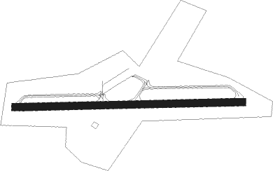
Claremont - Claremont Muni
Airport details
| Country | United States of America |
| State | New Hampshire |
| Region | K6 |
| Airspace | Boston Ctr |
| Municipality | Claremont |
| Elevation | 542ft (165m) |
| Timezone | GMT -5 |
| Coordinates | 43.37051, -72.36821 |
| Magnetic var | |
| Type | land |
| Available since | X-Plane v10.40 |
| ICAO code | KCNH |
| IATA code | CNH |
| FAA code | CNH |
Communication
| Claremont Muni CTAF/UNICOM | 122.700 |
Nearby Points of Interest:
William Rossiter House
-Claremont Warehouse No. 34
-Claremont City Hall
-David Dexter House
-North Charlestown Historic District
-Spencer Hollow School
-Twing Buckman House
-Unity Town Hall
-NAMCO Block
-Springfield Downtown Historic District
-Windsor House
-Old Constitution House
-Southview Housing Historic District
-Eureka Schoolhouse
-Louis St. Gaudens House and Studio
-Atherton Farmstead
-Charlestown Town Hall
-Richards Free Library
-Newport Opera House
-Isaac Reed House
-Newport Downtown Historic District
-Nettleton House
-Blow-Me-Down Covered Bridge
-Reading Town Hall
-Iron Bridge at Howard Hill Road
Nearby beacons
| code | identifier | dist | bearing | frequency |
|---|---|---|---|---|
| CNH | CLAREMONT NDB | 0.1 | 246° | 233 |
| LEB | DME | 19.6 | 26° | 113.70 |
| LAH | HANOVER (LEBANON) NDB | 21.5 | 30° | 276 |
| RUT | DME | 27 | 285° | 111 |
| DYO | SMUTO (RUTLAND) NDB | 32.5 | 300° | 221 |
| EEN | DME | 34.7 | 172° | 109.40 |
| CON | CONCORD VOR/DME | 35.8 | 101° | 112.90 |
| LC | BLNAP (LACONIA) NDB | 37.5 | 79° | 328 |
| CO | EPSOM (CONCORD) NDB | 42.8 | 105° | 216 |
| MPV | MONTPELIER VOR/DME | 43 | 354° | 116.90 |
| MJ | FITZY (MANCHESTER) NDB | 47.7 | 121° | 209 |
| CAM | CAMBRIDGE VOR/DME | 48.3 | 249° | 115 |
| GDM | GARDNER VOR/DME | 51.3 | 159° | 110.60 |
| MHT | MANCHESTER VOR/DME | 53.1 | 117° | 114.40 |
| GMA | MAHN (WHITEFIELD) NDB | 66.4 | 35° | 386 |
Instrument approach procedures
| runway | airway (heading) | route (dist, bearing) |
|---|---|---|
| RW29 | KEYEK (272°) | KEYEK 5200ft |
| RW29 | LAYIR (253°) | LAYIR 5200ft KEYEK (7mi, 185°) 5200ft |
| RW29 | MUNKS (292°) | MUNKS 5200ft KEYEK (7mi, 5°) 5200ft |
| RNAV | KEYEK 5200ft JAKUT (5mi, 272°) 3700ft DECEN (4mi, 272°) 2600ft ZOBYY (3mi, 272°) 1720ft KCNH (4mi, 272°) 573ft UPESY (4mi, 272°) JAMMA (9mi, 232°) 5400ft JAMMA (turn) 5400ft |
Disclaimer
The information on this website is not for real aviation. Use this data with the X-Plane flight simulator only! Data taken with kind consent from X-Plane 12 source code and data files. Content is subject to change without notice.