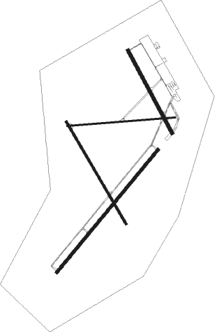
Carlsbad - Cavern City Air Terminal
Airport details
| Country | United States of America |
| State | New Mexico |
| Region | K2 |
| Airspace | Albuquerque Ctr |
| Municipality | Carlsbad |
| Elevation | 3292ft (1003m) |
| Timezone | GMT -7 |
| Coordinates | 32.33744, -104.26336 |
| Magnetic var | |
| Type | land |
| Available since | X-Plane v10.40 |
| ICAO code | KCNM |
| IATA code | CNM |
| FAA code | CNM |
Communication
| Cavern City Air Terminal ASOS | 118.375 |
| Cavern City Air Terminal CTAF/UNICOM | 123.000 |
Approach frequencies
| ILS-cat-I | RW03 | 111.9 | 18.00mi |
| 3° GS | RW03 | 111.9 | 18.00mi |
Nearby Points of Interest:
Carlsbad Irrigation District
-The Caverns Historic District
-Rattlesnake Springs Pump House
-Willie D. Atkeson House
-William Baskin House
-Wallace Pratt Lodge
-Wallace E. Pratt House
Runway info
Nearby beacons
| code | identifier | dist | bearing | frequency |
|---|---|---|---|---|
| CNM | CARLSBAD VORTAC | 5.2 | 155° | 116.30 |
| CV | CARLZ (CARLSBAD) NDB | 5.7 | 227° | 402 |
| ATS | ARTESIA NDB | 32.5 | 339° | 414 |
| HOB | HOBBS VORTAC | 53.4 | 73° | 111 |
| SFL | SALT FLAT VORTAC | 54.8 | 234° | 113 |
| PEQ | PECOS (PECOS CITY) VOR/DME | 62.8 | 142° | 111.80 |
Instrument approach procedures
| runway | airway (heading) | route (dist, bearing) |
|---|---|---|
| RW03 | AXEPE (46°) | AXEPE WAMVA (9mi, 50°) 6600ft |
| RW03 | LANIC (27°) | LANIC WAMVA (5mi, 348°) 6600ft |
| RNAV | WAMVA 6600ft ZETVO (4mi, 33°) 5600ft OXYAC (3mi, 49°) 4600ft KCNM (5mi, 46°) 3346ft (6127mi, 107°) 3495ft KEREY (6117mi, 287°) 5600ft KEREY (turn) | |
| RW14R | CNM (335°) | CNM BICNA (18mi, 331°) 6100ft BICNA (turn) 6000ft |
| RW14R | FATAP (161°) | FATAP BICNA (17mi, 170°) 6000ft |
| RNAV | BICNA 6000ft AYOPE (6mi, 150°) 5200ft HEKES (3mi, 150°) 4120ft KCNM (3mi, 146°) 3309ft (6127mi, 107°) 3519ft DAPEY (6123mi, 287°) 6000ft DAPEY (turn) | |
| RW21 | CNM (335°) | CNM KEREY (15mi, 31°) 6000ft KEREY (turn) 5600ft |
| RW21 | FATAP (161°) | FATAP KEREY (25mi, 134°) 5600ft |
| RW21 | HOMEX (261°) | HOMEX KEREY (12mi, 290°) 5600ft |
| RNAV | KEREY 5600ft TIBQU (7mi, 229°) 4900ft KCNM (5mi, 231°) 3305ft (6127mi, 107°) 3497ft GUADO (6134mi, 287°) LANIC (8mi, 179°) 8000ft LANIC (turn) | |
| RW32L | CAVRN (334°) | CAVRN DAPEY (21mi, 335°) 6000ft |
| RW32L | CNM (335°) | CNM DAPEY (7mi, 148°) 6000ft DAPEY (turn) 6000ft |
| RW32L | DILLI (38°) | DILLI IMIRE (27mi, 55°) 8000ft DAPEY (8mi, 55°) 6000ft |
| RNAV | DAPEY 6000ft ECIRE (7mi, 330°) 5000ft KCNM (6mi, 332°) 3307ft (6127mi, 107°) 3695ft BICNA (6131mi, 287°) 6000ft BICNA (turn) |
Disclaimer
The information on this website is not for real aviation. Use this data with the X-Plane flight simulator only! Data taken with kind consent from X-Plane 12 source code and data files. Content is subject to change without notice.

