Moab - Canyonlands Fld
Airport details
| Country | United States of America |
| State | Utah |
| Region | K2 |
| Airspace | Denver Ctr |
| Municipality | Grand County |
| Elevation | 4587ft (1398m) |
| Timezone | GMT -7 |
| Coordinates | 38.76006, -109.74712 |
| Magnetic var | |
| Type | land |
| Available since | X-Plane v10.40 |
| ICAO code | KCNY |
| IATA code | CNY |
| FAA code | CNY |
Communication
| Canyonlands Fld AWOS-3 | 118.525 |
| Canyonlands Fld CTAF/UNICOM | 122.800 |
Nearby Points of Interest:
Rock House-Custodian's Residence
-Wolfe Ranch
-Star Hall
-Slickrock Trail
-Denis Julien Inscription
-Horseshoe Canyon Archeological District
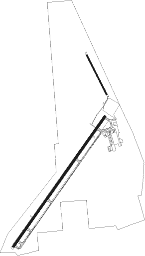
Runway info
Runway 3 / 21  | ||
| length | 2245m (7365ft) | |
| bearing | 47° / 227° | |
| width | 30m (100ft) | |
| surface | asphalt | |
| displ threshold | 244m (801ft) / 82m (269ft) | |
| blast zone | 46m (151ft) / 0m (0ft) | |
| Runway 15 / 33 | ||
| length | 610m (2001ft) | |
| bearing | 152° / 332° | |
| width | 18m (60ft) | |
| surface | gravel | |
| blast zone | 47m (154ft) / 44m (144ft) | |
Nearby beacons
| code | identifier | dist | bearing | frequency |
|---|---|---|---|---|
| OAB | MOAB VOR/DME | 0.2 | 210° | 109.80 |
| JNC | GRAND JUNCTION VOR/DME | 48 | 73° | 112.40 |
| HVE | HANKSVILLE VORTAC | 49.2 | 250° | 115.90 |
| DVC | DOVE CREEK VORTAC | 68.8 | 139° | 114.60 |
Instrument approach procedures
| runway | airway (heading) | route (dist, bearing) |
|---|---|---|
| RW03 | ARCHH (257°) | ARCHH HANOG (22mi, 246°) 8100ft HANOG (turn) 8100ft |
| RW03 | KIDNE (69°) | KIDNE HANOG (8mi, 84°) 8100ft |
| RW03 | PIGSE (37°) | PIGSE HANOG (11mi, 357°) 8100ft |
| RNAV | HANOG 8100ft NERRI (6mi, 62°) 7200ft FELTA (3mi, 61°) 6120ft FATPU (1mi, 61°) 5660ft FOGUG (2mi, 61°) 4819ft (6324mi, 109°) 4990ft HANOG (6335mi, 289°) 8100ft HANOG (turn) 8100ft |
Disclaimer
The information on this website is not for real aviation. Use this data with the X-Plane flight simulator only! Data taken with kind consent from X-Plane 12 source code and data files. Content is subject to change without notice.