Coeur D'alene - Coeur D'alene Pappy Boyington
Airport details
| Country | United States of America |
| State | Idaho |
| Region | K1 |
| Airspace | Seattle Ctr |
| Municipality | Kootenai County |
| Elevation | 2319ft (707m) |
| Timezone | GMT -8 |
| Coordinates | 47.77431, -116.81958 |
| Magnetic var | |
| Type | land |
| Available since | X-Plane v10.40 |
| ICAO code | KCOE |
| IATA code | COE |
| FAA code | COE |
Communication
| Coeur d'Alene Pappy Boyington AWOS 3 | 135.075 |
| Coeur d'Alene Pappy Boyington CTAF/UNICOM | 122.800 |
| Coeur d'Alene Pappy Boyington SPOKANE Approach/Departure | 132.100 |
Approach frequencies
| ILS-cat-I | RW06 | 110.7 | 18.00mi |
| 3° GS | RW06 | 110.7 | 18.00mi |
Nearby Points of Interest:
John A. Finch Caretaker's House
-Clark House
-Fort Sherman
-Kootenai County Courthouse
-Harvey M. Davey House
-First United Methodist Church (Coeur d'Alene, Idaho)
-Coeur d'Alene Federal Building
-Coeur d'Alene Masonic Temple
-Coeur d'Alene City Hall
-Post Falls Community United Presbyterian Church
-Samuel and Ann Young House
-John P. and Stella Gray House
-Spokane River Centennial Trail
-Mineral Ridge National Recreation Trail, Idaho
-Mount Spokane Vista House
-Rosebush House
-Mount Saint Michael
-Spokane Public Library - East Side Branch
-Frequency Changing Station
-Cambern Dutch Shop Windmill
-United States Post Office, Courthouse, and Custom House
-Priest River Commercial Core Historic District
-The Globe Hotel
-Kemp & Hebert Building
-Spokane Public Library - North Monroe Branch
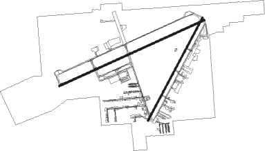
Runway info
Runway 6 / 24  | ||
| length | 2252m (7388ft) | |
| bearing | 76° / 256° | |
| width | 30m (100ft) | |
| surface | asphalt | |
| blast zone | 13m (43ft) / 0m (0ft) | |
| Runway 2 / 20 | ||
| length | 1649m (5410ft) | |
| bearing | 43° / 223° | |
| width | 23m (75ft) | |
| surface | asphalt | |
Nearby beacons
| code | identifier | dist | bearing | frequency |
|---|---|---|---|---|
| COE | COEUR D'ALENE VOR/DME | 0 | 239° | 108.80 |
| DPY | DEER PARK NDB | 27 | 288° | 365 |
| SZT | SANDPOE (SANDPOINT) NDB | 32.6 | 26° | 264 |
| GEG | SPOKANE VORTAC | 34.9 | 255° | 115.50 |
| SKA | FAIRCHILD (SPOKANE) TACAN | 35.4 | 259° | 111.40 |
| ION | IONE NDB | 61 | 328° | 379 |
Instrument approach procedures
| runway | airway (heading) | route (dist, bearing) |
|---|---|---|
| RW06 | GEG (75°) | GEG POBIY (21mi, 75°) 5600ft |
| RW06 | JOMRU (109°) | JOMRU POBIY (17mi, 144°) 5600ft |
| RW06 | POBIY (76°) | POBIY 5600ft |
| RW06 | ROPES (54°) | ROPES VUNUC (5mi, 354°) 7300ft POBIY (5mi, 354°) 5600ft |
| RNAV | POBIY 5600ft CIPUT (7mi, 76°) 4500ft KCOE (7mi, 77°) 2333ft (6465mi, 112°) 2477ft CIMAL (6462mi, 292°) CODSA (17mi, 352°) DIANN (16mi, 282°) 7000ft DIANN (turn) |
Disclaimer
The information on this website is not for real aviation. Use this data with the X-Plane flight simulator only! Data taken with kind consent from X-Plane 12 source code and data files. Content is subject to change without notice.