Concord - Concord Muni
Airport details
| Country | United States of America |
| State | New Hampshire |
| Region | K6 |
| Airspace | Boston Ctr |
| Municipality | Concord |
| Elevation | 340ft (104m) |
| Timezone | GMT -5 |
| Coordinates | 43.20272, -71.50228 |
| Magnetic var | |
| Type | land |
| Available since | X-Plane v10.40 |
| ICAO code | KCON |
| IATA code | CON |
| FAA code | CON |
Communication
| Concord Muni ASOS | 132.325 |
| Concord Muni CLEARANCE DELIVERY | 133.650 |
| Concord Muni CTAF/UNICOM | 122.700 |
| Concord Muni BOSTON Approach/Departure | 127.350 |
Approach frequencies
| ILS-cat-I | RW35 | 108.7 | 18.00mi |
| 3° GS | RW35 | 108.7 | 18.00mi |
Nearby Points of Interest:
Concord Gas Light Company Gasholder House
-Gov. Frank West Rollins House
-Franklin Pierce House
-New Hampshire Savings Bank Building
-Downtown Concord Historic District
-Lewis Downing, Jr., House
-Chamberlin House
-Concord Civic District
-Upham-Walker House
-Merrimack County Courthouse
-New Hampshire Legislative Office Building
-Merrimack County Bank
-Reuben Foster House and Perley Cleaves House
-Henry J. Crippen House
-Page Belting Company Mills
-2½ Beacon Street
-Farrington House
-Leavitt Farm
-Donald D. Tuttle House
-Blossom Hill and Calvary Cemeteries
-New Hampshire Governor's Mansion
-White Farm
-Suncook Village Commercial-Civic Historic District
-Allenstown Meeting House
-Bear Brook State Park Civilian Conservation Corps (CCC) Camp Historic District
Runway info
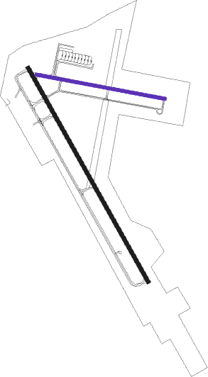
Runway 17 / 35  | ||
| length | 1832m (6010ft) | |
| bearing | 148° / 328° | |
| width | 30m (100ft) | |
| surface | asphalt | |
| displ threshold | 195m (640ft) / 0m (0ft) | |
| Runway 12 / 30 | ||
| length | 976m (3202ft) | |
| bearing | 101° / 281° | |
| width | 23m (75ft) | |
| surface | asphalt | |
Nearby beacons
| code | identifier | dist | bearing | frequency |
|---|---|---|---|---|
| CON | CONCORD VOR/DME | 3.3 | 283° | 112.90 |
| CO | EPSOM (CONCORD) NDB | 5.4 | 149° | 216 |
| LC | BLNAP (LACONIA) NDB | 20.1 | 354° | 328 |
| MJ | FITZY (MANCHESTER) NDB | 20.3 | 184° | 209 |
| MHT | MANCHESTER VOR/DME | 20.8 | 158° | 114.40 |
| ESG | ROLLINS (ROLLINSFORD) NDB | 29.5 | 89° | 260 |
| PSM | (PORTSMOUTH) DME | 30.2 | 100° | 116.50 |
| SF | SANFD (SANFORD) NDB | 30.2 | 79° | 349 |
| LWM | DME | 33 | 139° | 112.50 |
| CNH | CLAREMONT NDB | 39.2 | 281° | 233 |
| ENE | KENNEBUNK VOR/DME | 41 | 76° | 117.10 |
| LAH | HANOVER (LEBANON) NDB | 42 | 306° | 276 |
| LEB | DME | 42.2 | 304° | 113.70 |
| EEN | DME | 42.4 | 243° | 109.40 |
| GDM | GARDNER VOR/DME | 46.4 | 220° | 110.60 |
| BOS | BOSTON VOR/DME | 55.5 | 149° | 112.70 |
| MPV | MONTPELIER VOR/DME | 67.1 | 313° | 116.90 |
Instrument approach procedures
| runway | airway (heading) | route (dist, bearing) |
|---|---|---|
| RW12 | CON (103°) | CON VACBU (9mi, 281°) 4200ft VACBU (turn) 4200ft |
| RNAV | VACBU 4200ft WOTAM (8mi, 101°) 1900ft URTEJ (2mi, 101°) 1220ft KCON (3mi, 105°) 392ft (4602mi, 121°) 742ft VACBU (4614mi, 301°) 4200ft VACBU (turn) 4200ft | |
| RW17 | CON (103°) | CON INKOW (11mi, 343°) 4400ft INKOW (turn) 4400ft |
| RW17 | FABBO (120°) | FABBO INKOW (7mi, 76°) 4400ft |
| RW17 | YECKA (194°) | YECKA INKOW (9mi, 249°) 4400ft |
| RNAV | INKOW 4400ft EHFAB (7mi, 147°) 2300ft KCON (6mi, 147°) 389ft (4602mi, 121°) 742ft INKOW (4610mi, 301°) 4400ft INKOW (turn) 4400ft | |
| RW35 | CON (103°) | CON ZUVLI (14mi, 137°) 3800ft ZUVLI (turn) 3800ft |
| RW35 | LURCH (45°) | LURCH ZUVLI (20mi, 73°) 3800ft |
| RW35 | RAYMY (290°) | RAYMY ZUVLI (12mi, 263°) 3800ft |
| RNAV | ZUVLI 3800ft YODGU (6mi, 328°) 2000ft KCON (6mi, 329°) 380ft (4602mi, 121°) 586ft INKOW (4610mi, 301°) 4500ft INKOW (turn) 4500ft |
Disclaimer
The information on this website is not for real aviation. Use this data with the X-Plane flight simulator only! Data taken with kind consent from X-Plane 12 source code and data files. Content is subject to change without notice.