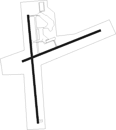
Cloquet - Cloquet Carlton Co
Airport details
| Country | United States of America |
| State | Minnesota |
| Region | K3 |
| Airspace | Minneapolis Ctr |
| Municipality | Cloquet |
| Elevation | 1276ft (389m) |
| Timezone | GMT -6 |
| Coordinates | 46.70111, -92.50356 |
| Magnetic var | |
| Type | land |
| Available since | X-Plane v10.40 |
| ICAO code | KCOQ |
| IATA code | n/a |
| FAA code | COQ |
Communication
| Cloquet Carlton Co AWOS 3 | 118.525 |
| Cloquet Carlton Co CTAF/UNICOM | 122.800 |
Nearby beacons
| code | identifier | dist | bearing | frequency |
|---|---|---|---|---|
| DL | PYKLA (DULUTH) NDB | 10.6 | 46° | 379 |
| DLH | DULUTH VORTAC | 13.7 | 71° | 112.60 |
| LKI | LAKESIDE (DULUTH) TACAN | 15.6 | 66° | 135.40 |
| HIB | HIBBING VOR/DME | 36.9 | 342° | 110.80 |
| GPZ | GRAND RAPIDS VOR/DME | 49 | 295° | 111.40 |
| BXR | BIG DOCTOR (SIREN) NDB | 53.1 | 171° | 203 |
| RZN | DME | 53.1 | 172° | 109.40 |
Instrument approach procedures
| runway | airway (heading) | route (dist, bearing) |
|---|---|---|
| RW18 | CIBNA (128°) | CIBNA WEDNU (17mi, 108°) 3000ft |
| RW18 | DLH (251°) | DLH WEDNU (13mi, 284°) 3000ft WEDNU (turn) 3000ft |
| RW18 | FOSUP (228°) | FOSUP WEDNU (19mi, 247°) 3000ft |
| RW18 | HIB (162°) | HIB WEDNU (27mi, 155°) 3000ft |
| RNAV | WEDNU 3000ft NESIC (5mi, 179°) 2900ft HUTKU (2mi, 179°) 2200ft KCOQ (3mi, 177°) 1318ft (5508mi, 117°) 1539ft FIDUP (5509mi, 297°) 2900ft FIDUP (turn) | |
| RW36 | DLH (251°) | DLH FIDUP (21mi, 226°) 3000ft FIDUP (turn) 2900ft |
| RW36 | KINGZ (338°) | KINGZ FIDUP (19mi, 326°) 2900ft |
| RW36 | WENIB (45°) | WENIB FIDUP (37mi, 55°) 2900ft |
| RNAV | FIDUP 2900ft EDUCU (6mi, 359°) 2900ft KCOQ (5mi, 0°) 1312ft (5508mi, 117°) 1529ft WEDNU (5508mi, 297°) 3000ft WEDNU (turn) |
Disclaimer
The information on this website is not for real aviation. Use this data with the X-Plane flight simulator only! Data taken with kind consent from X-Plane 12 source code and data files. Content is subject to change without notice.

