Celina - Lakefield
Airport details
| Country | United States of America |
| State | Ohio |
| Region | K5 |
| Airspace | Indianapolis Ctr |
| Municipality | Mercer County |
| Elevation | 894ft (272m) |
| Timezone | GMT -5 |
| Coordinates | 40.48428, -84.55820 |
| Magnetic var | |
| Type | land |
| Available since | X-Plane v10.40 |
| ICAO code | KCQA |
| IATA code | n/a |
| FAA code | CQA |
Communication
| Lakefield CTAF/UNICOM | 122.800 |
| Lakefield DAYTON Approach/Departure | 134.450 |
Nearby Points of Interest:
St. Charles Seminary
-Precious Blood Catholic Church
-Matthias Gast House
-Dr. Issac Elmer Williams House and Office
-William Luelleman House
-Julius Boesel House
-Adolph Boesel House
-Fort Recovery
-H.E. Fledderjohann Property
-Wallischeck Homestead
-Holy Trinity Catholic Church
-Sacred Heart Catholic Church
-William English House
-Miami and Erie Canal Deep Cut
-Versailles Town Hall and Wayne Township House
-Brown Township Building
-Blume High School
-First Presbyterian Church of Wapakoneta
-John H. Nichols House
-Charles Wintzer Building
-Auglaize County Courthouse
-St. Peter's Evangelical Lutheran Church
-Anna Town Hall
-Floral Hall
-James Haines Farm
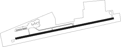
Runway info
| Runway 8 / 26 | ||
| length | 1337m (4386ft) | |
| bearing | 84° / 264° | |
| width | 23m (75ft) | |
| surface | asphalt | |
| blast zone | 71m (233ft) / 0m (0ft) | |
Nearby beacons
| code | identifier | dist | bearing | frequency |
|---|---|---|---|---|
| AWW | WINCHESTER NDB | 25.2 | 229° | 212 |
| ROD | ROSEWOOD VORTAC | 26.3 | 111° | 117.50 |
| DQN | DAYTON VOR/DME | 29 | 161° | 114.50 |
| JN | BALLL (MUNCIE) NDB | 39.3 | 248° | 365 |
| MI | BALLL (MUNCIE) NDB | 39.3 | 248° | 365 |
| AT | BRUNY (DAYTON) NDB | 39.6 | 161° | 315 |
| MIE | MUNCIE VOR/DME | 41 | 254° | 114.40 |
| FWA | FORT WAYNE VORTAC | 41.2 | 308° | 117.80 |
| RID | RICHMOND VOR/DME | 45.6 | 201° | 110.60 |
| FBC | FLAG CITY VORTAC | 46.1 | 60° | 108.20 |
| FFO | PATTERSON (DAYTON) TACAN | 46.1 | 143° | 115.20 |
| SQ | PNTHR (CONNERSVILLE) NDB | 49.9 | 219° | 227 |
| AI | VIDEO (ANDERSON) NDB | 50.2 | 246° | 394 |
| UWL | NEW CASTLE NDB | 50.3 | 232° | 385 |
| SGH | DME | 50.8 | 132° | 113.20 |
| XSF | SPRINGFIELD TACAN | 50.8 | 132° | 133.80 |
| GW | SHENK (AUBURN) NDB | 52.4 | 335° | 227 |
| MW | ONIDA (MIDDLETOWN) NDB | 55.4 | 165° | 223 |
| HKF | HOOK FIELD (MIDDLETOWN) NDB | 59.4 | 174° | 239 |
| OLK | WEBSTER LAKE VOR | 62.5 | 309° | 110.40 |
| IL | AIRBO (WILMINGTON) NDB | 70.4 | 140° | 407 |
Instrument approach procedures
| runway | airway (heading) | route (dist, bearing) |
|---|---|---|
| RW08 | AVOXE (84°) | AVOXE 3000ft |
| RW08 | COLMI (65°) | COLMI 3000ft AVOXE (5mi, 350°) 3000ft |
| RW08 | EKLLR (102°) | EKLLR 3000ft AVOXE (5mi, 170°) 3000ft |
| RNAV | AVOXE 3000ft EVOCO (6mi, 84°) 2600ft KCQA (6mi, 84°) 934ft EVOZU (5mi, 84°) ICREB (8mi, 116°) 3000ft ICREB (turn) | |
| RW26 | ICREB (283°) | ICREB 3000ft IZZIE (5mi, 351°) 3000ft |
| RW26 | IZZIE (264°) | IZZIE 3000ft |
| RW26 | LUSHU (245°) | LUSHU 3000ft IZZIE (5mi, 171°) 3000ft |
| RNAV | IZZIE 3000ft EVOZU (6mi, 264°) 2600ft KCQA (5mi, 264°) 927ft EVOCO (6mi, 264°) COLMI (8mi, 230°) 3000ft COLMI (turn) |
Disclaimer
The information on this website is not for real aviation. Use this data with the X-Plane flight simulator only! Data taken with kind consent from X-Plane 12 source code and data files. Content is subject to change without notice.