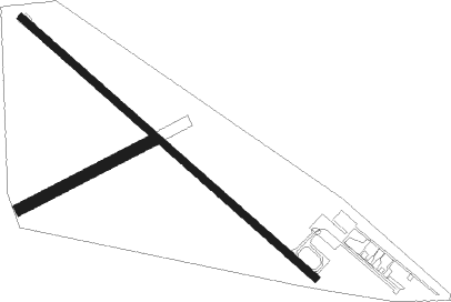
Cook - Cook Muni
Airport details
| Country | United States of America |
| State | Minnesota |
| Region | K3 |
| Airspace | Minneapolis Ctr |
| Municipality | Cook |
| Elevation | 1327ft (404m) |
| Timezone | GMT -6 |
| Coordinates | 47.82208, -92.69053 |
| Magnetic var | |
| Type | land |
| Available since | X-Plane v10.40 |
| ICAO code | KCQM |
| IATA code | n/a |
| FAA code | CQM |
Communication
| COOK MUNI AWOS 3 | 118.175 |
| COOK MUNI CTAF | 122.900 |
Nearby Points of Interest:
LeMoine Building
-Orr Roadside Parking Area
-Tower Train Museum
-Tower Fire Hall
-Civilian Conservation Corps Camp S-52
-Charles Lenont House
-Jukola Boardinghouse
-Virginia Depot
-Lincoln School Building
-Virginia–Rainy Lake Lumber Company Office
-Finnish Sauna
-St. Louis County District Courthouse
-Church of St. John the Baptist
-B'nai Abraham Synagogue
-Coates House
-W.T. Bailey House
-Sts. Peter and Paul Russian Orthodox Church
-Buhl City Hall
-Gregorius and Mary Hanka Farmstead
-Chisholm Commercial Historic District
-Saints Peter and Paul Church-Ukrainian Catholic
-Bruce Mine Headframe
-Church of the Holy Family
-W. Bailey House
-Anna and Mikko Pyhala Farm

Nearby beacons
| code | identifier | dist | bearing | frequency |
|---|---|---|---|---|
| SCG | SCOTT (CRANE LAKE) NDB | 27.6 | 26° | 385 |
| HIB | HIBBING VOR/DME | 31.2 | 181° | 110.80 |
| ELO | DME | 34.6 | 90° | 109.60 |
| FOZ | BIGFORK NDB | 38.9 | 268° | 345 |
| GPZ | GRAND RAPIDS VOR/DME | 51.1 | 230° | 111.40 |
| INL | INTERNATIONAL FALLS VOR/DME | 53 | 316° | 111 |
| DL | PYKLA (DULUTH) NDB | 60.2 | 161° | 379 |
| YAG | FORT FRANCES NDB | 62.1 | 316° | 376 |
| LKI | LAKESIDE (DULUTH) TACAN | 62.2 | 153° | 135.40 |
Instrument approach procedures
| runway | airway (heading) | route (dist, bearing) |
|---|---|---|
| RW13 | SAYOB (283°) | SAYOB WELVO (31mi, 290°) 3500ft WELVO (turn) 3500ft |
| RW13 | TOEGO (60°) | TOEGO WELVO (17mi, 4°) 3500ft WELVO (turn) 3500ft |
| RW13 | ZUNNI (120°) | ZUNNI WELVO (12mi, 116°) 3500ft |
| RNAV | WELVO 3500ft HIDGO (6mi, 125°) 3200ft FIRIL (4mi, 125°) 1900ft KCQM (2mi, 126°) 1367ft (5514mi, 117°) 1680ft JUDOD (5506mi, 297°) 3500ft JUDOD (turn) | |
| RW31 | HIB (1°) | HIB JUDOD (24mi, 30°) 3500ft |
| RW31 | INKER (102°) | INKER JUDOD (26mi, 112°) 3500ft JUDOD (turn) 3500ft |
| RW31 | SAYOB (283°) | SAYOB JUDOD (11mi, 262°) 3500ft |
| RNAV | JUDOD 3500ft COPLU (6mi, 305°) 3200ft PACIG (4mi, 305°) 2020ft KCQM (2mi, 304°) 1357ft (5514mi, 117°) 1640ft WELVO (5522mi, 297°) 3500ft WELVO (turn) |
Disclaimer
The information on this website is not for real aviation. Use this data with the X-Plane flight simulator only! Data taken with kind consent from X-Plane 12 source code and data files. Content is subject to change without notice.