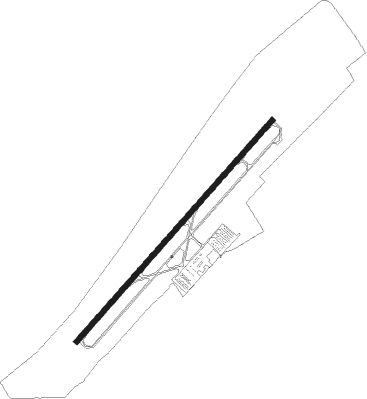
North Myrtle Beach - Grand Strand
Airport details
| Country | United States of America |
| State | South Carolina |
| Region | K7 |
| Airspace | Jacksonville Ctr |
| Municipality | North Myrtle Beach |
| Elevation | 32ft (10m) |
| Timezone | GMT -5 |
| Coordinates | 33.81175, -78.72395 |
| Magnetic var | |
| Type | land |
| Available since | X-Plane v10.40 |
| ICAO code | KCRE |
| IATA code | CRE |
| FAA code | CRE |
Communication
| Grand Strand ATIS | 119.625 |
| Grand Strand STRAND Ground Control | 121.800 |
| Grand Strand STRAND Tower | 124.600 |
| Grand Strand MYRTLE BEACH Approach/Departure | 119.200 |
Approach frequencies
| ILS-cat-I | RW23 | 111.7 | 18.00mi |
| 3° GS | RW23 | 111.7 | 18.00mi |
Nearby Points of Interest:
Myrtle Beach Atlantic Coast Line Railroad Station
-Atlantic Coast Line Railroad Depot
-Waccamaw River Memorial Bridge
-Waccamaw River Warehouse Historic District
-C.P. Quattlebaum House
-Paul Quattlebaum House
-C.P. Quattlebaum Office
-Old Horry County Courthouse
-Beaty-Spivey House
-Conway Downtown Historic District
-United States Post Office
-Arthur M. Burroughs House
-Beaty-Little House
-J.W. Holliday Jr. House
-W. H. Winborne House
-Conway Residential Historic District
-Burroughs School
-H.W. Ambrose House
-Buck's Upper Mill Farm
-John P. Derham House
-Brookgreen Gardens
-Atalaya Castle
-Atalaya and Brookgreen Gardens
-Chicora Wood Plantation
-Summer Chapel, Prince Frederick's Episcopal Church
Nearby beacons
| code | identifier | dist | bearing | frequency |
|---|---|---|---|---|
| CRE | GRAND STRAND VORTAC | 0.1 | 345° | 114.40 |
| HYW | HORRY (CONWAY) NDB | 20.1 | 272° | 370 |
| CPC | CAMP (WHITEVILLE) NDB | 27.7 | 1° | 227 |
| PHH | ANDREWS NDB | 45.6 | 246° | 255 |
| IL | AIRLI (WILMINGTON) NDB | 48.4 | 66° | 281 |
| JB | JIGEL (LUMBERTON) NDB | 48.6 | 331° | 384 |
| DLC | DILLON NDB | 49.9 | 315° | 274 |
| FLO | FLORENCE VORTAC | 52.8 | 294° | 115.20 |
| ILM | WILMINGTON VORTAC | 53.2 | 58° | 117 |
| GM | WILZE NDB | 55.2 | 60° | 205 |
| ME | MAXTN (MAXTON) NDB | 65.8 | 322° | 257 |
Instrument approach procedures
| runway | airway (heading) | route (dist, bearing) |
|---|---|---|
| RW05 | KOOKE (115°) | KOOKE OPMAY (12mi, 166°) 2100ft ZULSY (5mi, 131°) 2100ft |
| RW05 | PLANN (56°) | PLANN ZULSY (13mi, 60°) 2100ft |
| RNAV | ZULSY 2100ft YUPCY (6mi, 51°) 1600ft VEJTA (3mi, 51°) 700ft KCRE (2mi, 51°) 71ft MUPAE (4mi, 51°) RERDE (10mi, 311°) OPMAY (16mi, 212°) 2100ft OPMAY (turn) | |
| RW23 | CHAMS (237°) | CHAMS FIPEG (6mi, 249°) 2000ft |
| RW23 | HICKE (173°) | HICKE OTCEN (9mi, 129°) 2000ft FIPEG (5mi, 131°) 2000ft |
| RNAV | FIPEG 2000ft GAPNY (6mi, 231°) 1600ft MUQTU (2mi, 231°) 880ft KCRE (3mi, 231°) 84ft (4844mi, 113°) 1000ft OTCEN (4840mi, 293°) 2000ft OTCEN (turn) |
Disclaimer
The information on this website is not for real aviation. Use this data with the X-Plane flight simulator only! Data taken with kind consent from X-Plane 12 source code and data files. Content is subject to change without notice.
