Jacksonville - Jacksonville Executive At Craig Airport
Airport details
| Country | United States of America |
| State | Florida |
| Region | K7 |
| Airspace | Jacksonville Ctr |
| Municipality | Jacksonville |
| Elevation | 41ft (12m) |
| Timezone | GMT -5 |
| Coordinates | 30.33633, -81.51444 |
| Magnetic var | |
| Type | land |
| Available since | X-Plane v10.40 |
| ICAO code | KCRG |
| IATA code | CRG |
| FAA code | CRG |
Communication
| Jacksonville Executive at Craig Airport ATIS | 125.400 |
| Jacksonville Executive at Craig Airport CTAF | 132.100 |
| Jacksonville Executive at Craig Airport UNICOM | 122.950 |
| Jacksonville Executive at Craig Airport Clearance DEL | 118.350 |
| Jacksonville Executive at Craig Airport Ground Control | 121.800 |
| Jacksonville Executive at Craig Airport Tower | 132.100 |
| Jacksonville Executive at Craig Airport JACKSONVILLE Approach | 124.900 |
| Jacksonville Executive at Craig Airport JACKSONVILLE Departure | 118.000 |
Approach frequencies
| ILS-cat-I | RW32 | 111.7 | 18.00mi |
| 3° GS | RW32 | 111.7 | 18.00mi |
Nearby Points of Interest:
John S. Sammis House
-St. Johns River Light
-Napoleon Bonaparte Broward House
-Mount Zion AME Church
-Groover-Stewart Drug Company Building
-St. Johns Light
-Jacksonville Fire Museum
-Ribault Inn Club
-South Atlantic Investment Corporation Building
-Buckman and Ulmer Building
-Kingsley Plantation
-Morocco Temple
-Henry John Klutho House
-Title & Trust Company of Florida Building
-Jacksonville Public Library
-11 East Forsyth
-Dyal-Upchurch Building
-The Carling
-Hutchinson-Suddath Building
-Elks Club Building
-W. A. Knight Building
-St. James Building
-Schultz Building
-Florida Baptist Building
-South Jacksonville Grammar School
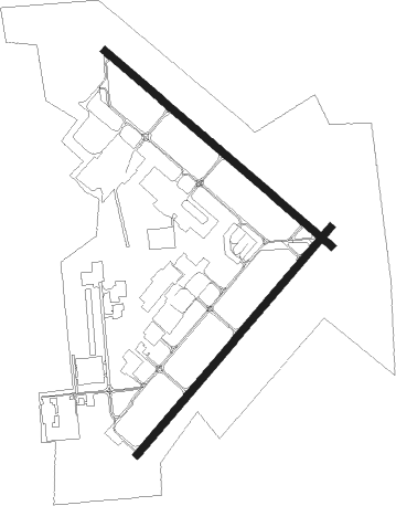
Runway info
Runway 14 / 32  | ||
| length | 1222m (4009ft) | |
| bearing | 131° / 311° | |
| width | 30m (98ft) | |
| surface | asphalt | |
| blast zone | 21m (69ft) / 24m (79ft) | |
| Runway 5 / 23 | ||
| length | 1221m (4006ft) | |
| bearing | 49° / 229° | |
| width | 30m (98ft) | |
| surface | asphalt | |
| displ threshold | 0m (0ft) / 73m (240ft) | |
| blast zone | 46m (151ft) / 23m (75ft) | |
Nearby beacons
| code | identifier | dist | bearing | frequency |
|---|---|---|---|---|
| CRG | CRAIG (JACKSONVILLE) VORTAC | 0.2 | 61° | 114.50 |
| NRB | MAYPORT TACAN | 5.6 | 60° | 111.40 |
| NIP | JACKSONVILLE TACAN | 10.3 | 238° | 108.20 |
| JA | DINNS (JACKSONVILLE) NDB | 16.7 | 294° | 344 |
| NZC | CECIL TACAN | 19.7 | 252° | 114.10 |
| RYD | REYNOLDS (GREEN COVE SPRINGS) NDB | 23.3 | 201° | 338 |
| SGJ | SAINT AUGUSTINE VOR/DME | 24.7 | 154° | 109.40 |
| SSI | BRUNSWICK (ST SIMONS I) VORTAC | 43 | 5° | 109.80 |
| GN | WYNDS (GAINESVILLE) NDB | 52.6 | 225° | 269 |
| GNV | GATORS VORTAC | 55.2 | 230° | 116.20 |
| AY | WIKET (WAYCROSS) NDB | 74.8 | 318° | 219 |
Departure and arrival routes
| Transition altitude | 18000ft |
| Transition level | 18000ft |
| STAR starting points | distance | inbound heading | |
|---|---|---|---|
| ALL | |||
| AMG2 | 88.4 | 140° | |
| HOTAR1 | 36.0 | 221° | |
| POGIE2 | 108.1 | 354° | |
Instrument approach procedures
| runway | airway (heading) | route (dist, bearing) |
|---|---|---|
| RW14 | GOBDE (106°) | GOBDE DIXYN (5mi, 48°) 3000ft |
| RW14 | IPTAQ (147°) | IPTAQ DIXYN (5mi, 208°) 3000ft |
| RNAV | DIXYN 3000ft AMGEJ (6mi, 121°) 1800ft CEBIS (3mi, 131°) 900ft KCRG (3mi, 134°) 76ft (4966mi, 110°) 284ft JEVAG (4957mi, 290°) 1900ft JEVAG (turn) | |
| RW32 | EPXOM (332°) | EPXOM JEVAG (5mi, 39°) 1900ft |
| RW32 | JEVAG (310°) | JEVAG 1900ft |
| RW32 | LOBLE (291°) | LOBLE JEVAG (5mi, 239°) 1900ft |
| RNAV | JEVAG 1900ft ADERR (6mi, 311°) 1900ft MUDVE (3mi, 311°) 1000ft KCRG (3mi, 308°) 82ft (4966mi, 110°) 700ft JEVAG (4957mi, 290°) 1900ft JEVAG (turn) |
Holding patterns
| STAR name | hold at | type | turn | heading* | altitude | leg | speed limit |
|---|---|---|---|---|---|---|---|
| POGIE2 | SHINR | VHF | right | 175 (355)° | DME 8.0mi | ICAO rules | |
| *) magnetic outbound (inbound) holding course | |||||||
Disclaimer
The information on this website is not for real aviation. Use this data with the X-Plane flight simulator only! Data taken with kind consent from X-Plane 12 source code and data files. Content is subject to change without notice.