Corpus Christi - Corpus Christi Intl
Airport details
| Country | United States of America |
| State | Texas |
| Region | K4 |
| Airspace | Houston Oceanic Ctr |
| Municipality | Corpus Christi |
| Elevation | 41ft (12m) |
| Timezone | GMT -6 |
| Coordinates | 27.77835, -97.50725 |
| Magnetic var | |
| Type | land |
| Available since | X-Plane v10.40 |
| ICAO code | KCRP |
| IATA code | CRP |
| FAA code | CRP |
Communication
| Corpus Christi Intl ATIS | 126.800 |
| Corpus Christi Intl UNICOM | 122.950 |
| Corpus Christi Intl CORPUS Clearance DEL | 118.550 |
| Corpus Christi Intl CORPUS GROUND | 121.900 |
| Corpus Christi Intl CORPUS TOWER | 119.400 |
| Corpus Christi Intl CORPUS Approach/Departure | 120.900 |
Approach frequencies
| LOC | RW31 | 110.3 | 18.00mi |
| ILS-cat-I | RW13 | 110.3 | 18.00mi |
| ILS-cat-I | RW36 | 109.5 | 18.00mi |
| 3° GS | RW13 | 110.3 | 18.00mi |
| 3° GS | RW36 | 109.5 | 18.00mi |
Nearby Points of Interest:
Novillo Line Camp
-John B. Ragland Mercantile Company Building
-King Ranch
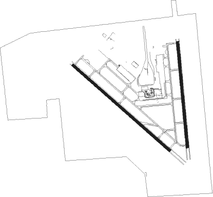
Runway info
Runway 13 / 31  | ||
| length | 2292m (7520ft) | |
| bearing | 132° / 312° | |
| width | 46m (150ft) | |
| surface | asphalt | |
| blast zone | 60m (197ft) / 255m (837ft) | |
| Runway 18 / 36 | ||
| length | 1871m (6138ft) | |
| bearing | 179° / 359° | |
| width | 46m (150ft) | |
| surface | asphalt | |
| blast zone | 58m (190ft) / 235m (771ft) | |
Nearby beacons
| code | identifier | dist | bearing | frequency |
|---|---|---|---|---|
| CRP | CORPUS CHRISTI VORTAC | 8.2 | 26° | 115.50 |
| NGP | TRUAX (CORPUS CHRISTI) TACAN | 12.5 | 113° | 114 |
| NQI | KINGSVILLE TACAN | 23 | 227° | 117.80 |
| ALI | ALICE VOR | 27.4 | 266° | 114.50 |
| NOG | ORANGE GROVE TACAN | 29.2 | 282° | 133.60 |
| THX | THREE RIVERS VORTAC | 55.3 | 318° | 111.40 |
| EOC | COYOTE (ENCINO) NDB | 67.2 | 218° | 232 |
Instrument approach procedures
| runway | airway (heading) | route (dist, bearing) |
|---|---|---|
| RW13-Y | SKIDS (146°) | SKIDS JAGRU (19mi, 155°) 2100ft |
| RNAV | JAGRU 2100ft CEVUS (6mi, 132°) 1700ft DOMIW (3mi, 132°) 720ft KCRP (2mi, 125°) 96ft (5804mi, 106°) 500ft SOLON (5801mi, 286°) 2000ft SOLON (turn) | |
| RW13-Z | COPAN (227°) | COPAN YEHEC (19mi, 242°) 3000ft ITONY (3mi, 241°) 2100ft WUBAM (3mi, 188°) 1100ft |
| RW13-Z | SKIDS (146°) | SKIDS JAGRU (19mi, 155°) 2100ft CEVUS (6mi, 132°) 1700ft WUBAM (2mi, 132°) 1100ft |
| RNAV | WUBAM 1100ft KCRP (4mi, 128°) 96ft JOGAT (7mi, 135°) SOLON (15mi, 182°) 2000ft SOLON (turn) | |
| RW18 | COPAN (227°) | COPAN CAVLA (17mi, 252°) 2100ft |
| RW18 | SKIDS (146°) | SKIDS CAVLA (21mi, 129°) 2100ft |
| RNAV | CAVLA 2100ft PEERS (6mi, 179°) 1700ft KCRP (5mi, 186°) 90ft (5804mi, 106°) 500ft SOLON (5801mi, 286°) 2000ft SOLON (turn) | |
| RW31-X | SKIDS (146°) | SKIDS ZULEX (43mi, 142°) 2000ft ZULEX (turn) 2000ft |
| RW31-X | SOLON (347°) | SOLON ZULEX (12mi, 26°) 2000ft |
| RW31-X | WORRY (217°) | WORRY FAPMA (27mi, 166°) 2000ft ZULEX (11mi, 256°) 2000ft |
| RNAV | ZULEX 2000ft JUSTO (7mi, 313°) 1700ft PINRR (2mi, 313°) 1300ft KCRP (4mi, 316°) 92ft (5804mi, 106°) 446ft ATHIS (5820mi, 286°) 2000ft ATHIS (turn) | |
| RW31-Y | SKIDS (146°) | SKIDS ZULEX (43mi, 142°) 2000ft ZULEX (turn) 2000ft |
| RW31-Y | SOLON (347°) | SOLON ZULEX (12mi, 26°) 2000ft |
| RW31-Y | WORRY (217°) | WORRY FAPMA (27mi, 166°) 2000ft ZULEX (11mi, 256°) 2000ft |
| RNAV | ZULEX 2000ft JUSTO (7mi, 313°) 1700ft KCRP (6mi, 315°) 92ft (5804mi, 106°) 243ft ATHIS (5820mi, 286°) 2000ft ATHIS (turn) | |
| RW31-Z | COPAN (227°) | COPAN CUNRO (20mi, 226°) 4000ft RIXMU (3mi, 226°) 4000ft PIVGY (3mi, 230°) 3200ft SIWOC (3mi, 182°) 2400ft |
| RW31-Z | CRP (206°) | CRP CUNRO (6mi, 191°) 4000ft RIXMU (3mi, 226°) 4000ft PIVGY (3mi, 230°) 3200ft SIWOC (3mi, 182°) 2400ft |
| RW31-Z | SKIDS (146°) | SKIDS EJUXO (10mi, 166°) 4000ft FEDEB (11mi, 166°) 4000ft ZUNER (6mi, 136°) 4000ft SIWOC (8mi, 133°) 2400ft |
| RNAV | SIWOC 2400ft NIGBE (4mi, 71°) 1200ft QODLU (2mi, 336°) KCRP (3mi, 319°) 92ft ATHIS (25mi, 312°) 2000ft ATHIS (turn) | |
| RW36-Y | CRP (206°) | CRP HADON (20mi, 188°) 2000ft HADON (turn) 2000ft |
| RW36-Y | SOLON (347°) | SOLON HADON (9mi, 334°) 2000ft |
| RNAV | HADON 2000ft OSSOE (6mi, 359°) 2000ft COKNU (5mi, 359°) 520ft KCRP (2mi, 343°) 92ft (5804mi, 106°) 240ft FEKEL (5803mi, 286°) ATHIS (23mi, 305°) 2000ft ATHIS (turn) | |
| RW36-Z | AUSTS (219°) | AUSTS COPAN (10mi, 198°) 4000ft GLASN (20mi, 211°) 4000ft RUVVU (3mi, 211°) 3100ft YUCUN (1mi, 195°) 2700ft YADUS (4mi, 239°) 2000ft ZADUR (2mi, 324°) 1300ft |
| RW36-Z | CRP (206°) | CRP WADPI (3mi, 146°) 4000ft VOWKO (5mi, 180°) 4000ft YUCUN (4mi, 178°) 2700ft YADUS (4mi, 239°) 2000ft ZADUR (2mi, 324°) 1300ft |
| RW36-Z | HADON (356°) | HADON 1600ft ZADUR (8mi, 359°) 1300ft |
| RW36-Z | SKIDS (146°) | SKIDS EJUXO (10mi, 166°) 4000ft FEDEB (11mi, 166°) 4000ft FIKLI (6mi, 134°) 4000ft ENMOJ (7mi, 149°) 2400ft ZIBKO (3mi, 106°) 1900ft ZADUR (2mi, 34°) 1300ft |
| RNAV | ZADUR 1300ft KCRP (5mi, 351°) 92ft EXIKE (8mi, 4°) ATHIS (20mi, 295°) 2000ft ATHIS (turn) |
Disclaimer
The information on this website is not for real aviation. Use this data with the X-Plane flight simulator only! Data taken with kind consent from X-Plane 12 source code and data files. Content is subject to change without notice.