Creston - Creston Muni
Airport details
| Country | United States of America |
| State | Iowa |
| Region | K3 |
| Airspace | Minneapolis Ctr |
| Municipality | Union County |
| Elevation | 1296ft (395m) |
| Timezone | GMT -6 |
| Coordinates | 41.02145, -94.36330 |
| Magnetic var | |
| Type | land |
| Available since | X-Plane v11.50 |
| ICAO code | KCSQ |
| IATA code | CSQ |
| FAA code | CSQ |
Communication
| Creston Muni AWOS 3 | 124.750 |
| Creston Muni CTAF/UNICOM | 122.800 |
Nearby Points of Interest:
Catalpa
-Adams County Jail
-Corning Commercial Historic District
-Adair County Courthouse
-hotel greenfield
-Warren Opera House Block and Hetherington Block
-Beaconsfield Supply Store
-Ringgold County Courthouse
-Ringgold County Jail
-Noah Odell House
-C.D. Bevington House and Stone Barn
-C.D. and Eliza Heath Bevington Privy
-Guiberson House
-W.J. and Nettie J. Cornell House
-Miller Richard and Mary Fisher Tidrick House
-Madison County Courthouse
-Henry C. Wallace House
-White, Munger and Company Store
-William R. and Martha Foster Shriver House
-Emily Hornback House
-Middlefork Methodist Episcopal Church
-Lenox Round Barn
-Bedford House
-Taylor County Courthouse
-Bedford Oil Company Station
Runway info
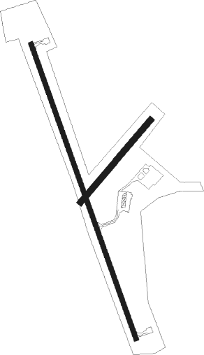
Runway 16 / 34  | ||
| length | 1496m (4908ft) | |
| bearing | 160° / 340° | |
| width | 23m (75ft) | |
| surface | asphalt | |
| Runway 04 / 22 | ||
| length | 516m (1693ft) | |
| bearing | 53° / 233° | |
| width | 30m (100ft) | |
| surface | grass | |
Nearby beacons
| code | identifier | dist | bearing | frequency |
|---|---|---|---|---|
| LMN | LAMONI VOR/DME | 31.2 | 137° | 116.70 |
| DSM | DES MOINES VORTAC | 40.8 | 60° | 117.50 |
| EFW | JEFFERSON NDB | 59.5 | 1° | 391 |
Instrument approach procedures
| runway | airway (heading) | route (dist, bearing) |
|---|---|---|
| RW16 | LYMAN (120°) | LYMAN SICON (9mi, 102°) 3000ft NOCSI (10mi, 102°) 3000ft |
| RW16 | NOCSI (160°) | NOCSI 3000ft |
| RW16 | UKIPE (163°) | UKIPE NOCSI (8mi, 168°) 3000ft |
| RNAV | NOCSI 3000ft CIVIM (6mi, 160°) 3000ft KCSQ (6mi, 160°) 1335ft (5603mi, 113°) 1539ft FOVOB (5600mi, 293°) 3000ft FOVOB (turn) | |
| RW34 | FOVOB (341°) | FOVOB 3000ft |
| RW34 | RILGE (359°) | RILGE FOVOB (7mi, 30°) 3000ft |
| RNAV | FOVOB 3000ft HIBAV (6mi, 340°) 3000ft LARIY (3mi, 340°) 2040ft KCSQ (3mi, 341°) 1341ft (5603mi, 113°) 1700ft NOCSI (5605mi, 294°) 3000ft NOCSI (turn) |
Disclaimer
The information on this website is not for real aviation. Use this data with the X-Plane flight simulator only! Data taken with kind consent from X-Plane 12 source code and data files. Content is subject to change without notice.