Cut Bank - Cut Bank Muni
Airport details
| Country | United States of America |
| State | Montana |
| Region | K1 |
| Airspace | Salt Lake City Ctr |
| Municipality | Glacier County |
| Elevation | 3854ft (1175m) |
| Timezone | GMT -7 |
| Coordinates | 48.60836, -112.37615 |
| Magnetic var | |
| Type | land |
| Available since | X-Plane v10.40 |
| ICAO code | KCTB |
| IATA code | CTB |
| FAA code | CTB |
Communication
| Cut Bank Muni ASOS | 119.025 |
| Cut Bank Muni CTAF/UNICOM | 122.800 |
Nearby Points of Interest:
Camp Disappointment
-Rainbow Conoco
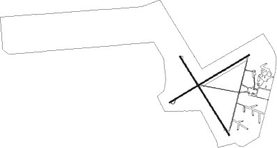
Runway info
Runway 14 / 32  | ||
| length | 1616m (5302ft) | |
| bearing | 142° / 322° | |
| width | 23m (75ft) | |
| surface | asphalt | |
| blast zone | 255m (837ft) / 0m (0ft) | |
| Runway 5 / 23 | ||
| length | 1614m (5295ft) | |
| bearing | 72° / 252° | |
| width | 23m (75ft) | |
| surface | asphalt | |
Nearby beacons
| code | identifier | dist | bearing | frequency |
|---|---|---|---|---|
| CTB | CUT BANK VOR/DME | 2.9 | 143° | 113.35 |
| 6T | FOREMOST NDB | 63.2 | 45° | 362 |
| QL | LETHBRIDGE NDB | 63.2 | 333° | 248 |
Departure and arrival routes
| Transition altitude | 18000ft |
| Transition level | 18000ft |
| SID end points | distance | outbound heading | |
|---|---|---|---|
| RW05 | |||
| MRIAS3 | 32mi | 166° | |
| RW14 | |||
| MRIAS3 | 32mi | 166° | |
| RW23 | |||
| MRIAS3 | 32mi | 166° | |
| RW32 | |||
| MRIAS3 | 32mi | 166° | |
Instrument approach procedures
| runway | airway (heading) | route (dist, bearing) |
|---|---|---|
| RW05 | GAPAR (41°) | GAPAR UCEBE (25mi, 30°) 10400ft ZEGEL (10mi, 18°) 6800ft |
| RW05 | PENRY (346°) | PENRY UCEBE (24mi, 292°) 10400ft ZEGEL (10mi, 18°) 6800ft |
| RNAV | ZEGEL 6800ft WUBIT (9mi, 60°) 5900ft ZULEG (4mi, 72°) 4460ft KCTB (2mi, 73°) 3905ft (6281mi, 113°) 4500ft WEBVO (6246mi, 294°) 11000ft WEBVO (turn) | |
| RW14 | CTB (323°) | CTB JOVEN (14mi, 314°) 6300ft JOVEN (turn) 6300ft |
| RW14 | GAPAR (41°) | GAPAR NOSRE (46mi, 19°) 11000ft JOVEN (10mi, 58°) 6300ft |
| RW14 | HOLOX (167°) | HOLOX JOVEN (10mi, 212°) 6300ft |
| RW14 | SUYOV (185°) | SUYOV JOVEN (10mi, 239°) 6300ft |
| RNAV | JOVEN 6300ft CIGUD (6mi, 125°) 5400ft NUMSE (3mi, 141°) 4440ft KCTB (2mi, 139°) 3910ft (6281mi, 113°) 4400ft PENRY (6285mi, 293°) 9000ft PENRY (turn) | |
| RW23 | CTB (323°) | CTB ZULTU (13mi, 61°) 6700ft ZULTU (turn) 6700ft |
| RW23 | WEBVO (273°) | WEBVO ZULTU (27mi, 282°) 6700ft |
| RNAV | ZULTU 6700ft WUTBO (6mi, 252°) 5800ft ZABOV (4mi, 252°) 4400ft KCTB (2mi, 251°) 3892ft (6281mi, 113°) 4400ft PENRY (6285mi, 293°) 9000ft PENRY (turn) | |
| RW32 | AGRYN (275°) | AGRYN EPILE (17mi, 253°) 6300ft |
| RW32 | BRADZ (320°) | BRADZ EPILE (20mi, 319°) 6300ft |
| RW32 | CTB (323°) | CTB EPILE (8mi, 142°) 6300ft EPILE (turn) 6300ft |
| RW32 | PENRY (346°) | PENRY EPILE (22mi, 360°) 6300ft |
| RNAV | EPILE 6300ft MALCO (6mi, 322°) 5400ft WEDAP (3mi, 322°) 4320ft KCTB (2mi, 324°) 3895ft (6281mi, 113°) 4400ft WEBVO (6246mi, 294°) 11000ft WEBVO (turn) |
Disclaimer
The information on this website is not for real aviation. Use this data with the X-Plane flight simulator only! Data taken with kind consent from X-Plane 12 source code and data files. Content is subject to change without notice.