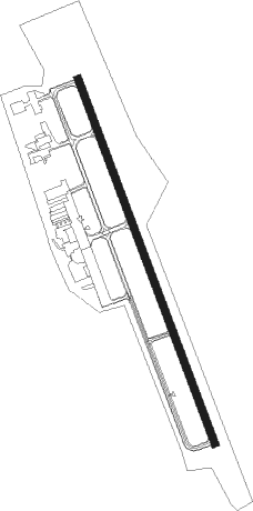
Carrollton - West Georgia Rgnl O V Gray Fld
Airport details
| Country | United States of America |
| State | Georgia |
| Region | K7 |
| Airspace | Atlanta Ctr |
| Municipality | Carroll County |
| Elevation | 1161ft (354m) |
| Timezone | GMT -5 |
| Coordinates | 33.63170, -85.15227 |
| Magnetic var | |
| Type | land |
| Available since | X-Plane v10.40 |
| ICAO code | KCTJ |
| IATA code | CTJ |
| FAA code | CTJ |
Communication
| WEST GEORGIA RGNL O V GRAY FLD AWOS 3 | 118.175 |
| WEST GEORGIA RGNL O V GRAY FLD CTAF/UNICOM | 122.975 |
| WEST GEORGIA RGNL O V GRAY FLD ATLANTA Approach/Departure | 121.000 |
Approach frequencies
| ILS-cat-I | RW35 | 111.7 | 18.00mi |
| 3° GS | RW35 | 111.7 | 18.00mi |
Nearby Points of Interest:
Carroll County Courthouse
-Dr. James L. Lovvorn House
-Haralson County Courthouse
-Veal School
-North Villa Rica Commercial Historic District
-Heard County Jail
-Douglas County Courthouse
-Col. William T. Roberts House
-John Morgan House
-Cleburne County Courthouse
-Powell Chapel School
-Paulding County Courthouse
-Coweta County Courthouse
-Hawkes Children's Library
-Cedartown Waterworks-Woman's Building-Big Spring Park Historic District
-Hiram Colored School
-Beulah Grove Lodge No. 372, Free and Accepted York Masons
-Thomas P. Arnold House
-McFarland-Render House
-Mary Ray Memorial School
-Pickett's Mill Battlefield Site
-Southern Railway Depot
-Campbell County Courthouse
-Roanoke Downtown Historic District
-Riverview Carousel
Nearby beacons
| code | identifier | dist | bearing | frequency |
|---|---|---|---|---|
| GPQ | CARROLLTON NDB | 4 | 162° | 278 |
| AT | CATTA (ATLANTA) NDB | 30.5 | 89° | 375 |
| EQQ | COWETA COUNTY (NEWNAN) NDB | 31.4 | 130° | 234 |
| RMG | ROME VORTAC | 31.9 | 4° | 115.40 |
| LGC | LA GRANGE VORTAC | 35 | 185° | 115.60 |
| ATL | ATLANTA VORTAC | 35.8 | 90° | 116.90 |
| DOB | DOBBINS (MARIETTA) TACAN | 36.4 | 66° | 113 |
| FFC | PECAT (ATLANTA) NDB | 38.8 | 116° | 316 |
| AN | BOGGA (ANNISTON) NDB | 39.4 | 263° | 211 |
| TDG | DME | 44.6 | 266° | 108.80 |
| PDK | PEACHTREE (ATLANTA) VOR/DME | 45 | 74° | 116.60 |
| DJD | CHERO NDB | 49.8 | 47° | 415 |
| GAD | GADSDEN VOR/DME | 50.8 | 290° | 112.30 |
| OP | YATES (THOMASTON) NDB | 64.6 | 126° | 339 |
Departure and arrival routes
| Transition altitude | 18000ft |
| Transition level | 18000ft |
| STAR starting points | distance | inbound heading | |
|---|---|---|---|
| ALL | |||
| DEHAN3 | 77.2 | 234° | |
Instrument approach procedures
| runway | airway (heading) | route (dist, bearing) |
|---|---|---|
| RW17 | EBEYO (136°) | EBEYO 3200ft WALIG (5mi, 76°) 3200ft |
| RW17 | GIBRE (188°) | GIBRE 3200ft WALIG (5mi, 256°) 3200ft |
| RW17 | WALIG (161°) | WALIG 3200ft |
| RNAV | WALIG 3200ft HATIV (6mi, 161°) 2900ft PEYTI (3mi, 161°) 1860ft KCTJ (3mi, 161°) 1209ft (5163mi, 112°) 1561ft JUGIL (5159mi, 291°) 3200ft JUGIL (turn) | |
| RW35 | JUGIL (341°) | JUGIL 3200ft |
| RW35 | ONOYU (7°) | ONOYU 3200ft JUGIL (5mi, 76°) 3200ft |
| RW35 | POSIY (317°) | POSIY 3200ft JUGIL (5mi, 256°) 3200ft |
| RNAV | JUGIL 3200ft TACUL (7mi, 341°) 2900ft KCTJ (6mi, 341°) 1157ft (5163mi, 112°) 1390ft WALIG (5167mi, 292°) 3200ft WALIG (turn) |
Holding patterns
| STAR name | hold at | type | turn | heading* | altitude | leg | speed limit |
|---|---|---|---|---|---|---|---|
| DEHAN3 | AWSON | VHF | left | 29 (209)° | DME 10.0mi | ICAO rules | |
| DEHAN3 | TRALZ | VHF | right | 32 (212)° | DME 10.0mi | ICAO rules | |
| *) magnetic outbound (inbound) holding course | |||||||
Disclaimer
The information on this website is not for real aviation. Use this data with the X-Plane flight simulator only! Data taken with kind consent from X-Plane 12 source code and data files. Content is subject to change without notice.