Castroville - Castroville Municipal
Airport details
| Country | United States of America |
| State | Texas |
| Region | K4 |
| Airspace | Houston Oceanic Ctr |
| Municipality | Castroville |
| Elevation | 770ft (235m) |
| Timezone | GMT -6 |
| Coordinates | 29.34239, -98.85122 |
| Magnetic var | |
| Type | land |
| Available since | X-Plane v10.40 |
| ICAO code | KCVB |
| IATA code | n/a |
| FAA code | T89 |
Communication
| Castroville Municipal AWOS-3 | 119.250 |
| Castroville Municipal CTAF/UNICOM | 122.800 |
| Castroville Municipal SAN ANTONIO Approach/Departure | 118.050 |
Nearby Points of Interest:
Castroville Historic District
-Prospect Hill Missionary Baptist Church
-Anton Wulff House
-Alamo Methodist Church
-Yturri-Edmunds House
-Bexar County Courthouse
-Main and Military Plazas Historic District
-Ethel Wilson Harris House
-David J. and May Bock Woodward House
-Aurora Apartment Hotel
-Jeremiah Dashiell House
-Acequia Madre de Valero
-Otto Bombach House
-Hipolito F. Garcia Federal Building and United States Courthouse
-Alamo Plaza Historic District
-Stinson Municipal Airport
-Johann and Anna Heidgen House
-Hangar 9, Brooks Air Force Base
-Monastery of Our Lady of Charity
-Fence at Alamo Cement Company
-Fort Sam Houston
-San Antonio Military Medical Center
-Kendall County Courthouse and Jail
-Frederick and Sallie Lyons House
-Administration Building
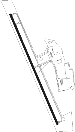
Runway info
| Runway 16 / 34 | ||
| length | 1405m (4610ft) | |
| bearing | 159° / 339° | |
| width | 23m (75ft) | |
| surface | asphalt | |
Nearby beacons
| code | identifier | dist | bearing | frequency |
|---|---|---|---|---|
| HHH | DEVINE NDB | 13 | 203° | 359 |
| KSY | KELLY (SAN ANTONIO) TACAN | 14.4 | 80° | 112 |
| AN | ALAMO (SAN ANTONIO) NDB | 21.6 | 47° | 368 |
| SSF | STINSON (SAN ANTONIO) VOR | 21.9 | 102° | 108.40 |
| SAT | SAN ANTONIO VORTAC | 27.2 | 52° | 116.80 |
| RND | RANDOLPH VORTAC | 31.4 | 73° | 112.30 |
| DHK | RANDOLPH TACAN | 32.6 | 72° | 109.90 |
| CSI | CENTER POINT (KERRVILLE) VORTAC | 39.6 | 328° | 117.50 |
| STV | STONEWALL VORTAC | 52.4 | 10° | 113.80 |
| COT | COTULLA VORTAC | 54.7 | 197° | 115.80 |
| RU | GARYS (AUSTIN) NDB | 59.8 | 56° | 272 |
| THX | THREE RIVERS VORTAC | 62.3 | 140° | 111.40 |
Instrument approach procedures
| runway | airway (heading) | route (dist, bearing) |
|---|---|---|
| RW16 | CSI (148°) | CSI BIBRE (19mi, 137°) 4100ft JEDOL (12mi, 158°) 3000ft |
| RNAV | JEDOL 3000ft FIMUL (5mi, 158°) 2000ft POCPO (1mi, 159°) 1540ft KCVB (3mi, 159°) 814ft (5868mi, 107°) 1174ft SHEOL (5865mi, 286°) 3000ft SHEOL (turn) | |
| RW34 | KICED (153°) | KICED SHEOL (32mi, 155°) 3200ft SHEOL (turn) 3000ft |
| RW34 | SOMER (310°) | SOMER SHEOL (7mi, 268°) 3000ft |
| RNAV | SHEOL 3000ft IBDOW (6mi, 339°) 2500ft TAAHD (4mi, 339°) 1300ft KCVB (2mi, 339°) 802ft (5868mi, 107°) 1300ft SHEOL (5865mi, 286°) 3000ft SHEOL (turn) |
Disclaimer
The information on this website is not for real aviation. Use this data with the X-Plane flight simulator only! Data taken with kind consent from X-Plane 12 source code and data files. Content is subject to change without notice.