Clovis - Clovis Muni
Airport details
| Country | United States of America |
| State | New Mexico |
| Region | K2 |
| Airspace | Albuquerque Ctr |
| Municipality | Curry County |
| Elevation | 4213ft (1284m) |
| Timezone | GMT -7 |
| Coordinates | 34.42659, -103.07758 |
| Magnetic var | |
| Type | land |
| Available since | X-Plane v10.40 |
| ICAO code | KCVN |
| IATA code | CVN |
| FAA code | CVN |
Communication
| Clovis Muni AWOS 3 | 135.375 |
| Clovis Muni CTAF/UNICOM | 122.800 |
| Clovis Muni CANNON Approach | 125.500 |
| Clovis Muni CANNON Departure | 125.500 |
Approach frequencies
| ILS-cat-I | RW04 | 108.9 | 18.00mi |
| 3° GS | RW04 | 108.9 | 18.00mi |
Nearby Points of Interest:
Hillcrest Park Archway
-Clovis Baptist Hospital
-1908 Clovis City Hall and Fire Station
-Curry County Courthouse
-Clovis Central Fire Station
-Clovis Depot
-Old Clovis Post Office
-Blackwater Draw archaeological site
-Portales Main Post Office
-Administration Building
-Muleshoe National Wildlife Refuge
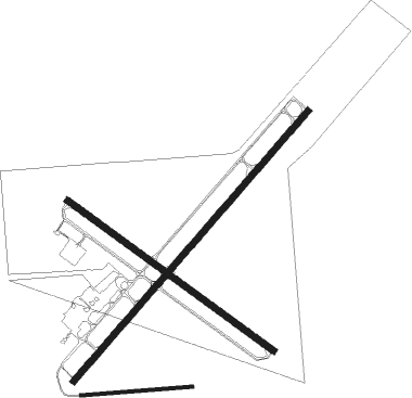
Runway info
Runway 4 / 22  | ||
| length | 2438m (7999ft) | |
| bearing | 51° / 231° | |
| width | 46m (150ft) | |
| surface | asphalt | |
| displ threshold | 244m (801ft) / 0m (0ft) | |
| Runway 12 / 30 | ||
| length | 1736m (5696ft) | |
| bearing | 125° / 305° | |
| width | 46m (150ft) | |
| surface | asphalt | |
| Runway 08 / 26 | ||
| length | 759m (2490ft) | |
| bearing | 90° / 270° | |
| width | 23m (75ft) | |
| surface | dirt | |
Nearby beacons
| code | identifier | dist | bearing | frequency |
|---|---|---|---|---|
| CV | HISAN (CLOVIS) NDB | 6.6 | 232° | 335 |
| CVS | CANNON (CLOVIS) TACAN | 12.4 | 259° | 111.60 |
| TXO | TEXICO VORTAC | 12.4 | 74° | 112.20 |
| TCC | TUCUMCARI VORTAC | 52.1 | 325° | 113.60 |
Instrument approach procedures
| runway | airway (heading) | route (dist, bearing) |
|---|---|---|
| RW04 | KEBYO (15°) | KEBYO VEZFO (9mi, 310°) 6300ft |
| RW04 | VEZFO (51°) | VEZFO 6300ft |
| RNAV | VEZFO 6300ft ELDAJ (7mi, 51°) 6300ft CIPAT (3mi, 51°) 5200ft KCVN (3mi, 52°) 4247ft (6051mi, 108°) 4405ft RIMKE (6042mi, 289°) 6000ft RIMKE (turn) | |
| RW22 | SELPE (163°) | SELPE RIMKE (10mi, 96°) 7000ft RIMKE (turn) 6000ft |
| RW22 | TXO (254°) | TXO RIMKE (5mi, 309°) 7000ft RIMKE (turn) 6000ft |
| RW22 | ZULAK (246°) | ZULAK RIMKE (12mi, 260°) 6000ft |
| RNAV | RIMKE 6000ft YOKUR (5mi, 231°) 6000ft MAYAS (4mi, 231°) 4800ft KCVN (2mi, 230°) 4261ft (6051mi, 108°) 4520ft VEZFO (6062mi, 288°) 6300ft VEZFO (turn) | |
| RW30 | KEBYO (15°) | KEBYO PLODD (10mi, 69°) 6300ft LYSOL (5mi, 46°) 6000ft |
| RW30 | LYSOL (305°) | LYSOL 12000ft LYSOL (turn) 6000ft |
| RW30 | TXO (254°) | TXO MUCHO (8mi, 178°) 6600ft LYSOL (5mi, 226°) 6000ft |
| RNAV | LYSOL 6000ft BABBS (6mi, 305°) 5900ft KCVN (6mi, 306°) 4237ft (6051mi, 108°) 4616ft LYSOL (6043mi, 288°) 6000ft LYSOL (turn) |
Disclaimer
The information on this website is not for real aviation. Use this data with the X-Plane flight simulator only! Data taken with kind consent from X-Plane 12 source code and data files. Content is subject to change without notice.