Clovis - Cannon Afb
Airport details
| Country | United States of America |
| State | New Mexico |
| Region | K2 |
| Airspace | Albuquerque Ctr |
| Municipality | Curry County |
| Elevation | 4292ft (1308m) |
| Timezone | GMT -7 |
| Coordinates | 34.37011, -103.31308 |
| Magnetic var | |
| Type | land |
| Available since | X-Plane v10.40 |
| ICAO code | KCVS |
| IATA code | CVS |
| FAA code | CVS |
Communication
| CANNON AFB ATIS | 119.100 |
| CANNON AFB Clearance DEL | 120.200 |
| CANNON AFB Ground Control | 121.900 |
| CANNON AFB Tower | 120.400 |
| CANNON AFB Approach | 125.500 |
| CANNON AFB Departure | 125.500 |
Approach frequencies
| ILS-cat-I | RW31 | 108.3 | 18.00mi |
| ILS-cat-I | RW22 | 109.7 | 18.00mi |
| ILS-cat-I | RW04 | 108.5 | 18.00mi |
| ILS-cat-I | RW13 | 110.35 | 18.00mi |
| 3° GS | RW31 | 108.3 | 18.00mi |
| 3° GS | RW22 | 109.7 | 18.00mi |
| 3° GS | RW13 | 110.35 | 18.00mi |
| 2.5° GS | RW04 | 108.5 | 18.00mi |
Nearby Points of Interest:
Old Clovis Post Office
-Clovis Depot
-Blackwater Draw archaeological site
-Clovis Central Fire Station
-Curry County Courthouse
-1908 Clovis City Hall and Fire Station
-Clovis Baptist Hospital
-Hillcrest Park Archway
-Portales Main Post Office
-Administration Building
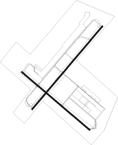
Runway info
Runway 4 / 22  | ||
| length | 3051m (10010ft) | |
| bearing | 50° / 230° | |
| width | 46m (150ft) | |
| surface | concrete | |
| blast zone | 255m (837ft) / 255m (837ft) | |
| Runway 13 / 31 | ||
| length | 2498m (8196ft) | |
| bearing | 129° / 309° | |
| width | 46m (150ft) | |
| surface | asphalt | |
| blast zone | 255m (837ft) / 255m (837ft) | |
Nearby beacons
| code | identifier | dist | bearing | frequency |
|---|---|---|---|---|
| CVS | CANNON (CLOVIS) TACAN | 0.7 | 318° | 111.60 |
| CV | HISAN (CLOVIS) NDB | 6.9 | 98° | 335 |
| TXO | TEXICO VORTAC | 24.6 | 75° | 112.20 |
| TCC | TUCUMCARI VORTAC | 50.7 | 341° | 113.60 |
Instrument approach procedures
| runway | airway (heading) | route (dist, bearing) |
|---|---|---|
| RW04 | CURAM (54°) | CURAM 7000ft |
| RNAV | CURAM 7000ft FINDI (6mi, 50°) 6000ft KCVS (7mi, 58°) 4321ft (6063mi, 108°) 4695ft FETEP (6060mi, 288°) HEKDI (7mi, 50°) 7000ft HEKDI (turn) 10000ft | |
| RW13 | ZUNEN (169°) | ZUNEN 8000ft RAPKE (14mi, 209°) 7000ft |
| RNAV | RAPKE 7000ft LERAY (7mi, 130°) 5900ft KCVS (6mi, 129°) 4338ft (6063mi, 108°) 4695ft HOMEP (6060mi, 288°) SOPLE (6mi, 130°) 7000ft SOPLE (turn) 10000ft | |
| RW22 | PIBIE (178°) | PIBIE 7000ft BURNR (16mi, 134°) 7000ft |
| RW22 | STAFO (269°) | STAFO 7000ft BURNR (15mi, 307°) 7000ft |
| RNAV | BURNR 7000ft FETEP (9mi, 230°) 5600ft KCVS (5mi, 220°) 4339ft (6063mi, 108°) 4695ft JEBES (6068mi, 288°) CLINK (7mi, 178°) 7000ft CLINK (turn) 10000ft | |
| RW31 | RUSLE (286°) | RUSLE 8000ft FOBUR (10mi, 259°) 7000ft |
| RW31 | WIBES (340°) | WIBES 8000ft FOBUR (10mi, 18°) 7000ft |
| RNAV | FOBUR 7000ft HOMEP (6mi, 310°) 5900ft KCVS (5mi, 310°) 4307ft (6063mi, 108°) 4695ft RAPKE (6071mi, 288°) ZUNEN (14mi, 29°) 7000ft ZUNEN (turn) 10000ft |
Disclaimer
The information on this website is not for real aviation. Use this data with the X-Plane flight simulator only! Data taken with kind consent from X-Plane 12 source code and data files. Content is subject to change without notice.