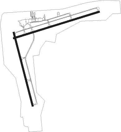
Mosinee - Central Wisconsin
Airport details
| Country | United States of America |
| State | Wisconsin |
| Region | K5 |
| Airspace | Minneapolis Ctr |
| Municipality | Mosinee |
| Elevation | 1275ft (389m) |
| Timezone | GMT -6 |
| Coordinates | 44.77763, -89.66678 |
| Magnetic var | |
| Type | land |
| Available since | X-Plane v10.40 |
| ICAO code | KCWA |
| IATA code | CWA |
| FAA code | CWA |
Communication
| Central Wisconsin ATIS | 127.450 |
| Central Wisconsin CTAF | 119.750 |
| Central Wisconsin UNICOM | 122.950 |
| Central Wisconsin Ground Control | 121.900 |
| Central Wisconsin Tower | 119.750 |
Approach frequencies
| ILS-cat-I | RW08 | 110.3 | 18.00mi |
| ILS-cat-I | RW35 | 110.9 | 18.00mi |
| 3° GS | RW08 | 110.3 | 18.00mi |
| 3° GS | RW35 | 110.9 | 18.00mi |
Nearby Points of Interest:
Karl Mathie House
-Joseph Dessert Library
-Louis Marchetti House
-Duey and Julia Wright House
-Marathon County Fairgrounds
-Hiram C. Stewart House
-Granville D. Jones House
-C. H. Wegner House
-Ely Wright House
-C. B. Bird House
-E.K. Schuetz House
-C. F. Dunbar House
-D. C. Everest House
-Old Plover Methodist Church
-Fromm Brothers Fur and Ginseng Farm
-Willard D. Purdy Junior High and Vocational School
-First Street Bridge (Merrill, Wisconsin)
-T.B. Scott Free Library
-Merrill City Hall
-L. A. Pomeroy House

Nearby beacons
| code | identifier | dist | bearing | frequency |
|---|---|---|---|---|
| AUW | WAUSAU VOR/DME | 5.3 | 49° | 111.60 |
| DAF | NECEDAH NDB | 48 | 209° | 233 |
| RH | ARSHA (RHINELANDER) NDB | 51.1 | 3° | 272 |
| RHI | RHINELANDER VOR/DME | 52.1 | 14° | 109.20 |
| VOK | VOLK (CAMP DOUGLAS) TACAN | 56.2 | 215° | 110.40 |
| CMY | MC COY NDB | 65.5 | 229° | 412 |
Instrument approach procedures
| runway | airway (heading) | route (dist, bearing) |
|---|---|---|
| RW08 | BELGO (81°) | BELGO PLEAD (20mi, 81°) 3000ft |
| RW08 | MAXMA (98°) | MAXMA PLEAD (16mi, 112°) 3000ft |
| RW08 | RROBB (330°) | RROBB PLEAD (21mi, 294°) 3000ft PLEAD (turn) 3000ft |
| RNAV | PLEAD 3000ft HENPA (7mi, 81°) 3000ft WOKOS (3mi, 81°) 1960ft KCWA (2mi, 85°) 1329ft (5391mi, 117°) 1474ft ASARE (5378mi, 297°) 3000ft ASARE (turn) | |
| RW17 | CULOG (139°) | CULOG DUGTE (10mi, 114°) 3600ft |
| RW17 | EDGRR (106°) | EDGRR DUGTE (12mi, 63°) 3600ft DUGTE (turn) 3600ft |
| RW17 | ENETE (203°) | ENETE DUGTE (8mi, 250°) 3600ft |
| RNAV | DUGTE 3600ft FASEX (6mi, 166°) 3100ft KCWA (6mi, 162°) 1322ft (5391mi, 117°) 1534ft LEERY (5389mi, 296°) 2900ft LEERY (turn) | |
| RW26 | IPUCO (290°) | IPUCO ASARE (22mi, 309°) 3000ft |
| RW26 | RROBB (330°) | RROBB ASARE (18mi, 30°) 3000ft ASARE (turn) 3000ft |
| RW26 | USERS (231°) | USERS ASARE (22mi, 207°) 3000ft |
| RNAV | ASARE 3000ft TETEE (7mi, 261°) 3000ft ZIKUG (3mi, 261°) 1940ft KCWA (3mi, 258°) 1305ft (5391mi, 117°) 1510ft PLEAD (5403mi, 296°) 3000ft PLEAD (turn) | |
| RW35 | EDGRR (106°) | EDGRR LEERY (21mi, 130°) 3000ft LEERY (turn) 3000ft |
| RW35 | RROBB (330°) | RROBB LEERY (5mi, 299°) 3000ft |
| RNAV | LEERY 3000ft JONIS (5mi, 346°) 3000ft HUREB (3mi, 346°) 1900ft KCWA (3mi, 356°) 1275ft (5391mi, 117°) 1451ft DUGTE (5393mi, 297°) 3600ft DUGTE (turn) |
Disclaimer
The information on this website is not for real aviation. Use this data with the X-Plane flight simulator only! Data taken with kind consent from X-Plane 12 source code and data files. Content is subject to change without notice.