Claxton - Claxton Evans
Airport details
| Country | United States of America |
| State | Georgia |
| Region | K7 |
| Airspace | Jacksonville Ctr |
| Municipality | Evans County |
| Elevation | 109ft (33m) |
| Timezone | GMT -5 |
| Coordinates | 32.19506, -81.86955 |
| Magnetic var | |
| Type | land |
| Available since | X-Plane v10.40 |
| ICAO code | KCWV |
| IATA code | n/a |
| FAA code | CWV |
Communication
| Claxton Evans CTAF/UNICOM | 122.800 |
Nearby Points of Interest:
Dr. James W. Daniel House
-Evans County Courthouse
-Mitchell J. Green Plantation
-George W. DeLoach House
-Bryan County Courthouse
-South Metter Residential Historic District
-Metter Downtown Historic District
-Candler County Courthouse
-Donehoo-Brannen House
-James Alonzo Brannen House
-Savannah Avenue Historic District
-Candler County Jail
-Dr. Madison Monroe Holland House
-Bulloch County Courthouse
-Upper Lott's Creek Primitive Baptist Church and Cemetery
-Glen Echo
-Jim Smith House
-First Methodist Episcopal Church
-Robert and Missouri Garbutt House
-Liberty County Courthouse
-Bacon-Fraser House
-Liberty County Jail
-Harris-Murrow-Trowell House
-Davis-Proctor House
-Twin City Historic District
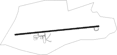
Runway info
| Runway 9 / 27 | ||
| length | 1522m (4993ft) | |
| bearing | 89° / 269° | |
| width | 23m (75ft) | |
| surface | asphalt | |
| displ threshold | 0m (0ft) / 305m (1001ft) | |
| blast zone | 32m (105ft) / 27m (89ft) | |
Nearby beacons
| code | identifier | dist | bearing | frequency |
|---|---|---|---|---|
| BZ | BULLO (STATESBORO) NDB | 16.8 | 43° | 407 |
| UQN | ONYUN (VIDALIA) NDB | 21.8 | 274° | 372 |
| MOQ | MC INTOSH (HINESVILLE) NDB | 28.5 | 135° | 263 |
| JYL | SYLVANIA NDB | 30.6 | 31° | 245 |
| SAV | SAVANNAH VORTAC | 34.2 | 94° | 115.95 |
| SVN | HUNTER (SAVANNAH) VOR/DME | 38.6 | 104° | 111.60 |
| BHC | BAXLEY NDB | 39.3 | 227° | 376 |
| EEX | EMANUEL COUNTY (SWAINSBORO) NDB | 40.9 | 309° | 309 |
| AZE | HAZLEHURST NDB | 43.8 | 248° | 414 |
| SV | WASSA (SAVANNAH) NDB | 46.3 | 102° | 335 |
| AMG | ALMA VORTAC | 51.2 | 224° | 115.10 |
| DBN | DUBLIN VORTAC | 53.5 | 291° | 113.10 |
| ALD | ALLENDALE VOR | 57.1 | 35° | 116.70 |
| AY | WIKET (WAYCROSS) NDB | 58.7 | 211° | 219 |
| AYS | WAYCROSS VORTAC | 65.7 | 217° | 110.20 |
Instrument approach procedures
| runway | airway (heading) | route (dist, bearing) |
|---|---|---|
| RW10 | LUHQY (89°) | LUHQY 2600ft |
| RNAV | LUHQY 2600ft OCPOV (7mi, 89°) 1800ft HIDRU (2mi, 89°) 1040ft KCWV (3mi, 89°) 157ft (4992mi, 111°) 500ft AHIDO (4980mi, 292°) 2600ft AHIDO (turn) | |
| RW28 | AHIDO (269°) | AHIDO 2600ft |
| RNAV | AHIDO 2600ft BUPAW (7mi, 269°) 1800ft JURSA (2mi, 269°) 1140ft KCWV (3mi, 269°) 159ft (4992mi, 111°) 386ft LUHQY (5005mi, 291°) 2600ft LUHQY (turn) |
Disclaimer
The information on this website is not for real aviation. Use this data with the X-Plane flight simulator only! Data taken with kind consent from X-Plane 12 source code and data files. Content is subject to change without notice.