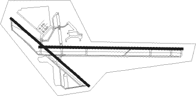
Cheyenne - Cheyenne Rgnl Jerry Olson Fld
Airport details
| Country | United States of America |
| State | Wyoming |
| Region | K1 |
| Airspace | Denver Ctr |
| Municipality | Cheyenne |
| Elevation | 6153ft (1875m) |
| Timezone | GMT -7 |
| Coordinates | 41.15711, -104.81161 |
| Magnetic var | |
| Type | land |
| Available since | X-Plane v10.40 |
| ICAO code | KCYS |
| IATA code | CYS |
| FAA code | CYS |
Communication
| CHEYENNE RGNL JERRY OLSON FLD ATIS | 134.425 |
| CHEYENNE RGNL JERRY OLSON FLD CTAF | 118.700 |
| CHEYENNE RGNL JERRY OLSON FLD UNICOM | 122.950 |
| CHEYENNE RGNL JERRY OLSON FLD Ground Control | 121.900 |
| CHEYENNE RGNL JERRY OLSON FLD Tower | 118.700 |
| CHEYENNE RGNL JERRY OLSON FLD Approach/Departure | 124.550 |
Approach frequencies
| ILS-cat-I | RW27 | 110.1 | 18.00mi |
| 3° GS | RW27 | 110.1 | 18.00mi |
Nearby Points of Interest:
Boeing/United Airlines Terminal Building, Hangar and Fountain
-Moore Haven Heights Historic District
-Capitol North Historic District
-Lakeview Historic District
-Rainsford Historic District
-Cheyenne Veterans Administration Hospital
-City and County Building
-Downtown Cheyenne Historic District
-Cheyenne South Side Historic District
-Fort D.A. Russell
-Dale Creek Crossing
Runway info
Nearby beacons
| code | identifier | dist | bearing | frequency |
|---|---|---|---|---|
| CYS | CHEYENNE VORTAC | 3.6 | 36° | 113.10 |
| GLL | GILL VOR/DME | 40.9 | 158° | 114.20 |
| LAR | LARAMIE VOR/DME | 42.4 | 281° | 117.60 |
| FN | COLLN (FT COLLINS-LOVELAND) NDB | 48.2 | 191° | 400 |
| TOR | TORRINGTON NDB | 62 | 36° | 293 |
Instrument approach procedures
| runway | airway (heading) | route (dist, bearing) |
|---|---|---|
| RW09 | BARGR (45°) | BARGR TODVE (18mi, 350°) 10600ft TODVE (turn) 10600ft |
| RW09 | CYS (216°) | CYS TODVE (16mi, 265°) 10600ft TODVE (turn) 10600ft |
| RNAV | TODVE 10600ft SIGSE (7mi, 94°) 8600ft HAXUG (3mi, 94°) 7800ft WIKAR (2mi, 94°) 7060ft KCYS (3mi, 93°) 6194ft (6072mi, 111°) 6474ft CIVOS (6066mi, 291°) HAMER (9mi, 123°) 8500ft HAMER (turn) | |
| RW13 | CYS (216°) | CYS EMOTY (12mi, 290°) 9000ft EMOTY (turn) 9000ft |
| RW13 | MILKY (127°) | MILKY EMOTY (9mi, 128°) 9000ft |
| RW13 | SENSE (112°) | SENSE EMOTY (3mi, 33°) 9000ft EMOTY (turn) 9000ft |
| RNAV | EMOTY 9000ft EXUMY (6mi, 127°) 7900ft JIMIG (2mi, 127°) 7180ft KCYS (4mi, 123°) 6210ft (6072mi, 111°) 6600ft HAMER (6060mi, 291°) 8500ft HAMER (turn) | |
| RW27 | CRIMS (299°) | CRIMS COLLA (8mi, 6°) 7800ft |
| RW27 | CYS (216°) | CYS COLLA (13mi, 106°) 8500ft COLLA (turn) 7800ft |
| RW27 | EGBER (267°) | EGBER COLLA (11mi, 259°) 7800ft |
| RW27 | POGTE (224°) | POGTE FERBU (9mi, 141°) 8200ft COLLA (7mi, 187°) 7800ft |
| RW27 | VIDEE (237°) | VIDEE FERBU (6mi, 149°) 8100ft COLLA (7mi, 187°) 7800ft |
| RNAV | COLLA 7800ft HORSE (8mi, 274°) 7800ft KCYS (6mi, 274°) 6154ft (6072mi, 111°) 6600ft SENSE (6081mi, 291°) 10400ft SENSE (turn) 10400ft | |
| RW31 | CIKNU (344°) | CIKNU ZORIS (7mi, 53°) 7800ft |
| RW31 | CYS (216°) | CYS ZORIS (13mi, 145°) 8500ft ZORIS (turn) 7800ft |
| RW31 | HAMER (291°) | HAMER ZORIS (6mi, 257°) 7800ft |
| RNAV | ZORIS 7800ft LORYI (6mi, 307°) 7800ft KCYS (5mi, 311°) 6185ft (6072mi, 111°) 6600ft SENSE (6081mi, 291°) 10400ft SENSE (turn) 10400ft |
Disclaimer
The information on this website is not for real aviation. Use this data with the X-Plane flight simulator only! Data taken with kind consent from X-Plane 12 source code and data files. Content is subject to change without notice.

