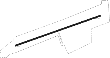
Cascade Locks
Airport details
| Country | United States of America |
| State | Oregon |
| Region | K1 |
| Airspace | Seattle Ctr |
| Municipality | Cascade Locks |
| Elevation | 147ft (45m) |
| Timezone | GMT -8 |
| Coordinates | 45.67694, -121.87889 |
| Magnetic var | |
| Type | land |
| Available since | X-Plane v10.40 |
| ICAO code | KCZK |
| IATA code | CZK |
| FAA code | CZK |
Communication
Nearby Points of Interest:
Cascade Locks Work Center
-Edward J. DeHart House
-Cliff Lodge
-Ernest S. and Clara C. Colby House
-Orrin B. Hartley House
-I.O.O.F. – Paris Fair Building
-Robert and Mabel Loomis House
-Lester and Hazel Murphy House
-Simpson Copple House
-Shaw–Dumble House
-John C. Duckwall House
-Davidson–Childs House
-Roe–Parker House
-Martin and Carrie Hill House
-Butler Bank
-Waucoma Hotel
-Mount Hood Railroad
-Andreas Graf House
-Vista House
-St. John the Evangelist Roman Catholic Church
-Jefferson Mosier House
-Springdale School
-John Roffler House
-Farrell Building
-Troutdale Methodist Episcopal Church
Runway info
| Runway 6 / 24 | ||
| length | 548m (1798ft) | |
| bearing | 80° / 260° | |
| width | 9m (30ft) | |
| surface | asphalt | |
Nearby beacons
| code | identifier | dist | bearing | frequency |
|---|---|---|---|---|
| BTG | BATTLE GROUND VORTAC | 30.1 | 276° | 116.60 |
| CBU | COLUMBIA (PORTLAND) TACAN | 31.2 | 263° | 109.20 |
| LTJ | KLICKITAT (THE DALLES) VOR/DME | 32.7 | 87° | 112.30 |
Disclaimer
The information on this website is not for real aviation. Use this data with the X-Plane flight simulator only! Data taken with kind consent from X-Plane 12 source code and data files. Content is subject to change without notice.
