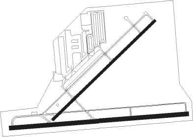
Daggett - Barstow Daggett
Airport details
| Country | United States of America |
| State | California |
| Region | K2 |
| Airspace | Los Angeles Ctr |
| Municipality | San Bernardino County |
| Elevation | 1924ft (586m) |
| Timezone | GMT -8 |
| Coordinates | 34.85953, -116.78748 |
| Magnetic var | |
| Type | land |
| Available since | X-Plane v10.40 |
| ICAO code | KDAG |
| IATA code | DAG |
| FAA code | DAG |
Communication
| BARSTOW DAGGETT ASOS | 132.175 |
| BARSTOW DAGGETT CTAF/UNICOM | 123.000 |
Nearby Points of Interest:
Rainbow Basin
Nearby beacons
| code | identifier | dist | bearing | frequency |
|---|---|---|---|---|
| DAG | DAGGETT VORTAC | 12 | 64° | 113.20 |
| HEC | HECTOR VORTAC | 16.4 | 101° | 112.70 |
| VCV | VICTORVILLE VOR/DME | 33.7 | 246° | 109.05 |
| EDW | EDWARDS VORTAC | 47.1 | 277° | 116.40 |
| SB | PETIS (SAN BERNARDINO) NDB | 56 | 216° | 397 |
| PSP | PALM SPRINGS VORTAC | 62 | 160° | 115.50 |
| RIV | MARCH (RIVERSIDE) TACAN | 62.1 | 207° | 113 |
| RAL | RIVERSIDE VOR | 63.4 | 216° | 112.40 |
| NID | CHINA LAKE TACAN | 66.5 | 313° | 111.60 |
| PDZ | PARADISE (ONTARIO) VORTAC | 67.4 | 218° | 112.20 |
| POM | POMONA VORTAC | 68.1 | 232° | 110.40 |
Departure and arrival routes
| Transition altitude | 18000ft |
| Transition level | 18000ft |
| SID end points | distance | outbound heading | |
|---|---|---|---|
| RW04 | |||
| DAG1 | 24mi | 65° | |
| RW08 | |||
| DAG1 | 24mi | 65° | |
| RW22 | |||
| DAG1 | 24mi | 65° | |
| RW26 | |||
| DAG1 | 24mi | 65° | |
Instrument approach procedures
| runway | airway (heading) | route (dist, bearing) |
|---|---|---|
| RW22 | DISBE (237°) | DISBE BILKE (14mi, 238°) 5000ft |
| RW22 | HEC (281°) | HEC ADIRE (8mi, 325°) 6000ft BILKE (5mi, 315°) 5000ft |
| RW22 | TEELE (245°) | TEELE BILKE (13mi, 252°) 5000ft |
| RNAV | BILKE 5000ft FALBA (6mi, 236°) 3500ft CUTNO (4mi, 236°) 2272ft CIKVI (3mi, 236°) BINTE (8mi, 287°) NULMN (10mi, 212°) 8000ft NULMN (turn) | |
| RW26 | BASAL (36°) | BASAL DOGSE (18mi, 75°) 8000ft DOGSE (turn) 6100ft |
| RW26 | BULGY (319°) | BULGY DOGSE (12mi, 32°) 8000ft DOGSE (turn) 6100ft |
| RW26 | DISBE (237°) | DISBE DOGSE (17mi, 205°) 6100ft |
| RW26 | JOEES (276°) | JOEES DOGSE (14mi, 281°) 6100ft |
| RW26 | TEELE (245°) | TEELE DOGSE (14mi, 215°) 6100ft |
| RNAV | DOGSE 6100ft ZABSA (4mi, 270°) 4900ft CABAM (4mi, 270°) 3800ft KDAG (6mi, 274°) 1959ft (6709mi, 107°) 2600ft BINTE (6717mi, 287°) NULMN (10mi, 212°) 8000ft NULMN (turn) |
Disclaimer
The information on this website is not for real aviation. Use this data with the X-Plane flight simulator only! Data taken with kind consent from X-Plane 12 source code and data files. Content is subject to change without notice.

