Danville - Danville Regl
Airport details
| Country | United States of America |
| State | Virginia |
| Region | K6 |
| Airspace | Washington Ctr |
| Municipality | Danville |
| Elevation | 569ft (173m) |
| Timezone | GMT -5 |
| Coordinates | 36.57248, -79.33624 |
| Magnetic var | |
| Type | land |
| Available since | X-Plane v10.40 |
| ICAO code | KDAN |
| IATA code | DAN |
| FAA code | DAN |
Communication
| Danville Regl ASOS | 128.125 |
| Danville Regl CTAF/UNICOM | 123.050 |
Approach frequencies
| ILS-cat-I | RW02 | 110.7 | 18.00mi |
| 3° GS | RW02 | 110.7 | 18.00mi |
Nearby Points of Interest:
Danville Tobacco Warehouse and Residential Historic District
-North Danville Historic District
-Danville Municipal Building
-Downtown Danville Historic District
-Dan River Mill No. 8
-Danville Public Library (Danville, Virginia)
-Mechanicsville Historic District
-Penn-Wyatt House
-Danville Historic District
-Langhorne House
-Holbrook-Ross Street Historic District
-Schoolfield Welfare Building
-Hylton Hall
-Longwood
-Milton Historic District
-Dan's Hill
-Woodside
-John Johnston House
-Melrose/Williamson House
-Poteat House
-Bartlett Yancey House
-Wildwood
-Red House Presbyterian Church
-Yanceyville Historic District
-Oak Ridge
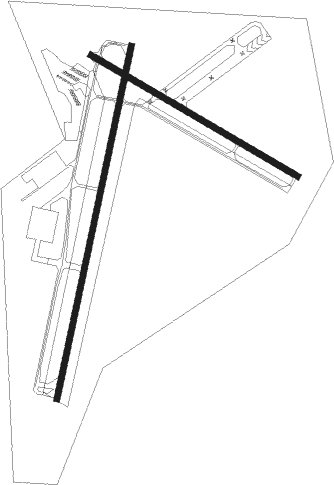
Runway info
Runway 2 / 20  | ||
| length | 1800m (5906ft) | |
| bearing | 20° / 200° | |
| width | 30m (100ft) | |
| surface | asphalt | |
| displ threshold | 0m (0ft) / 92m (302ft) | |
| Runway 13 / 31 | ||
| length | 1193m (3914ft) | |
| bearing | 119° / 299° | |
| width | 30m (100ft) | |
| surface | asphalt | |
| blast zone | 255m (837ft) / 0m (0ft) | |
Nearby beacons
| code | identifier | dist | bearing | frequency |
|---|---|---|---|---|
| DAN | DANVILLE VOR | 0.2 | 187° | 113.10 |
| SBV | SOUTH BOSTON VORTAC | 16.6 | 72° | 110.40 |
| SIF | SLAMMER (REIDSVILLE) NDB | 23.5 | 246° | 423 |
| HUR | PERSON (ROXBORO) NDB | 24.2 | 141° | 220 |
| UV | BALES (MARTINSVILLE) NDB | 28 | 272° | 396 |
| HB | ALAMM NDB | 37.6 | 203° | 361 |
| HXO | HUNTSBORO (OXFORD) NDB | 38.3 | 111° | 271 |
| LYH | LYNCHBURG VOR/DME | 41.2 | 8° | 109.20 |
| LY | BOJAR (LYNCHBURG) NDB | 41.6 | 8° | 385 |
| GSO | GREENSBORO VORTAC | 44.2 | 231° | 116.20 |
| VIT | VINTON (ROANOKE) NDB | 46 | 319° | 277 |
| LIB | LIBERTY VORTAC | 47.6 | 200° | 113 |
| LE | LEEVY (RALEIGH/DURHAM) NDB | 48.8 | 136° | 350 |
| RDU | RALEIGH-DURHAM VORTAC | 49.8 | 142° | 117.20 |
| IN | REENO (WINSTON SALEM) NDB | 50.2 | 239° | 317 |
| ODR | WOODRUM (ROANOKE) VOR | 54.6 | 319° | 114.90 |
| ROA | ROANOKE VOR/DME | 58.1 | 316° | 109.40 |
Instrument approach procedures
| runway | airway (heading) | route (dist, bearing) |
|---|---|---|
| RW02 | REIDE (42°) | REIDE LANTA (9mi, 69°) 2500ft |
| RW02 | SBV (252°) | SBV LANTA (26mi, 233°) 2500ft LANTA (turn) 2500ft |
| RNAV | LANTA 2500ft JIMIL (7mi, 20°) 2100ft KDAN (5mi, 21°) 590ft (4892mi, 115°) 1000ft LANTA (4894mi, 295°) 2500ft LANTA (turn) | |
| RW20 | DUNCE (151°) | DUNCE HIVDO (12mi, 114°) 2500ft |
| RW20 | SBV (252°) | SBV HIVDO (13mi, 287°) 2500ft |
| RNAV | HIVDO 2500ft ORDUH (6mi, 200°) 2200ft HEVSO (3mi, 200°) 1380ft KDAN (3mi, 198°) 615ft LANTA (12mi, 200°) 2500ft LANTA (turn) | |
| RW31 | NUGBE (298°) | NUGBE 2500ft |
| RW31 | SEGPE (273°) | SEGPE NUGBE (7mi, 221°) 2500ft |
| RW31 | UXEWE (321°) | UXEWE NUGBE (8mi, 4°) 2500ft |
| RNAV | NUGBE 2500ft ZUVNI (6mi, 299°) 2100ft JEGUX (2mi, 299°) 1360ft KDAN (3mi, 295°) 568ft (4892mi, 115°) 1000ft ENTUK (4903mi, 295°) 3300ft ENTUK (turn) |
Disclaimer
The information on this website is not for real aviation. Use this data with the X-Plane flight simulator only! Data taken with kind consent from X-Plane 12 source code and data files. Content is subject to change without notice.