Rochester - Skyhaven
Airport details
| Country | United States of America |
| State | New Hampshire |
| Region | K6 |
| Airspace | Boston Ctr |
| Municipality | Rochester |
| Elevation | 320ft (98m) |
| Timezone | GMT -5 |
| Coordinates | 43.28424, -70.92955 |
| Magnetic var | |
| Type | land |
| Available since | X-Plane v10.40 |
| ICAO code | KDAW |
| IATA code | DAW |
| FAA code | DAW |
Communication
| Skyhaven ASOS | 135.275 |
| Skyhaven CTAF/UNICOM | 122.700 |
| Skyhaven BOSTON Approach/Departure | 125.050 |
| Skyhaven BOSTON Approach/Departure | 128.200 |
Nearby Points of Interest:
Rochester Commercial and Industrial District
-Jenness Farm
-Richard Hayes House
-US Post Office-Somersworth Main
-Queensbury Mill
-Lehoullier Building
-Green Street School
-County Farm Bridge
-Strafford County Farm
-Woodbury Mill
-Rollinsford Town Hall
-Michael Reade House
-United States Post Office
-Public Market
-Cocheco Mills
-William Hale House
-Samuel Wyatt House
-South Berwick Village Historic District
-Woodman Institute Museum
-Sarah Orne Jewett House
-Religious Society of Friends Meetinghouse
-First Parish Church
-Sawyer Woolen Mills
-Old Grist Mill
-Farmington Town Pound
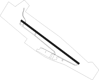
Runway info
| Runway 15 / 33 | ||
| length | 1279m (4196ft) | |
| bearing | 122° / 302° | |
| width | 30m (100ft) | |
| surface | asphalt | |
Nearby beacons
| code | identifier | dist | bearing | frequency |
|---|---|---|---|---|
| SF | SANFD (SANFORD) NDB | 5.1 | 62° | 349 |
| ESG | ROLLINS (ROLLINSFORD) NDB | 5.8 | 122° | 260 |
| PSM | (PORTSMOUTH) DME | 12.7 | 154° | 116.50 |
| ENE | KENNEBUNK VOR/DME | 16.2 | 66° | 117.10 |
| CO | EPSOM (CONCORD) NDB | 24.9 | 252° | 216 |
| CON | CONCORD VOR/DME | 28.5 | 264° | 112.90 |
| LC | BLNAP (LACONIA) NDB | 30.5 | 293° | 328 |
| MHT | MANCHESTER VOR/DME | 31.5 | 227° | 114.40 |
| LWM | DME | 33.4 | 197° | 112.50 |
| MJ | FITZY (MANCHESTER) NDB | 36.4 | 235° | 209 |
| LE | LEWIE (AUBURN-LEWISTON) NDB | 48.1 | 41° | 240 |
| BOS | BOSTON VOR/DME | 55.7 | 184° | 112.70 |
Instrument approach procedures
| runway | airway (heading) | route (dist, bearing) |
|---|---|---|
| RW33 | GRVEL (336°) | GRVEL LGURI (7mi, 50°) 3000ft |
| RW33 | LGURI (303°) | LGURI 3000ft |
| RW33 | OGNQT (277°) | OGNQT LGURI (7mi, 230°) 3000ft |
| RNAV | LGURI 3000ft ROLNS (6mi, 303°) 1900ft KDAW (5mi, 302°) 365ft (4579mi, 121°) 2000ft LGURI (4569mi, 301°) 3000ft LGURI (turn) |
Disclaimer
The information on this website is not for real aviation. Use this data with the X-Plane flight simulator only! Data taken with kind consent from X-Plane 12 source code and data files. Content is subject to change without notice.