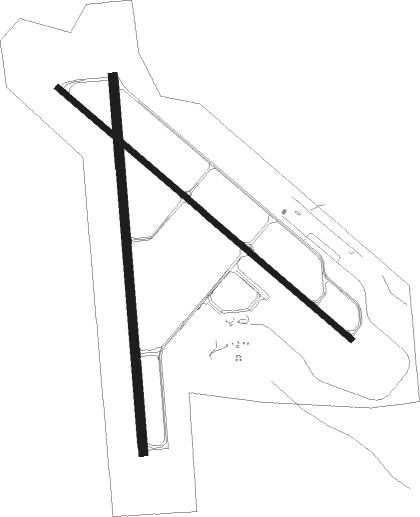
Dubuque - Dubuque Rgnl
Airport details
| Country | United States of America |
| State | Iowa |
| Region | K3 |
| Airspace | Chicago Ctr |
| Municipality | Dubuque County |
| Elevation | 1076ft (328m) |
| Timezone | GMT -6 |
| Coordinates | 42.40200, -90.70947 |
| Magnetic var | |
| Type | land |
| Available since | X-Plane v10.40 |
| ICAO code | KDBQ |
| IATA code | DBQ |
| FAA code | DBQ |
Communication
| Dubuque Rgnl ATIS | 127.250 |
| Dubuque Rgnl UNICOM | 122.950 |
| Dubuque Rgnl CTAF | 119.500 |
| Dubuque Rgnl Ground Control | 121.800 |
| Dubuque Rgnl Tower | 119.500 |
Approach frequencies
| LOC | RW31 | 108.7 | 18.00mi |
| ILS-cat-I | RW36 | 110.9 | 18.00mi |
| 3° GS | RW36 | 110.9 | 18.00mi |
Nearby Points of Interest:
Round Barn, Dubuque Township
-McMahon House
-Johann Christian Frederick Rath House
-Kelley House
-T. Ben Loetscher House
-Garland House
-Langworthy House
-Old Chapel Hall
-Bishop's Block
-United States Post Office and Courthouse
-Old Main Street Historic District
-Dunleith and Dubuque Bridge
-Ora Holland House
-J.H. Thedinga House
-German Bank
-Redstone
-Roshek's
-Security Building
-Dubuque County Courthouse
-Charles T. Hancock House
-Upper Main Street Historic District
-Carnegie-Stout Public Library
-Dubuque YMCA Building
-Henry N. Frentess Farmstead
-Dubuque Star Brewery

Nearby beacons
| code | identifier | dist | bearing | frequency |
|---|---|---|---|---|
| DBQ | DUBUQUE VORTAC | 0 | 143° | 115.80 |
| DB | ZILOM (DUBUQUE) NDB | 6.8 | 126° | 341 |
| FN | HILLZ (CLINTON) NDB | 41.5 | 154° | 517 |
| CVA | DAVENPORT VORTAC | 42.8 | 162° | 113.80 |
| LNR | ROCK DME | 59.2 | 33° | 116.05 |
| UKN | DME | 64.1 | 317° | 116.60 |
| IOW | IOWA CITY VOR/DME | 66.6 | 226° | 116.20 |
Instrument approach procedures
| runway | airway (heading) | route (dist, bearing) |
|---|---|---|
| RW13 | CASSY (137°) | CASSY HULOT (14mi, 146°) 2800ft |
| RW13 | DBQ (323°) | DBQ HULOT (12mi, 307°) 2800ft HULOT (turn) 2800ft |
| RNAV | HULOT 2800ft JOPUX (6mi, 126°) 2700ft KDBQ (5mi, 128°) 1126ft (5437mi, 115°) 1477ft JIPDA (5428mi, 295°) 3100ft JIPDA (turn) | |
| RW18 | BAULK (241°) | BAULK WITOK (23mi, 263°) 3000ft |
| RW18 | CASSY (137°) | CASSY WITOK (16mi, 112°) 3000ft |
| RW18 | DBQ (323°) | DBQ WITOK (13mi, 359°) 3000ft WITOK (turn) 3000ft |
| RW18 | SWAGG (164°) | SWAGG WITOK (15mi, 151°) 3000ft |
| RNAV | WITOK 3000ft ZUGNI (7mi, 180°) 2900ft KDBQ (6mi, 178°) 1123ft (5437mi, 115°) 1323ft DIVGE (5437mi, 295°) 2700ft DIVGE (turn) | |
| RW31 | DBQ (323°) | DBQ JIPDA (12mi, 126°) 3100ft JIPDA (turn) 3100ft |
| RW31 | LOTTE (342°) | LOTTE JIPDA (20mi, 6°) 3100ft |
| RW31 | WACKS (290°) | WACKS JIPDA (22mi, 283°) 3100ft |
| RNAV | JIPDA 3100ft RIPOC (6mi, 307°) 2700ft KDBQ (5mi, 305°) 1112ft (5437mi, 115°) 1477ft HULOT (5445mi, 295°) 2800ft HULOT (turn) | |
| RW36 | ANOSA (65°) | ANOSA JUGIT (23mi, 79°) 2700ft DIVGE (5mi, 90°) 2700ft |
| RW36 | DBQ (323°) | DBQ DIVGE (12mi, 181°) 2700ft DIVGE (turn) 2700ft |
| RW36 | LOTTE (342°) | LOTTE NEGUE (16mi, 351°) 2700ft DIVGE (5mi, 270°) 2700ft |
| RNAV | DIVGE 2700ft LATCI (6mi, 360°) 2700ft KDBQ (6mi, 2°) 1083ft WABKU (5mi, 358°) CASSY (21mi, 309°) 3000ft CASSY (turn) |
Disclaimer
The information on this website is not for real aviation. Use this data with the X-Plane flight simulator only! Data taken with kind consent from X-Plane 12 source code and data files. Content is subject to change without notice.