Decatur - Decatur Muni
Airport details
| Country | United States of America |
| State | Illinois |
| Region | K5 |
| Airspace | Kansas City Ctr |
| Municipality | Decatur |
| Elevation | 682ft (208m) |
| Timezone | GMT -6 |
| Coordinates | 39.83456, -88.86569 |
| Magnetic var | |
| Type | land |
| Available since | X-Plane v10.40 |
| ICAO code | KDEC |
| IATA code | DEC |
| FAA code | DEC |
Communication
| Decatur Muni ATIS | 126.350 |
| Decatur Muni CTAF | 118.900 |
| Decatur Muni UNICOM | 122.950 |
| Decatur Muni Ground Control | 121.750 |
| Decatur Muni Tower | 118.900 |
| Decatur Muni CHAMPAIGN ApproachROACH | 132.850 |
| Decatur Muni CHAMPAIGN DepartureARTURE | 132.850 |
Approach frequencies
| ILS-cat-I | RW06 | 110.9 | 18.00mi |
| 3° GS | RW06 | 110.9 | 18.00mi |
Nearby Points of Interest:
Eli Ulery House
-Decatur Historic District
-James Millikin House
-Roosevelt Junior High School
-West End Historic District
-Trobaugh-Good House
-Voorhies Castle
-Monticello Courthouse Square Historic District
-North State Street Historic District
-South Charter Street Historic District
-Moultrie County Courthouse
-Magill House
-Illinois State Bank Building
-Robert Buckles Barn
-Westervelt Christian Church
-Theodore H. O. Mattfeldt House
-Chautauqua Auditorium
-Horace M. Tallman House
-Joseph Ross House
-Arcola Carnegie Public Library
-Louis Jehle House
-Lincoln Public Library
-University Hall
-Stephan A. Foley House
-Hoblit House
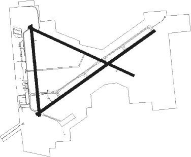
Runway info
Runway 6 / 24  | ||
| length | 2587m (8488ft) | |
| bearing | 65° / 245° | |
| width | 46m (150ft) | |
| surface | asphalt | |
| Runway 18 / 36 | ||
| length | 1618m (5308ft) | |
| bearing | 179° / 359° | |
| width | 46m (150ft) | |
| surface | asphalt | |
| Runway 12 / 30 | ||
| length | 2070m (6791ft) | |
| bearing | 113° / 293° | |
| width | 46m (150ft) | |
| surface | asphalt | |
Nearby beacons
| code | identifier | dist | bearing | frequency |
|---|---|---|---|---|
| DE | ELWIN (DECATUR) NDB | 4.8 | 243° | 275 |
| AXC | ADDERS VORTAC | 5.8 | 175° | 117.20 |
| SYZ | SHELBYVILLE NDB | 25.7 | 177° | 365 |
| AAA | ABRAHAM (LINCOLN) NDB | 29.2 | 305° | 329 |
| CMI | CHAMPAIGN VORTAC | 29.6 | 71° | 110 |
| CM | VEALS (CHAMPAIGN/URBANA) NDB | 32.4 | 79° | 407 |
| CJ | CALDE (SPRINGFIELD) NDB | 33.6 | 267° | 240 |
| LQ | LICOL (SPRINGFIELD) NDB | 34.3 | 276° | 375 |
| MTO | DME | 34.3 | 122° | 109.40 |
| SPI | SPINNER (SPRINGFIELD) VORTAC | 37.4 | 270° | 112.70 |
| BMI | BLOOMINGTON VOR/DME | 38.9 | 354° | 108.20 |
| SP | HUSKK (SPRINGFIELD) NDB | 41.4 | 266° | 382 |
| LH | EGROW (BLOOMINGTON-NORMAL) NDB | 43.5 | 359° | 334 |
| VLA | VANDALIA VOR/DME | 46.5 | 202° | 114.30 |
| RBS | ROBERTS VOR/DME | 55.2 | 43° | 116.80 |
| PI | TUNGG (PEORIA) NDB | 57 | 317° | 356 |
| BIB | BIBLE GROVE VORTAC | 57.7 | 157° | 109 |
| PNT | PONTIAC VOR/DME | 59.5 | 8° | 109.60 |
| PIA | PEORIA VORTAC | 66.2 | 312° | 115.20 |
Instrument approach procedures
| runway | airway (heading) | route (dist, bearing) |
|---|---|---|
| RW06 | AXC (355°) | AXC FIKDO (10mi, 269°) 2200ft FIKDO (turn) |
| RW06 | LATHA (81°) | LATHA FIKDO (7mi, 110°) 2200ft |
| RW06 | PANAE (37°) | PANAE FIKDO (15mi, 11°) 2200ft |
| RNAV | FIKDO 2200ft HIXAN (6mi, 65°) 2200ft KDEC (5mi, 64°) 730ft ZOLIP (12mi, 66°) 2800ft ZOLIP (turn) | |
| RW12 | MCLEN (154°) | MCLEN KENNS (20mi, 181°) 3000ft YENVU (8mi, 162°) 3000ft |
| RW12 | SPI (90°) | SPI LINPE (21mi, 80°) 3000ft YENVU (6mi, 80°) 3000ft |
| RW12 | YENVU (114°) | YENVU 3000ft |
| RNAV | YENVU 3000ft YOPNU (8mi, 113°) 2000ft CESIV (2mi, 113°) 1320ft KDEC (2mi, 116°) 723ft (5353mi, 114°) 1020ft ZOBSE (5343mi, 294°) 3000ft ZOBSE (turn) | |
| RW18 | HEPAX (176°) | HEPAX 2500ft |
| RW18 | KENNS (130°) | KENNS HEPAX (12mi, 96°) 2500ft |
| RW18 | LODGE (228°) | LODGE HEPAX (17mi, 253°) 2500ft |
| RNAV | HEPAX 2500ft GATKE (6mi, 179°) 2500ft KDEC (6mi, 174°) 733ft (5353mi, 114°) 952ft OKEVE (5353mi, 294°) 2300ft OKEVE (turn) | |
| RW24 | EWITT (189°) | EWITT ZOLIP (18mi, 150°) 2800ft |
| RW24 | LODGE (228°) | LODGE ZOLIP (14mi, 209°) 2800ft |
| RW24 | REGOY (259°) | REGOY ZOLIP (5mi, 293°) 2800ft |
| RW24 | ZOLIP (246°) | ZOLIP 2800ft |
| RNAV | ZOLIP 2800ft PEDIC (6mi, 245°) 2300ft ZINOB (3mi, 245°) 1500ft KDEC (3mi, 248°) 734ft (5353mi, 114°) 932ft FIKDO (5363mi, 294°) 2300ft FIKDO (turn) | |
| RW30 | AXC (355°) | AXC ZOBSE (9mi, 88°) 3000ft ZOBSE (turn) 3000ft |
| RW30 | BAUDS (296°) | BAUDS ZOBSE (5mi, 304°) 3000ft |
| RW30 | CMI (251°) | CMI FABKO (19mi, 233°) 3000ft ZOBSE (6mi, 233°) 3000ft |
| RNAV | ZOBSE 3000ft AKTIF (6mi, 293°) 2200ft SUBUE (3mi, 293°) 1360ft KDEC (3mi, 291°) 729ft (5353mi, 114°) 879ft YENVU (5364mi, 294°) 3000ft YENVU (turn) | |
| RW36 | ARCOL (287°) | ARCOL WUBTA (12mi, 247°) 2300ft OKEVE (17mi, 284°) 2300ft |
| RW36 | AXC (355°) | AXC OKEVE (6mi, 188°) 2300ft OKEVE (turn) 2300ft |
| RW36 | PANAE (37°) | PANAE OKEVE (15mi, 59°) 2300ft |
| RNAV | OKEVE 2300ft HELIS (6mi, 359°) 2300ft KDEC (5mi, 4°) 730ft (5353mi, 114°) 984ft HEPAX (5354mi, 294°) 3100ft HEPAX (turn) |
Disclaimer
The information on this website is not for real aviation. Use this data with the X-Plane flight simulator only! Data taken with kind consent from X-Plane 12 source code and data files. Content is subject to change without notice.