Deland - Deland Muni
Airport details
| Country | United States of America |
| State | Florida |
| Region | K7 |
| Airspace | Jacksonville Ctr |
| Municipality | DeLand |
| Elevation | 79ft (24m) |
| Timezone | GMT -5 |
| Coordinates | 29.06703, -81.28375 |
| Magnetic var | |
| Type | land |
| Available since | X-Plane v10.40 |
| ICAO code | KDED |
| IATA code | n/a |
| FAA code | DED |
Communication
| Deland Muni AWOS 3 | 119.575 |
| Deland Muni CTAF/UNICOM | 123.075 |
| Deland Muni DAYTONA Approach/Departure | 125.350 |
Nearby Points of Interest:
Chief Master at Arms House
-Stetson University Campus Historic District
-Old DeLand Memorial Hospital
-West DeLand Residential District
-Downtown DeLand Historic District
-Alexander Haynes House
-Kilkoff House
-Stockton-Lindquist House
-John B. Stetson House
-Strawn Historic Agricultural District
-Lake Helen Historic District
-Strawn Historic Citrus Packing House District
-Strawn Historic Sawmill District
-Ann Stevens House
-Southern Cassadaga Spiritualist Camp Historic District
-Seth French House
-Orange City Town Hall
-Barberville Central High School
-Gamble Place Historic District
-Spruce Creek Mound Complex
-Sanford Commercial District
-Seybold Baking Company Factory
-Old Fernald-Laughton Memorial Hospital
-Sanford Grammar School
-Sanford Residential Historic District
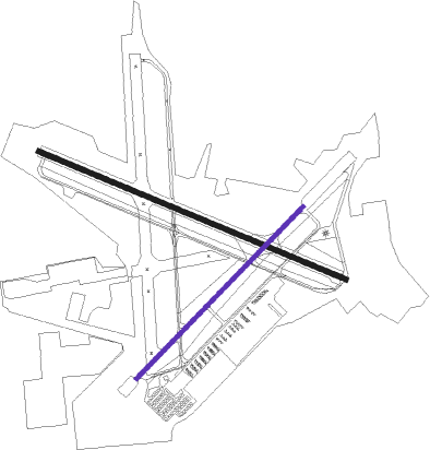
Runway info
Runway 12 / 30  | ||
| length | 1828m (5997ft) | |
| bearing | 114° / 294° | |
| width | 30m (100ft) | |
| surface | asphalt | |
| Runway 5 / 23 | ||
| length | 1312m (4304ft) | |
| bearing | 52° / 232° | |
| width | 23m (75ft) | |
| surface | asphalt | |
Nearby beacons
| code | identifier | dist | bearing | frequency |
|---|---|---|---|---|
| OMN | ORMOND BEACH VORTAC | 16.7 | 36° | 112.60 |
| ORL | ORLANDO VORTAC | 31.6 | 186° | 112.20 |
| OR | HERNY (ORLANDO) NDB | 34.5 | 195° | 221 |
| OCF | OCALA VORTAC | 49.8 | 277° | 113.70 |
| SGJ | SAINT AUGUSTINE VOR/DME | 53.4 | 357° | 109.40 |
| RYD | REYNOLDS (GREEN COVE SPRINGS) NDB | 57.4 | 337° | 338 |
| GN | WYNDS (GAINESVILLE) NDB | 58.9 | 304° | 269 |
| COF | PATRICK (COCOA) TACAN | 61.1 | 141° | 115 |
| GNV | GATORS VORTAC | 63.9 | 302° | 116.20 |
| MLB | MELBOURNE VOR/DME | 67.1 | 146° | 115.85 |
Departure and arrival routes
| Transition altitude | 18000ft |
| Transition level | 18000ft |
| STAR starting points | distance | inbound heading | |
|---|---|---|---|
| ALL | |||
| TTHOR2 | 35.9 | 185° | |
Instrument approach procedures
| runway | airway (heading) | route (dist, bearing) |
|---|---|---|
| RW05 | MAMBO (47°) | MAMBO UFIPI (14mi, 42°) 2000ft |
| RNAV | UFIPI 2000ft RUXZO (6mi, 52°) 2000ft SEVAE (3mi, 52°) 900ft KDED (3mi, 50°) 118ft (4948mi, 110°) 385ft HOSOK (4945mi, 290°) BARBS (15mi, 314°) 3000ft BARBS (turn) | |
| RW12 | BARBS (153°) | BARBS XEHMO (10mi, 205°) 1600ft |
| RNAV | XEHMO 1600ft IDROF (6mi, 114°) 1600ft KDED (5mi, 115°) 114ft (4948mi, 110°) 404ft CUGAK (4937mi, 290°) OAKIE (11mi, 130°) 2000ft OAKIE (turn) | |
| RW23 | OMN (216°) | OMN WEKLU (7mi, 184°) 1600ft |
| RNAV | WEKLU 1600ft HOSOK (6mi, 232°) 1600ft KDED (5mi, 234°) 108ft (4948mi, 110°) 374ft RUXZO (4952mi, 290°) MAMBO (20mi, 225°) 3000ft MAMBO (turn) | |
| RW30 | OAKIE (301°) | OAKIE CUGAK (11mi, 310°) 2000ft |
| RW30 | SMYRA (282°) | SMYRA CUGAK (5mi, 252°) 2000ft |
| RNAV | CUGAK 2000ft YEBBU (7mi, 294°) 1600ft KDED (5mi, 293°) 110ft (4948mi, 110°) 480ft XEHMO (4959mi, 290°) BARBS (10mi, 25°) 3000ft BARBS (turn) |
Holding patterns
| STAR name | hold at | type | turn | heading* | altitude | leg | speed limit |
|---|---|---|---|---|---|---|---|
| TTHOR2 | LPERD | VHF | right | 14 (194)° | DME 10.0mi | ICAO rules | |
| TTHOR2 | WEEEK | VHF | left | 2 (182)° | DME 10.0mi | ICAO rules | |
| *) magnetic outbound (inbound) holding course | |||||||
Disclaimer
The information on this website is not for real aviation. Use this data with the X-Plane flight simulator only! Data taken with kind consent from X-Plane 12 source code and data files. Content is subject to change without notice.