Detroit - Coleman A. Young Muni
Airport details
| Country | United States of America |
| State | Michigan |
| Region | K5 |
| Airspace | Cleveland Ctr |
| Municipality | Detroit |
| Elevation | 625ft (190m) |
| Timezone | GMT -5 |
| Coordinates | 42.40933, -83.01019 |
| Magnetic var | |
| Type | land |
| Available since | X-Plane v10.40 |
| ICAO code | KDET |
| IATA code | DET |
| FAA code | DET |
Communication
| Coleman A. Young Muni ATIS | 124.875 |
| Coleman A. Young Muni UNICOM | 122.950 |
| Coleman A. Young Muni Ground Control | 121.850 |
| Coleman A. Young Muni Tower | 121.300 |
| Coleman A. Young Muni Approach/Departure | 126.850 |
Approach frequencies
| ILS-cat-I | RW15 | 111.3 | 18.00mi |
| ILS-cat-I | RW33 | 111.3 | 18.00mi |
| 3° GS | RW15 | 111.3 | 18.00mi |
| 3° GS | RW33 | 111.3 | 18.00mi |
Nearby Points of Interest:
St. Thomas the Apostle's Church
-Church of the Transfiguration Historic District
-Elizabeth Cleveland Intermediate School
-Joseph Campau Historic District
-St. Catherine of Siena Roman Catholic Church
-St. Florian Church
-Engine House No. 18
-Pilgrim and Puritan Apartment Complex
-Alger Theater
-Hibbard Apartment Building
-Kingston Arms Apartments
-Saint Paul Manor Apartments
-East Grand Boulevard Historic District
-Frederic M. Sibley Lumber Company Office Building
-Engine House No. 11
-Arthur M. Parker House
-Highland Heights-Stevens' Subdivision Historic District
-Piquette Avenue Industrial Historic District
-Tushiyah United Hebrew School – Scott Memorial Methodist Episcopal Church
-Frederick K. Stearns House
-Saint Rita Apartments
-Religious Structures of Woodward Avenue TR
-Marwood Apartments
-Alden Park Towers
-Dunbar Hospital
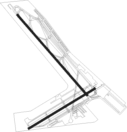
Runway info
Runway 15 / 33  | ||
| length | 1561m (5121ft) | |
| bearing | 135° / 315° | |
| width | 30m (100ft) | |
| surface | asphalt | |
| blast zone | 198m (650ft) / 76m (249ft) | |
| Runway 7 / 25 | ||
| length | 1131m (3711ft) | |
| bearing | 70° / 250° | |
| width | 30m (100ft) | |
| surface | asphalt | |
| displ threshold | 218m (715ft) / 0m (0ft) | |
| blast zone | 0m (0ft) / 113m (371ft) | |
Nearby beacons
| code | identifier | dist | bearing | frequency |
|---|---|---|---|---|
| QG | WINDSOR NDB | 8.5 | 124° | 353 |
| DM | SPENC (DETROIT) NDB | 14.2 | 226° | 223 |
| MTC | SELFRIDGE (MOUNT CLEMENS) TACAN | 14.5 | 41° | 133.70 |
| RYS | GROSSE ILE (DETROIT) NDB | 19.5 | 205° | 419 |
| DXO | DETROIT VOR/DME | 19.7 | 241° | 113.40 |
| DT | REVUP (DETROIT) NDB | 25.5 | 236° | 388 |
| SVM | SALEM VORTAC | 25.8 | 270° | 114.30 |
| PSI | DME | 29 | 299° | 111 |
| CRL | CARLETON VOR/DME | 29.4 | 231° | 115.70 |
| PH | PHURN (PORT HURON) NDB | 31.8 | 44° | 332 |
| TCU | TECUMSEH NDB | 45 | 247° | 239 |
| FNT | FLINT VORTAC | 46.6 | 307° | 116.90 |
| ECK | PECK TACAN | 52.4 | 19° | 114 |
| PCW | PORT CLINTON NDB | 53.8 | 171° | 423 |
| TOL | TOLEDO TACAN | 60.3 | 224° | 112.50 |
| TO | TOPHR (TOLEDO) NDB | 65.5 | 227° | 219 |
Departure and arrival routes
| Transition altitude | 18000ft |
| Transition level | 18000ft |
| SID end points | distance | outbound heading | |
|---|---|---|---|
| RW07 | |||
| ZETTR3 | 46mi | 45° | |
| HHOWE3 | 67mi | 96° | |
| PAVYL2 | 66mi | 103° | |
| LIDDS2 | 113mi | 127° | |
| CLVIN2 | 215mi | 198° | |
| BARII2 | 133mi | 215° | |
| SNDRS2 | 118mi | 220° | |
| CCOBB2 | 93mi | 265° | |
| KAYLN2 | 138mi | 271° | |
| MIGGY2 | 105mi | 298° | |
| TRMML3 | 84mi | 333° | |
| METRO3 | 30mi | 345° | |
| RW15 | |||
| ZETTR3 | 46mi | 45° | |
| HHOWE3 | 67mi | 96° | |
| PAVYL2 | 66mi | 103° | |
| LIDDS2 | 113mi | 127° | |
| CLVIN2 | 215mi | 198° | |
| BARII2 | 133mi | 215° | |
| SNDRS2 | 118mi | 220° | |
| CCOBB2 | 93mi | 265° | |
| KAYLN2 | 138mi | 271° | |
| MIGGY2 | 105mi | 298° | |
| TRMML3 | 84mi | 333° | |
| METRO3 | 30mi | 345° | |
| RW25 | |||
| ZETTR3 | 46mi | 45° | |
| HHOWE3 | 67mi | 96° | |
| PAVYL2 | 66mi | 103° | |
| LIDDS2 | 113mi | 127° | |
| CLVIN2 | 215mi | 198° | |
| BARII2 | 133mi | 215° | |
| SNDRS2 | 118mi | 220° | |
| CCOBB2 | 93mi | 265° | |
| KAYLN2 | 138mi | 271° | |
| MIGGY2 | 105mi | 298° | |
| TRMML3 | 84mi | 333° | |
| METRO3 | 30mi | 345° | |
| RW33 | |||
| ZETTR3 | 46mi | 45° | |
| HHOWE3 | 67mi | 96° | |
| PAVYL2 | 66mi | 103° | |
| LIDDS2 | 113mi | 127° | |
| CLVIN2 | 215mi | 198° | |
| BARII2 | 133mi | 215° | |
| SNDRS2 | 118mi | 220° | |
| CCOBB2 | 93mi | 265° | |
| KAYLN2 | 138mi | 271° | |
| MIGGY2 | 105mi | 298° | |
| TRMML3 | 84mi | 333° | |
| METRO3 | 30mi | 345° | |
| STAR starting points | distance | inbound heading | |
|---|---|---|---|
| ALL | |||
| PETTE2 | 62.5 | 76° | |
| RRALF3 | 49.4 | 96° | |
| GIGGY2 | 51.9 | 248° | |
| FOREY2 | 37.4 | 329° | |
Instrument approach procedures
| runway | airway (heading) | route (dist, bearing) |
|---|---|---|
| RW15 | BLUEZ (222°) | BLUEZ IHIDE (36mi, 241°) 2800ft |
| RW15 | ESAYO (116°) | ESAYO IHIDE (5mi, 61°) 2800ft |
| RW15 | IHIDE (135°) | IHIDE 2800ft |
| RNAV | IHIDE 2800ft BULYN (6mi, 135°) 2800ft KDET (7mi, 136°) 683ft (5096mi, 117°) 927ft OBZOF (5087mi, 297°) 3000ft OBZOF (turn) | |
| RW33 | DELOW (132°) | DELOW OBZOF (17mi, 134°) 3000ft OBZOF (turn) 3000ft |
| RW33 | FEPNA (338°) | FEPNA OBZOF (5mi, 61°) 3000ft |
| RW33 | SWWAN (195°) | SWWAN DUZKO (29mi, 158°) 3000ft OBZOF (5mi, 241°) 3000ft |
| RNAV | OBZOF 3000ft CUPUD (6mi, 315°) 3000ft NEMKE (5mi, 315°) 1380ft KDET (2mi, 313°) 675ft (5096mi, 117°) 936ft JITSI (5097mi, 297°) SWWAN (18mi, 23°) 4000ft SWWAN (turn) |
Holding patterns
| STAR name | hold at | type | turn | heading* | altitude | leg | speed limit |
|---|---|---|---|---|---|---|---|
| FOREY2 | FOREY | VHF | right | 144 (324)° | DME 10.0mi | ICAO rules | |
| PETTE2 | PETTE | VHF | left | 241 (61)° | DME 10.0mi | ICAO rules | |
| RRALF3 | KILTT | VHF | right | 313 (133)° | DME 10.0mi | ICAO rules | |
| *) magnetic outbound (inbound) holding course | |||||||
Disclaimer
The information on this website is not for real aviation. Use this data with the X-Plane flight simulator only! Data taken with kind consent from X-Plane 12 source code and data files. Content is subject to change without notice.