Douglas - Douglas Muni
Airport details
| Country | United States of America |
| State | Arizona |
| Region | K2 |
| Airspace | Albuquerque Ctr |
| Municipality | Douglas |
| Elevation | 4171ft (1271m) |
| Timezone | GMT -7 |
| Coordinates | 31.34260, -109.50645 |
| Magnetic var | |
| Type | land |
| Available since | X-Plane v10.40 |
| ICAO code | KDGL |
| IATA code | DGL |
| FAA code | DGL |
Communication
| Douglas Muni CTAF/UNICOM | 122.800 |
Nearby Points of Interest:
Douglas Municipal Airport
-Double Adobe Site
-United States Post Office and Customs House–Douglas Main
-El Paso and Southwestern Railroad YMCA
-Grand Theatre
-Phelps Dodge General Office Building
-Bisbee Woman's Club Clubhouse
-St. Patrick's Roman Catholic Church
-Naco Border Station
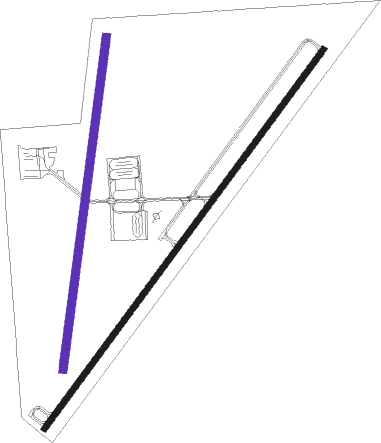
Runway info
Runway 3 / 21  | ||
| length | 1758m (5768ft) | |
| bearing | 45° / 225° | |
| width | 23m (75ft) | |
| surface | asphalt | |
| Runway 18 / 36 | ||
| length | 1249m (4098ft) | |
| bearing | 194° / 14° | |
| width | 30m (100ft) | |
| surface | dirt | |
Nearby beacons
| code | identifier | dist | bearing | frequency |
|---|---|---|---|---|
| DUG | DOUGLAS VORTAC | 9.2 | 324° | 108.80 |
| ARH | FORT HUACHUCA TACAN | 45 | 286° | 111.60 |
| FHU | LIBBY (FT HUACHUCA) VOR/DME | 45.9 | 286° | 113.60 |
| SSO | SAN SIMON VORTAC | 57 | 15° | 115.40 |
Disclaimer
The information on this website is not for real aviation. Use this data with the X-Plane flight simulator only! Data taken with kind consent from X-Plane 12 source code and data files. Content is subject to change without notice.