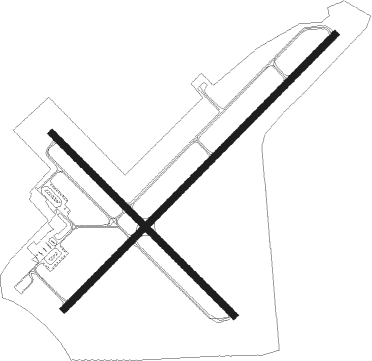
Dunkirk - Chautauqua Co Dunkirk
Airport details
| Country | United States of America |
| State | New York |
| Region | K6 |
| Airspace | Cleveland Ctr |
| Municipality | Town of Sheridan |
| Elevation | 689ft (210m) |
| Timezone | GMT -5 |
| Coordinates | 42.49393, -79.27110 |
| Magnetic var | |
| Type | land |
| Available since | X-Plane v10.40 |
| ICAO code | KDKK |
| IATA code | DKK |
| FAA code | DKK |
Communication
| Chautauqua Co Dunkirk ASOS | 119.275 |
| Chautauqua Co Dunkirk CTAF/UNICOM | 123.075 |
| Chautauqua Co Dunkirk BUFFALO Approach/Departure | 126.500 |
Nearby Points of Interest:
School No. 7
-United States Post Office
-Fredonia Commons Historic District
-Thomas Indian School
-Pioneer Cemetery
-Erie Federal Courthouse
-Gowanda Village Historic District
-Dunkirk Schooner Site
-Bank of Gowanda
-Gamel Hexadecagon Barn
-First Church of Evans Complex
-Reuben Wright House
-Reuben Gridley Wright Farm Complex
-Leon United Methodist Church
-East Main Street Historic District
-Lake Shore & Michigan Southern Freight Depot
-York-Skinner House
-Frank A. Hall House
-Henry Dwight Thompson House
-Lake Shore and Michigan Southern Railway Station
-Gerald Mack House
-French Portage Road Historic District
-Harriet Campbell-Taylor House
Nearby beacons
| code | identifier | dist | bearing | frequency |
|---|---|---|---|---|
| DKK | DME | 0.2 | 220° | 116.20 |
| JHW | JAMESTOWN VOR/DME | 19.5 | 154° | 114.70 |
| GB | PLAZZ (BUFFALO) NDB | 30.3 | 50° | 204 |
| BUF | BUFFALO VOR/DME | 37.9 | 55° | 116.40 |
| SN | ST CATHARINES NDB | 39.2 | 1° | 408 |
| IAG | NIAGARA FALLS TACAN | 39.5 | 27° | 111 |
| BU | KLUMP (BUFFALO) NDB | 40.9 | 51° | 231 |
| IA | KATHI (NIAGRA FALLS) NDB | 41.5 | 35° | 329 |
| ZHM | BINBROOK (HAMILTON) NDB | 45.3 | 321° | 266 |
| TDT | DME | 47.3 | 191° | 117.60 |
| HM | HAMILTON NDB | 49.6 | 310° | 221 |
| BFD | DME | 51.4 | 137° | 116.60 |
| ZHA | ANCASTER (HAMILTON) NDB | 53.7 | 313° | 397 |
Instrument approach procedures
| runway | airway (heading) | route (dist, bearing) |
|---|---|---|
| RW15 | MOAWK (114°) | MOAWK CISKI (19mi, 106°) 3200ft |
| RW15 | MYPAL (174°) | MYPAL CISKI (13mi, 214°) 3200ft |
| RNAV | CISKI 3200ft AYEHI (6mi, 131°) 2300ft KDKK (5mi, 129°) 710ft (4931mi, 118°) 1092ft TRUNT (4924mi, 298°) 3200ft TRUNT (turn) 3200ft | |
| RW33 | JHW (334°) | JHW WEBBO (8mi, 18°) 3600ft |
| RW33 | LANGS (257°) | LANGS MOTAR (11mi, 193°) 5500ft WEBBO (9mi, 246°) 3600ft |
| RNAV | WEBBO 3600ft RURLE (4mi, 311°) 3000ft SCITE (2mi, 311°) 2800ft PIBPI (2mi, 311°) 2240ft KDKK (5mi, 312°) 742ft (4931mi, 118°) 1092ft TRUNT (4924mi, 298°) 3200ft TRUNT (turn) | |
| RWNVA | BUF (235°) | BUF TRUNT (28mi, 234°) 3200ft |
| RWNVA | LANGS (257°) | LANGS TRUNT (10mi, 276°) 3200ft |
| RNAV | TRUNT 3200ft NOKAA (5mi, 238°) 2300ft CUVBA (2mi, 238°) 1440ft KDKK (3mi, 238°) 712ft (4931mi, 118°) 1900ft TRUNT (4924mi, 298°) 3200ft TRUNT (turn) | |
| RWNVB | FOUTN (65°) | FOUTN SERCH (5mi, 81°) 3400ft |
| RWNVB | JHW (334°) | JHW CRYST (15mi, 278°) 4300ft SERCH (8mi, 357°) 3400ft |
| RNAV | SERCH 3400ft ROCIN (5mi, 57°) 2600ft POYIB (3mi, 57°) 1700ft KDKK (4mi, 57°) 725ft (4931mi, 118°) 1092ft TRUNT (4924mi, 298°) 3200ft TRUNT (turn) |
Disclaimer
The information on this website is not for real aviation. Use this data with the X-Plane flight simulator only! Data taken with kind consent from X-Plane 12 source code and data files. Content is subject to change without notice.

