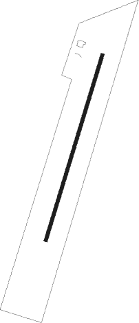
Crockett - Crockett Houston County
Airport details
| Country | United States of America |
| State | Texas |
| Region | K4 |
| Airspace | Houston Oceanic Ctr |
| Municipality | Houston County |
| Elevation | 348ft (106m) |
| Timezone | GMT -6 |
| Coordinates | 31.30697, -95.40383 |
| Magnetic var | |
| Type | land |
| Available since | X-Plane v10.40 |
| ICAO code | KDKR |
| IATA code | n/a |
| FAA code | DKR |
Communication
| Crockett Houston County AWOS 3 | 118.775 |
| Crockett Houston County CTAF | 122.900 |
Nearby Points of Interest:
First United Methodist Church
-Texas and Pacific 610
-First Presbyterian Church
-Anderson County Courthouse
-Sacred Heart Catholic Church and School
Runway info
| Runway 2 / 20 | ||
| length | 1222m (4009ft) | |
| bearing | 25° / 205° | |
| width | 23m (75ft) | |
| surface | asphalt | |
Nearby beacons
| code | identifier | dist | bearing | frequency |
|---|---|---|---|---|
| LF | FLUFY (LUFKIN) NDB | 30.1 | 99° | 350 |
| LOA | LEONA VORTAC | 30.9 | 252° | 110.80 |
| UTS | HUNTSVILLE NDB | 35.3 | 198° | 308 |
| LFK | LUFKIN VORTAC | 36.3 | 102° | 112.10 |
| OC | NADOS (NACOGDOCHES) NDB | 36.6 | 75° | 253 |
| FZT | FRANKSTON VOR/DME | 46.5 | 351° | 111.40 |
| CX | ALIBI (HOUSTON) NDB | 52.6 | 185° | 281 |
| CSZ | CROSSROADS NDB | 53.5 | 324° | 215 |
| CRS | CORSICANA NDB | 66.6 | 306° | 396 |
| CQY | CEDAR CREEK VORTAC | 67.1 | 317° | 114.80 |
| CL | ROWDY (COLLEGE STATION) NDB | 68.5 | 229° | 260 |
Instrument approach procedures
| runway | airway (heading) | route (dist, bearing) |
|---|---|---|
| RW02 | LFK (282°) | LFK MCCAL (35mi, 259°) 4000ft CRCKT (8mi, 307°) 3000ft |
| RW02 | LOA (72°) | LOA DAVYE (17mi, 90°) 4000ft CRCKT (8mi, 91°) 3000ft |
| RNAV | CRCKT 3000ft PIENE (7mi, 25°) 2000ft KDKR (5mi, 25°) 362ft (5682mi, 108°) 1000ft LOA (5712mi, 288°) 4000ft LOA (turn) | |
| RW20 | LFK (282°) | LFK CUNHM (31mi, 301°) 4000ft BRWER (6mi, 289°) 3000ft |
| RW20 | LOA (72°) | LOA ARTEE (36mi, 50°) 4000ft BRWER (8mi, 109°) 3000ft |
| RNAV | BRWER 3000ft PATRK (7mi, 205°) 2000ft KDKR (5mi, 205°) 388ft (5682mi, 108°) 748ft LOA (5712mi, 288°) 4000ft LOA (turn) |
Disclaimer
The information on this website is not for real aviation. Use this data with the X-Plane flight simulator only! Data taken with kind consent from X-Plane 12 source code and data files. Content is subject to change without notice.
