Deming - Deming Muni
Airport details
| Country | United States of America |
| State | New Mexico |
| Region | K2 |
| Airspace | Albuquerque Ctr |
| Municipality | Deming |
| Elevation | 4312ft (1314m) |
| Timezone | GMT -7 |
| Coordinates | 32.26239, -107.71900 |
| Magnetic var | |
| Type | land |
| Available since | X-Plane v10.40 |
| ICAO code | KDMN |
| IATA code | DMN |
| FAA code | DMN |
Communication
| Deming Muni ASOS | 118.525 |
| Deming Muni CTAF/UNICOM | 122.800 |
Nearby Points of Interest:
Downtown Deming Historic District
-Morgan Hall
-Mahoney Building
-Deming Main Post Office
-Luna County Courthouse
-Village of Columbus and Camp Furlong
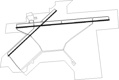
Runway info
Runway 8 / 26  | ||
| length | 2440m (8005ft) | |
| bearing | 90° / 270° | |
| width | 23m (75ft) | |
| surface | asphalt | |
| blast zone | 255m (837ft) / 48m (157ft) | |
| Runway 4 / 22 | ||
| length | 1730m (5676ft) | |
| bearing | 56° / 236° | |
| width | 18m (60ft) | |
| surface | asphalt | |
| blast zone | 147m (482ft) / 255m (837ft) | |
Nearby beacons
| code | identifier | dist | bearing | frequency |
|---|---|---|---|---|
| DMN | DEMING VORTAC | 5.8 | 83° | 108.60 |
| CUS | COLUMBUS VOR/DME | 27.6 | 162° | 111.20 |
| SV | COZEY (SILVER CITY) NDB | 28.2 | 317° | 251 |
| SVC | SILVER CITY VOR/DME | 31.7 | 310° | 110.80 |
Instrument approach procedures
| runway | airway (heading) | route (dist, bearing) |
|---|---|---|
| RW04 | FAAST (92°) | FAAST DUCCK (10mi, 117°) 8100ft HIRUT (6mi, 117°) 7000ft |
| RW04 | HUSIT (39°) | HUSIT HIRUT (13mi, 21°) 7000ft |
| RNAV | HIRUT 7000ft GINEC (6mi, 56°) 6100ft KDMN (6mi, 57°) 4356ft (6301mi, 107°) 4562ft JUTEP (6291mi, 287°) 7100ft JUTEP (turn) | |
| RW08 | HUSIT (39°) | HUSIT WIGTA (20mi, 3°) 7100ft |
| RW08 | KUNRE (91°) | KUNRE JUDEN (15mi, 93°) 8100ft WIGTA (5mi, 90°) 7100ft |
| RW08 | NUWIN (218°) | NUWIN JELIG (24mi, 250°) 9600ft WIGTA (5mi, 180°) 7100ft |
| RNAV | WIGTA 7100ft ZEMAG (6mi, 90°) 6400ft KDMN (7mi, 90°) 4364ft (6301mi, 107°) 4714ft YATUP (6298mi, 287°) NUWIN (16mi, 28°) 8000ft NUWIN (turn) | |
| RW22 | CRATT (280°) | CRATT YIBUY (24mi, 298°) 8700ft JUTEP (6mi, 289°) 7100ft |
| RW22 | NUWIN (218°) | NUWIN JUTEP (7mi, 183°) 7100ft |
| RNAV | JUTEP 7100ft ODLUE (6mi, 236°) 6100ft ZIPKI (2mi, 236°) 5400ft KDMN (4mi, 234°) 4355ft (6301mi, 107°) 4560ft GINEC (6306mi, 287°) FAAST (19mi, 282°) 9000ft FAAST (turn) | |
| RWNVA | CUS (342°) | CUS VIGUY (24mi, 29°) 7000ft TOSOY (6mi, 326°) 6800ft |
| RWNVA | KUNRE (91°) | KUNRE TOSOY (47mi, 91°) 9000ft TOSOY (turn) 6800ft |
| RWNVA | SEMRE (279°) | SEMRE TOSOY (11mi, 290°) 6800ft |
| RWNVA | WUMEX (211°) | WUMEX YUPUB (18mi, 160°) 8000ft TOSOY (6mi, 214°) 6800ft |
| RNAV | TOSOY 6800ft ZUTLO (8mi, 270°) 6000ft KDMN (6mi, 269°) 4329ft (6301mi, 107°) 5600ft TOSOY (6287mi, 287°) 7200ft TOSOY (turn) |
Disclaimer
The information on this website is not for real aviation. Use this data with the X-Plane flight simulator only! Data taken with kind consent from X-Plane 12 source code and data files. Content is subject to change without notice.