Santa Teresa - Dona Ana County
Airport details
| Country | United States of America |
| State | New Mexico |
| Region | K2 |
| Airspace | Albuquerque Ctr |
| Municipality | Santa Teresa |
| Elevation | 4110ft (1253m) |
| Timezone | GMT -7 |
| Coordinates | 31.87472, -106.69639 |
| Magnetic var | |
| Type | land |
| Available since | X-Plane v11.33 |
| ICAO code | KDNA |
| IATA code | n/a |
| FAA code | DNA |
Communication
| Dona Ana County AWOS | 124.175 |
| Dona Ana County CTAF/UNICOM | 122.725 |
| Dona Ana County El Paso | 119.150 |
Nearby Points of Interest:
O. T. Bassett Tower
-Henry C. Trost House
-Sunset Heights
-Woman's Club of El Paso
-Old Bnai Zion Synagogue
-Anson Mills Building
-U.S. Post Office
-Alhambra Theatre
-First Mortgage Company Building
-Roberts-Banner Building
-State National Bank
-Popular Department Store
-United States Court House
-House at 912 Magoffin Avenue
-Chamizal National Memorial
-Fort Bliss Main Post Historic District
-Frank and Amelia Jones House
-Franklin Canal
-Mesilla Park Historic District
-Mesilla Park Elementary School
-Mesilla Plaza
-Foster Hall
-Goddard Hall
-Hadley-Ludwick House
-Nason House
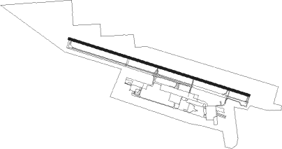
Runway info
| Runway 10 / 28 | ||
| length | 2906m (9534ft) | |
| bearing | 109° / 289° | |
| width | 30m (100ft) | |
| surface | asphalt | |
| blast zone | 46m (151ft) / 64m (210ft) | |
Nearby beacons
| code | identifier | dist | bearing | frequency |
|---|---|---|---|---|
| EL | VALTR (EL PASO) NDB | 19.3 | 92° | 242 |
| CJS | JUAREZ (CIUDAD JUAREZ) VOR/DME | 19.8 | 132° | 116.70 |
| ELP | EL PASO VORTAC | 21.4 | 98° | 115.20 |
| EWM | NEWMAN VORTAC | 22.1 | 80° | 112.40 |
| CUS | COLUMBUS VOR/DME | 44.9 | 266° | 111.20 |
| DMN | DEMING VORTAC | 52.1 | 294° | 108.60 |
| HMN | HOLLOMAN (ALAMOGORDO) TACAN | 66.3 | 31° | 114.50 |
| BWS | (ALAMOGORDO) DME | 66.5 | 36° | 109.60 |
Instrument approach procedures
| runway | airway (heading) | route (dist, bearing) |
|---|---|---|
| RW10 | CRATT (128°) | CRATT SUSIQ (9mi, 177°) 9000ft |
| RW10 | MOLLY (172°) | MOLLY SUSIQ (16mi, 256°) 9000ft SUSIQ (turn) 9000ft |
| RNAV | SUSIQ 9000ft WAREG (8mi, 109°) 7000ft SAZAR (6mi, 109°) 5000ft KDNA (4mi, 111°) 4154ft (6253mi, 107°) 4513ft SUSIQ (6269mi, 287°) 9000ft SUSIQ (turn) |
Disclaimer
The information on this website is not for real aviation. Use this data with the X-Plane flight simulator only! Data taken with kind consent from X-Plane 12 source code and data files. Content is subject to change without notice.