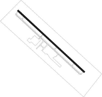
Dalton - Dalton Muni
Airport details
| Country | United States of America |
| State | Georgia |
| Region | K7 |
| Airspace | Atlanta Ctr |
| Municipality | Dalton |
| Elevation | 708ft (216m) |
| Timezone | GMT -5 |
| Coordinates | 34.72295, -84.87025 |
| Magnetic var | |
| Type | land |
| Available since | X-Plane v10.40 |
| ICAO code | KDNN |
| IATA code | DNN |
| FAA code | DNN |
Communication
| Dalton Muni AWOS 3 | 127.650 |
| Dalton Muni CTAF/UNICOM | 122.975 |
| Dalton Muni CHATTANOOGA Approach/Departure | 125.100 |
Approach frequencies
| ILS-cat-I | RW14 | 110.9 | 18.00mi |
| 3° GS | RW14 | 110.9 | 18.00mi |
Nearby Points of Interest:
Chief Vann House Historic Site
-Masonic Lodge No. 238
-Thomas A. Berry House
-Murray County Courthouse
-Western and Atlantic Depot (Dalton, Georgia)
-Wright Hotel
-Prater's Mill
-New Echota
-Calhoun Depot
-Ringgold Gap Battlefield
-Gilmer County Courthouse
-Walker County Courthouse
-Marsh-Warthen House
-Corra White Harris House, Study, and Chapel
-Lee and Gordon Mill
-Chickamauga Historic District
-Gordon-Lee Mansion
-James County Courthouse
-Chickamauga Lodge No. 221, Free and Accepted Masons, Prince Hall Affiliate
-Ocoee Dam No. 1
-Jones Observatory
-John Ross House
-Broad Street United Methodist Church
-St. Elmo Historic District
-W.J. Hughes Business House
Nearby beacons
| code | identifier | dist | bearing | frequency |
|---|---|---|---|---|
| GQO | CHOO CHOO (CHATTANOOGA) VORTAC | 19.9 | 310° | 115.80 |
| CQN | DAISY (N.CHATTANOOGA) NDB | 30.1 | 327° | 341 |
| DJD | CHERO NDB | 34 | 141° | 415 |
| RMG | ROME VORTAC | 35.8 | 204° | 115.40 |
| DTE | MARK ANTON (DAYTON) NDB | 45.6 | 355° | 394 |
| HRS | HARRIS VORTAC | 48.8 | 77° | 109.80 |
| DOB | DOBBINS (MARIETTA) TACAN | 51.7 | 156° | 113 |
| FKV | FLOWERY BRANCH (GAINESVILLE) NDB | 57 | 118° | 365 |
| PDK | PEACHTREE (ATLANTA) VOR/DME | 58.2 | 146° | 116.60 |
Instrument approach procedures
| runway | airway (heading) | route (dist, bearing) |
|---|---|---|
| RW14 | JETAL (106°) | JETAL ROLTE (7mi, 53°) 3800ft |
| RW14 | ROLTE (132°) | ROLTE 3800ft |
| RW14 | ZULIP (163°) | ZULIP ROLTE (7mi, 233°) 3800ft |
| RNAV | ROLTE 3800ft EWADA (6mi, 132°) 2600ft HRVEY (4mi, 132°) 1420ft KDNN (3mi, 132°) 758ft (5152mi, 112°) 959ft ONUTE (5143mi, 292°) 4500ft ONUTE (turn) | |
| RW32 | ONUTE (312°) | ONUTE 4500ft |
| RW32 | RUNIC (343°) | RUNIC ONUTE (7mi, 53°) 4500ft |
| RW32 | UTAZO (286°) | UTAZO ONUTE (7mi, 233°) 4500ft |
| RNAV | ONUTE 4500ft HIXOT (6mi, 312°) 2600ft JEGTI (4mi, 312°) 1340ft KDNN (2mi, 312°) 742ft (5152mi, 112°) 1109ft ROLTE (5161mi, 292°) 3800ft ROLTE (turn) 3800ft |
Disclaimer
The information on this website is not for real aviation. Use this data with the X-Plane flight simulator only! Data taken with kind consent from X-Plane 12 source code and data files. Content is subject to change without notice.