Douglas - Douglas Muni
Airport details
| Country | United States of America |
| State | Georgia |
| Region | K7 |
| Airspace | Jacksonville Ctr |
| Municipality | Douglas |
| Elevation | 255ft (78m) |
| Timezone | GMT -5 |
| Coordinates | 31.47671, -82.85439 |
| Magnetic var | |
| Type | land |
| Available since | X-Plane v10.40 |
| ICAO code | KDQH |
| IATA code | DQH |
| FAA code | DQH |
Communication
| DOUGLAS MUNI AWOS 3 | 119.075 |
| DOUGLAS MUNI CTAF/UNICOM | 122.800 |
Approach frequencies
| ILS-cat-I | RW04 | 108.7 | 18.00mi |
| 3° GS | RW04 | 108.7 | 18.00mi |
Nearby Points of Interest:
Eleventh District A & M School-South Georgia College Historic District
-Downtown Douglas Historic District
-Union Banking Company Building
-Lonnie A. Pope House
-Gaskin Avenue Historic District
-Atkinson County Courthouse
-McCranie's Turpentine Still
-Alapaha Colored School
-Alma Depot
-Rabinowitz Building
-Bacon County Courthouse
-Irwin County Courthouse
-Ocilla Public School
-Ben Hill County Jail
-Holtzendorf Apartments
-Ben Hill County Courthouse
-Old Berrien County Jail
-Berrien County Courthouse
-William G. Harrison House
-Jeff Davis County Courthouse
-Pace House
-Clinch County Courthouse
-United States Post Office and Courthouse
-Downtown Waycross Historic District
-First African Baptist Church and Parsonage (Waycross, Georgia)
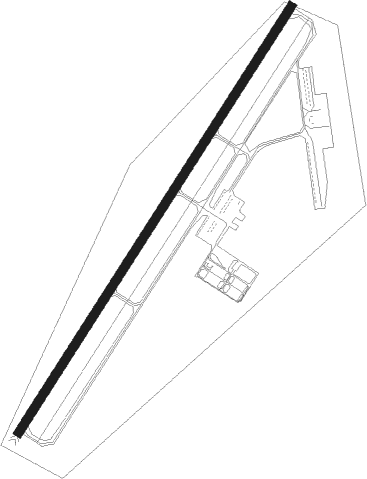
Runway info
| Runway 4 / 22 | ||
| length | 1831m (6007ft) | |
| bearing | 42° / 222° | |
| width | 30m (100ft) | |
| surface | asphalt | |
Nearby beacons
| code | identifier | dist | bearing | frequency |
|---|---|---|---|---|
| OWC | COFFEE COUNTY (DOUGLAS) NDB | 5.5 | 224° | 390 |
| AMG | ALMA VORTAC | 18 | 80° | 115.10 |
| AYS | WAYCROSS VORTAC | 19.7 | 125° | 110.20 |
| SUR | FITZGERALD NDB | 23.7 | 287° | 362 |
| AY | WIKET (WAYCROSS) NDB | 25 | 108° | 219 |
| HOE | HOMERVILLE NDB | 25.6 | 169° | 209 |
| AZE | HAZLEHURST NDB | 26.4 | 27° | 414 |
| BHC | BAXLEY NDB | 27.6 | 63° | 376 |
| IFM | TIFT MYERS (TIFTON) VOR | 32.6 | 266° | 112.50 |
| VAD | MOODY (VALDOSTA) TACAN | 35.5 | 213° | 113.30 |
| MQW | MC RAE NDB | 37.2 | 357° | 280 |
| EZM | EASTMAN NDB | 42.2 | 335° | 366 |
| OTK | VALDOSTA VOR/DME | 47.1 | 211° | 114.80 |
| UQN | ONYUN (VIDALIA) NDB | 53.1 | 37° | 372 |
| MGR | DME | 54.2 | 247° | 108.80 |
| VNA | VIENNA VORTAC | 55 | 319° | 116.50 |
| GTP | PATON (THOMASVILLE) NDB | 58.8 | 242° | 245 |
| TAY | TAYLOR VORTAC | 60.4 | 163° | 112.90 |
| GEF | GREENVILLE VORTAC | 73.3 | 225° | 109 |
Instrument approach procedures
| runway | airway (heading) | route (dist, bearing) |
|---|---|---|
| RW04 | OLHUP (43°) | OLHUP 2000ft |
| RNAV | OLHUP 2000ft EMDIH (7mi, 41°) 1800ft UNSEH (3mi, 42°) 800ft KDQH (2mi, 48°) 301ft (5039mi, 111°) 1000ft OLHUP (5046mi, 291°) 2000ft OLHUP (turn) | |
| RW22 | PAJTO (220°) | PAJTO 2000ft |
| RNAV | PAJTO 2000ft IPWEF (7mi, 222°) 1900ft BOLSE (2mi, 222°) 1240ft KDQH (3mi, 217°) 296ft (5039mi, 111°) 1200ft PAJTO (5033mi, 291°) 2000ft PAJTO (turn) |
Disclaimer
The information on this website is not for real aviation. Use this data with the X-Plane flight simulator only! Data taken with kind consent from X-Plane 12 source code and data files. Content is subject to change without notice.