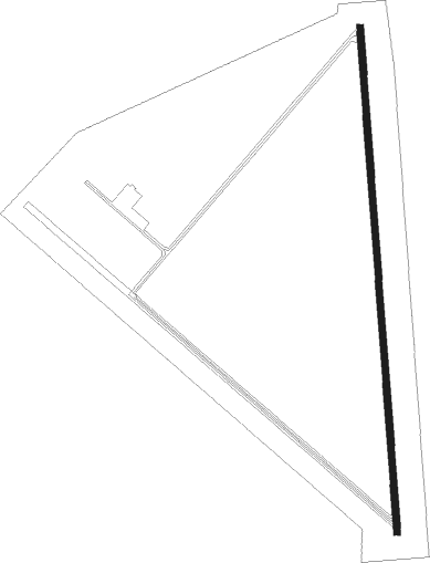
Delta - Delta Muni
Airport details
| Country | United States of America |
| State | Utah |
| Region | K2 |
| Airspace | Salt Lake City Ctr |
| Municipality | Delta |
| Elevation | 4757ft (1450m) |
| Timezone | GMT -7 |
| Coordinates | 39.38360, -112.50220 |
| Magnetic var | |
| Type | land |
| Available since | X-Plane v10.40 |
| ICAO code | KDTA |
| IATA code | DTA |
| FAA code | DTA |
Communication
| Delta Muni AWOS 3 | 127.750 |
| Delta Muni CTAF/UNICOM | 122.800 |
Nearby Points of Interest:
Hinckley High School Gymnasium
-Deseret Relief Society Hall
-Scipio Town Hall
-Thuesen-Petersen House
-Fillmore American Legion Hall
Nearby beacons
| code | identifier | dist | bearing | frequency |
|---|---|---|---|---|
| DTA | DELTA VORTAC | 4.8 | 182° | 116.10 |
| MIJ | MICHAEL (DUGWAY) TACAN | 52.2 | 333° | 113.20 |
| FFU | FAIRFIELD (PROVO) VORTAC | 59.4 | 32° | 116.60 |
| PVU | PROVO VOR/DME | 61.5 | 43° | 108.40 |
Instrument approach procedures
| runway | airway (heading) | route (dist, bearing) |
|---|---|---|
| RW17 | AADCO (186°) | AADCO WUNDI (8mi, 197°) 9700ft |
| RW17 | DTA (2°) | DTA WUNDI (21mi, 1°) 9700ft WUNDI (turn) 9700ft |
| RW17 | PUCIT (216°) | PUCIT WUNDI (10mi, 263°) 9700ft |
| RNAV | WUNDI 9700ft LUSSI (10mi, 180°) 6600ft ZOBMA (4mi, 180°) 5240ft KDTA (2mi, 180°) 4807ft (6439mi, 109°) 5300ft JULIK (6443mi, 289°) 12000ft JULIK (turn) 12000ft | |
| RW35 | BICAN (7°) | BICAN UTONE (13mi, 12°) 7300ft |
| RW35 | RUBOY (219°) | RUBOY UTONE (25mi, 202°) 7300ft UTONE (turn) 7300ft |
| RW35 | WADOK (187°) | WADOK UTONE (22mi, 183°) 7300ft UTONE (turn) 7300ft |
| RW35 | ZIBRA (24°) | ZIBRA UTONE (14mi, 42°) 7300ft |
| RNAV | UTONE 7300ft TAVTE (7mi, 0°) 6300ft KDTA (5mi, 0°) 4795ft (6439mi, 109°) 4955ft HADUS (6436mi, 289°) PUCIT (12mi, 60°) 10300ft PUCIT (turn) |
Disclaimer
The information on this website is not for real aviation. Use this data with the X-Plane flight simulator only! Data taken with kind consent from X-Plane 12 source code and data files. Content is subject to change without notice.
