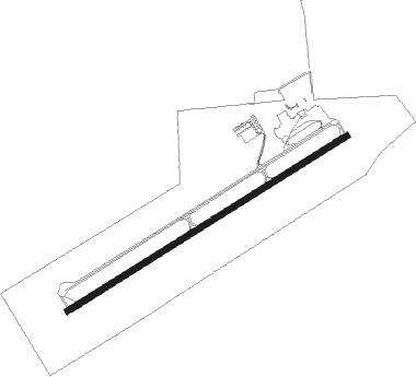
Dubois - Du Bois Jefferson Co
Airport details
| Country | United States of America |
| State | Pennsylvania |
| Region | K6 |
| Airspace | Cleveland Ctr |
| Municipality | Washington Township |
| Elevation | 1815ft (553m) |
| Timezone | GMT -5 |
| Coordinates | 41.17828, -78.89870 |
| Magnetic var | |
| Type | land |
| Available since | X-Plane v10.40 |
| ICAO code | KDUJ |
| IATA code | DUJ |
| FAA code | DUJ |
Communication
| Du Bois Jefferson Co ASOS | 119.025 |
| Du Bois Jefferson Co CTAF | 123.000 |
Approach frequencies
| ILS-cat-I | RW25 | 109.9 | 18.00mi |
| 3° GS | RW25 | 109.9 | 18.00mi |
Nearby Points of Interest:
Herpel Brothers Foundry and Machine Shop
-Brockway station
-DuBois Historic District
-Redferd Segers House
-Phillip Taylor House
-Brookville Historic District
-Brookville Presbyterian Church and Manse
-Gray-Taylor House
-Joseph E. Hall House
-Clear Creek State Park Day Use District
-Clear Creek State Park Family Cabin District
-Jefferson Theater
-T. M. Kurtz House
-Christian Miller House
-Bonifels
-Cook Forest State Park River Cabin District
-O.B. Grant House
-Ridgway Historic District
-Ridgway Armory
-Anthony Wayne Cook Mansion
-Cook Forest State Park Indian Cabin District
-S. B. Elliott State Park Day Use District
-Parker Dam State Park Family Cabin District
-S. B. Elliott State Park Family Cabin District
-Bridge in Greenwood Township
Nearby beacons
| code | identifier | dist | bearing | frequency |
|---|---|---|---|---|
| CIP | DME | 25.3 | 267° | 112.90 |
| ETG | KEATING VORTAC | 34.2 | 87° | 116 |
| REC | REVLOC VOR/DME | 38.5 | 167° | 110.60 |
| BFD | DME | 38.6 | 25° | 116.60 |
| TDT | DME | 39.7 | 316° | 117.60 |
| PSB | PHILIPSBURG VORTAC | 43.9 | 106° | 115.50 |
| FKL | FRANKLIN VOR | 45.9 | 285° | 109.60 |
| SLT | SLATE RUN VORTAC | 46.4 | 70° | 113.90 |
| JST | JOHNSTOWN VOR/DME | 51.8 | 176° | 113 |
| ELZ | DME | 68 | 45° | 111.40 |
Instrument approach procedures
| runway | airway (heading) | route (dist, bearing) |
|---|---|---|
| RW07 | EEYES (68°) | EEYES 4200ft |
| RW07 | TNKEE (95°) | TNKEE EEYES (8mi, 145°) 4200ft |
| RW07 | WNKEE (36°) | WNKEE EEYES (8mi, 325°) 4200ft |
| RNAV | EEYES 4200ft PLEAZ (6mi, 68°) 3400ft RYCHL (3mi, 68°) 2420ft KDUJ (2mi, 68°) 1862ft (4905mi, 118°) 2017ft CELSY (4890mi, 298°) 4200ft CELSY (turn) | |
| RW25 | CELSY (249°) | CELSY 4200ft |
| RW25 | KASTY (267°) | KASTY CELSY (8mi, 326°) 4200ft |
| RW25 | PEEDR (227°) | PEEDR CELSY (8mi, 145°) 4200ft |
| RNAV | CELSY 4200ft DUBOI (12mi, 249°) 3400ft KDUJ (5mi, 249°) 1874ft (4905mi, 118°) 2017ft EEYES (4914mi, 297°) 4200ft EEYES (turn) |
Disclaimer
The information on this website is not for real aviation. Use this data with the X-Plane flight simulator only! Data taken with kind consent from X-Plane 12 source code and data files. Content is subject to change without notice.
