Dumas - Moore Co
Airport details
| Country | United States of America |
| State | Texas |
| Region | K4 |
| Airspace | Albuquerque Ctr |
| Municipality | Moore County |
| Elevation | 3705ft (1129m) |
| Timezone | GMT -6 |
| Coordinates | 35.85743, -102.01331 |
| Magnetic var | |
| Type | land |
| Available since | X-Plane v10.40 |
| ICAO code | KDUX |
| IATA code | n/a |
| FAA code | DUX |
Communication
| Moore Co AWOS 3 | 118.075 |
| Moore Co CTAF/UNICOM | 122.800 |
Nearby Points of Interest:
Dallam County Courthouse
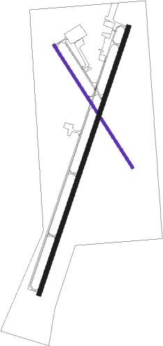
Runway info
Runway 1 / 19  | ||
| length | 1831m (6007ft) | |
| bearing | 28° / 208° | |
| width | 30m (100ft) | |
| surface | asphalt | |
| Runway 14 / 32 | ||
| length | 946m (3104ft) | |
| bearing | 146° / 326° | |
| width | 18m (60ft) | |
| surface | asphalt | |
Nearby beacons
| code | identifier | dist | bearing | frequency |
|---|---|---|---|---|
| DHT | DALHART VORTAC | 29.4 | 294° | 112 |
| BGD | BORGER VORTAC | 30.8 | 95° | 108.60 |
| PNH | PANHANDLE VORTAC | 40.4 | 153° | 116.60 |
| AM | PANDE (AMARILLO) NDB | 43.8 | 164° | 251 |
| GUY | GUYMON NDB | 56.5 | 31° | 275 |
Instrument approach procedures
| runway | airway (heading) | route (dist, bearing) |
|---|---|---|
| RW01 | BGD (275°) | BGD GETXU (32mi, 256°) 5700ft KIXSO (5mi, 289°) 5700ft |
| RW01 | DHT (114°) | DHT LALNE (28mi, 137°) 5700ft KIXSO (5mi, 109°) 5700ft |
| RW01 | KIXSO (28°) | KIXSO 5700ft |
| RNAV | KIXSO 5700ft WALAS (6mi, 28°) 5200ft JONIN (3mi, 28°) 4360ft KDUX (2mi, 27°) 3756ft MIVRE (11mi, 28°) 5700ft MIVRE (turn) | |
| RW19 | BGD (275°) | BGD ZUMTA (24mi, 293°) 5700ft MIVRE (5mi, 289°) 5700ft |
| RW19 | DHT (114°) | DHT WAVSU (26mi, 93°) 5700ft MIVRE (5mi, 109°) 5700ft |
| RW19 | MIVRE (208°) | MIVRE 5700ft |
| RNAV | MIVRE 5700ft UCARO (6mi, 208°) 5200ft KDUX (5mi, 208°) 3748ft KIXSO (11mi, 208°) 5700ft KIXSO (turn) |
Disclaimer
The information on this website is not for real aviation. Use this data with the X-Plane flight simulator only! Data taken with kind consent from X-Plane 12 source code and data files. Content is subject to change without notice.