Houston - David Wayne Hooks Mem
Airport details
| Country | United States of America |
| State | Texas |
| Region | K4 |
| Airspace | Houston Oceanic Ctr |
| Municipality | Harris County |
| Elevation | 149ft (45m) |
| Timezone | GMT -6 |
| Coordinates | 30.06804, -95.55186 |
| Magnetic var | |
| Type | land |
| Available since | X-Plane v10.40 |
| ICAO code | KDWH |
| IATA code | DWH |
| FAA code | DWH |
Communication
| David Wayne Hooks Mem ATIS | 128.375 |
| David Wayne Hooks Mem UNICOM | 122.950 |
| David Wayne Hooks Mem CTAF | 118.400 |
| David Wayne Hooks Mem Clearance DEL | 119.450 |
| David Wayne Hooks Mem Ground Control | 121.800 |
| David Wayne Hooks Mem Tower | 127.400 |
| David Wayne Hooks Mem Tower | 118.400 |
| David Wayne Hooks Mem Approach | 119.700 |
| David Wayne Hooks Mem Departure | 119.700 |
Approach frequencies
| LOC | RW17R | 110.5 | 18.00mi |
Nearby Points of Interest:
Charles Johnson House
-Ben C. and Jenetter Cyrus House
-Oscar Lindsay House
-Houston Heights Waterworks Reservoir
-David A. Carden House
-Houston Heights Woman's Club
-Allbach House
-Banta House
-Burge House
-Barker House
-Gillette House
-Houston Heights Fire Station
-Otto H. Baring House
-Webber House
-All Saints Catholic Church
-Isbell House
-John W. Anderson House
-Heights State Bank Building
-Star Engraving Company building
-1879 Houston Waterworks
-River Oaks Garden Club Forum of Civics
-Hogg Building
-Houston City Hall
-James Bute Company Warehouse
-Houston Cotton Exchange Building
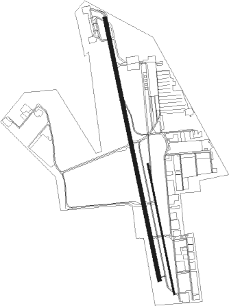
Runway info
Runway 17R / 35L  | ||
| length | 2144m (7034ft) | |
| bearing | 172° / 352° | |
| width | 30m (100ft) | |
| surface | asphalt | |
| displ threshold | 307m (1007ft) / 0m (0ft) | |
| Runway 17L / 35R | ||
| length | 1070m (3510ft) | |
| bearing | 172° / 352° | |
| width | 11m (35ft) | |
| surface | asphalt | |
| displ threshold | 0m (0ft) / 63m (207ft) | |
Nearby beacons
| code | identifier | dist | bearing | frequency |
|---|---|---|---|---|
| IAH | HUMBLE (HOUSTON) VORTAC | 12.6 | 118° | 116.60 |
| BVP | NIXIN (HOUSTON) NDB | 18 | 102° | 326 |
| CX | ALIBI (HOUSTON) NDB | 22.2 | 12° | 281 |
| TNV | NAVASOTA VOR/DME | 29.4 | 294° | 115.90 |
| EFD | ELLINGTON (HOUSTON) TACAN | 34.4 | 140° | 109.40 |
| UTS | HUNTSVILLE NDB | 40.4 | 357° | 308 |
| ELA | EAGLE LAKE VOR/DME | 46.7 | 242° | 116.40 |
| DAS | DAISETTA VORTAC | 47.6 | 82° | 116.90 |
| CL | ROWDY (COLLEGE STATION) NDB | 48.1 | 298° | 260 |
| MHF | TRINITY (SMITH POINT) VOR/DME | 52.3 | 123° | 113.60 |
| CLL | COLLEGE STATION VORTAC | 55.3 | 302° | 113.30 |
| VUH | SCHOLES (GALVESTON) VOR/DME | 59.7 | 139° | 113 |
Departure and arrival routes
| Transition altitude | 18000ft |
| Transition level | 18000ft |
| SID end points | distance | outbound heading | |
|---|---|---|---|
| ALL | |||
| GIFFA1 | 80mi | 13° | |
| ELD1 | 239mi | 41° | |
| AEX3 | 283mi | 77° | |
| LCH5 | 222mi | 84° | |
| IDU1 | 256mi | 236° | |
| LOA4 | 189mi | 330° | |
| CRIED1 | 132mi | 343° | |
| RW17R | |||
| INDIE8 | 207mi | 36° | |
| LURIC8 | 208mi | 48° | |
| STRYA8 | 231mi | 74° | |
| MMALT5 | 167mi | 97° | |
| HOODO7 | 118mi | 120° | |
| WATFO5 | 136mi | 143° | |
| KARRR6 | 150mi | 218° | |
| BORRN4 | 55mi | 256° | |
| PSX2 | 154mi | 262° | |
| STYCK8 | 132mi | 343° | |
| BLTWY7 | 77mi | 355° | |
| WYLSN8 | 87mi | 360° | |
| RW35L | |||
| INDIE8 | 207mi | 36° | |
| LURIC8 | 208mi | 48° | |
| STRYA8 | 231mi | 74° | |
| MMALT5 | 167mi | 97° | |
| HOODO7 | 118mi | 120° | |
| WATFO5 | 136mi | 143° | |
| KARRR6 | 150mi | 218° | |
| BORRN4 | 55mi | 256° | |
| PSX2 | 154mi | 262° | |
| STYCK8 | 132mi | 343° | |
| BLTWY7 | 77mi | 355° | |
| WYLSN8 | 87mi | 360° | |
| STAR starting points | distance | inbound heading | |
|---|---|---|---|
| ALL | |||
| WHAEL3 | 55.2 | 67° | |
| RIICE8 | 28.1 | 141° | |
| OHIIO4 | 24.6 | 261° | |
| HUDZY4 | 38.6 | 267° | |
Instrument approach procedures
| runway | airway (heading) | route (dist, bearing) |
|---|---|---|
| RW17R | BRKMN (143°) | BRKMN OILER (14mi, 123°) 2000ft |
| RW17R | SEALY (61°) | SEALY TUFFS (27mi, 33°) 2000ft OILER (6mi, 84°) 2000ft |
| RW17R | ZMSKL (204°) | ZMSKL WATSI (5mi, 205°) 2000ft OILER (6mi, 264°) 2000ft |
| RNAV | OILER 2000ft CUBIR (6mi, 172°) 1800ft HOPIP (3mi, 172°) 960ft DAMZO (turn) 640ft KDWH (2mi, 167°) 204ft (5694mi, 107°) 402ft KOHRY (5693mi, 287°) 2000ft KOHRY (turn) | |
| RW35L | JIDUK (18°) | JIDUK KOHRY (5mi, 84°) 1800ft |
| RNAV | KOHRY 1800ft HIWDE (6mi, 352°) 1800ft KDWH (6mi, 353°) 190ft (5694mi, 107°) 444ft OILER (5695mi, 288°) 2000ft OILER (turn) |
Holding patterns
| STAR name | hold at | type | turn | heading* | altitude | leg | speed limit |
|---|---|---|---|---|---|---|---|
| HUDZY4 | BRWCK | VHF | left | 55 (235)° | DME 20.0mi | ICAO rules | |
| HUDZY4 | WAPPL | VHF | left | 55 (235)° | DME 10.0mi | ICAO rules | |
| OHIIO4 | LYMBO | VHF | right | 71 (251)° | DME 20.0mi | ICAO rules | |
| OHIIO4 | ZEEKK | VHF | right | 46 (226)° | DME 10.0mi | ICAO rules | |
| RIICE8 | BAZBL | VHF | left | 313 (133)° | < 17999ft | 1.0min timed | ICAO rules |
| RIICE8 | CHMPZ | VHF | right | 340 (160)° | 1.0min timed | ICAO rules | |
| RIICE8 | HOMRN | VHF | right | 313 (133)° | < 17999ft | 1.0min timed | ICAO rules |
| RIICE8 | RIICE | VHF | right | 313 (133)° | < 60000ft | DME 10.0mi | ICAO rules |
| RIICE8 | TORNN | VHF | right | 334 (154)° | < 17999ft | 1.0min timed | ICAO rules |
| *) magnetic outbound (inbound) holding course | |||||||
Disclaimer
The information on this website is not for real aviation. Use this data with the X-Plane flight simulator only! Data taken with kind consent from X-Plane 12 source code and data files. Content is subject to change without notice.