Danbury - Danbury Muni
Airport details
| Country | United States of America |
| State | Connecticut |
| Region | K6 |
| Airspace | Boston Ctr |
| Municipality | Danbury |
| Elevation | 458ft (140m) |
| Timezone | GMT -5 |
| Coordinates | 41.37153, -73.48219 |
| Magnetic var | |
| Type | land |
| Available since | X-Plane v10.40 |
| ICAO code | KDXR |
| IATA code | DXR |
| FAA code | DXR |
Communication
| Danbury Muni ATIS | 127.750 |
| Danbury Muni UNICOM | 122.950 |
| Danbury Muni CTAF | 119.400 |
| Danbury Muni Clearance DEL | 128.600 |
| Danbury Muni Ground Control | 121.600 |
| Danbury Muni Tower | 119.400 |
| Danbury Muni NEW YORK Approach | 126.400 |
| Danbury Muni NEW YORK Departure | 126.400 |
Approach frequencies
| LOC | RW08 | 111.55 | 18.00mi |
Nearby Points of Interest:
P. Robinson Fur Cutting Company
-Tarrywile
-Octagon House
-Charles Ives House
-John Rider House
-Ball and Roller Bearing Company
-Meeker's Hardware
-Seth Seelye House
-Greenwood Avenue Historic District
-Thomas Hyatt House
-Rev. John Ely House
-Lewis June House
-Aaron Barlow House
-Umpawaug District School
-Hugh Cain Fulling Mill and Elias Glover Woolen Mill Archeological Site
-Union Hall
-West Mountain Historic District
-Putnam Memorial State Park
-Williams House
-Frederic Remington House
-Ridgefield Center Historic District
-Phineas Chapman Lounsbury House
-Daniel and Esther Bartlett House
-North Salem Town Hall
-Cosier-Murphy House
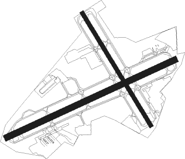
Runway info
Runway 8 / 26  | ||
| length | 1345m (4413ft) | |
| bearing | 74° / 254° | |
| width | 46m (151ft) | |
| surface | asphalt | |
| displ threshold | 112m (367ft) / 224m (735ft) | |
| Runway 17 / 35 | ||
| length | 956m (3136ft) | |
| bearing | 146° / 326° | |
| width | 30m (98ft) | |
| surface | asphalt | |
| displ threshold | 68m (223ft) / 70m (230ft) | |
Nearby beacons
| code | identifier | dist | bearing | frequency |
|---|---|---|---|---|
| CMK | CARMEL VOR/DME | 7 | 227° | 116.60 |
| BDR | BRIDGEPORT VOR/DME | 20.5 | 121° | 108.80 |
| IGN | KINGSTON VOR/DME | 23.3 | 311° | 117.60 |
| PWL | PAWLING (POUGHKEEPSIE) VOR/DME | 24.5 | 343° | 114.30 |
| SKU | STANWYCK (NEWBURGH) NDB | 27 | 286° | 261 |
| HVN | HAVEN DME | 27.7 | 100° | 109.80 |
| SW | NEELY (NEWBURGH) NDB | 34.2 | 279° | 335 |
| DPK | DEER PARK VOR/DME | 35.7 | 163° | 117.70 |
| FR | FRIKK (FARMINGDALE) NDB | 35.7 | 180° | 407 |
| MAD | MADISON VOR/DME | 35.7 | 94° | 110.40 |
| LGA | LA GUARDIA (NEW YORK) VOR/DME | 39.3 | 213° | 113.10 |
| CCC | CALVERTON VOR/DME | 40.7 | 123° | 117.20 |
| TEB | TETERBORO VOR/DME | 40.9 | 228° | 108.40 |
| HFD | HARTFORD VOR/DME | 45 | 74° | 114.90 |
| TE | TORBY (TETERBORO) NDB | 45 | 229° | 214 |
| JFK | KENNEDY (NEW YORK) VOR/DME | 46.2 | 201° | 115.90 |
| MM | MOREE (MORRISTOWN) NDB | 48.5 | 240° | 392 |
| CRI | CANARSIE VOR/DME | 49.2 | 209° | 112.30 |
| FOK | SUFFOLK CO (WESTHAMPTON B TACAN | 50 | 122° | 111 |
| PFH | PHILMONT (HUDSON) NDB | 54 | 345° | 272 |
| CAT | CHATHAM NDB | 57.2 | 236° | 254 |
| BAF | BARNES (WESTFIELD/SPRINGF VORTAC | 58.5 | 44° | 113 |
| CTR | CHESTER VOR/DME | 60.1 | 30° | 115.10 |
| CEF | WESTOVER(SPRINGFIELD/CHIC TACAN | 65.5 | 49° | 114 |
Departure and arrival routes
| Transition altitude | 18000ft |
| Transition level | 18000ft |
| STAR starting points | distance | inbound heading | |
|---|---|---|---|
| ALL | |||
| VALRE5 | 18.4 | 99° | |
| NOBBI5 | 16.6 | 135° | |
| RICED4 | 57.9 | 314° | |
Instrument approach procedures
| runway | airway (heading) | route (dist, bearing) |
|---|---|---|
| RW08 | BASYE (85°) | BASYE EGERS (5mi, 108°) 3000ft |
| RW08 | EZHED (54°) | EZHED EGERS (6mi, 360°) 3000ft |
| RNAV | EGERS 3000ft UHNUF (5mi, 74°) 2100ft KDXR (5mi, 74°) 507ft (4665mi, 119°) 857ft LOVES (4667mi, 299°) 3000ft LOVES (turn) | |
| RWNVA | FUGET (48°) | FUGET 2500ft |
| RNAV | FUGET 2500ft VITTY (4mi, 49°) 2000ft MACRG (5mi, 47°) 1540ft (4665mi, 119°) 1540ft LOVES (4667mi, 299°) 3000ft LOVES (turn) |
Holding patterns
| STAR name | hold at | type | turn | heading* | altitude | leg | speed limit |
|---|---|---|---|---|---|---|---|
| NOBBI5 | CMK | NDB | left | 16 (196)° | < 17999ft | 1.0min timed | ICAO rules |
| NOBBI5 | CRALY | VHF | left | 44 (224)° | < 17999ft | 1.0min timed | 210 |
| NOBBI5 | NOBBI | VHF | left | 356 (176)° | < 17999ft | 1.0min timed | ICAO rules |
| NOBBI5 | RKA | NDB | left | 313 (133)° | 18000ft - 45000ft | DME 10.0mi | ICAO rules |
| RICED4 | ALIXX | VHF | left | 108 (288)° | < 17999ft | 1.0min timed | ICAO rules |
| VALRE5 | IGN | NDB | right | 13 (193)° | < 17999ft | 1.0min timed | ICAO rules |
| VALRE5 | VALRE | VHF | right | 23 (203)° | 6001ft - 14000ft | 1.0min timed | 210 |
| *) magnetic outbound (inbound) holding course | |||||||
Disclaimer
The information on this website is not for real aviation. Use this data with the X-Plane flight simulator only! Data taken with kind consent from X-Plane 12 source code and data files. Content is subject to change without notice.