Madison - Lac Qui Parle Co
Airport details
| Country | United States of America |
| State | Minnesota |
| Region | K3 |
| Airspace | Minneapolis Ctr |
| Municipality | Lac qui Parle County |
| Elevation | 1082ft (330m) |
| Timezone | GMT -6 |
| Coordinates | 44.98643, -96.17786 |
| Magnetic var | |
| Type | land |
| Available since | X-Plane v10.40 |
| ICAO code | KDXX |
| IATA code | n/a |
| FAA code | DXX |
Communication
| Lac Qui Parle Co AWOS | 118.975 |
| Lac Qui Parle Co CTAF/UNICOM | 122.800 |
Nearby Points of Interest:
Madison Carnegie Library
-Lac Qui Parle County Courthouse
-Lac qui Parle Mission
-Appleton City Hall
-Gethsemane Episcopal Church
-First State Bank Building
-Canby Commercial Historic District
-Lundring Service Station
-Camp Release State Monument
-Chicago, Milwaukee and St. Paul Depot
-Big Stone County Courthouse
-First Congregational Church of Milbank
-Grant County Courthouse
-Swedish Lutheran Church of Strandburg
-St. Paul's Evangelical Lutheran Church & Parsonage
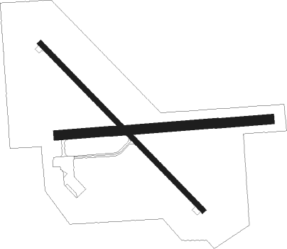
Runway info
Runway 14 / 32  | ||
| length | 1006m (3301ft) | |
| bearing | 130° / 310° | |
| width | 23m (75ft) | |
| surface | asphalt | |
| Runway 09 / 27 | ||
| length | 916m (3005ft) | |
| bearing | 90° / 270° | |
| width | 41m (135ft) | |
| surface | grass | |
Nearby beacons
| code | identifier | dist | bearing | frequency |
|---|---|---|---|---|
| MVE | MONTEVIDEO VOR/DME | 19.7 | 92° | 111.60 |
| GB | GARNO (MARSHALL) NDB | 31.2 | 151° | 253 |
| MML | MARSHALL VOR/DME | 35.6 | 147° | 111 |
| MOX | MORRIS VOR/DME | 35.8 | 20° | 109.60 |
| ATY | WATERTOWN VORTAC | 40.9 | 270° | 116.60 |
| BK | CHRLZ (BROOKINGS) NDB | 50.1 | 231° | 335 |
| AXN | ALEXANDRIA VOR/DME | 70.6 | 44° | 112.80 |
Instrument approach procedures
| runway | airway (heading) | route (dist, bearing) |
|---|---|---|
| RW14 | ARDUE (263°) | ARDUE WERUL (28mi, 277°) 3000ft WERUL (turn) 3000ft |
| RW14 | ATY (90°) | ATY SOYON (20mi, 79°) 3600ft WERUL (15mi, 80°) 3000ft |
| RW14 | MOX (200°) | MOX WERUL (31mi, 221°) 3000ft |
| RNAV | WERUL 3000ft GICYU (6mi, 130°) 2600ft WETMO (3mi, 130°) 1780ft KDXX (2mi, 129°) 1123ft (5667mi, 115°) 1283ft ZIRER (5661mi, 295°) 3000ft ZIRER (turn) | |
| RW32 | CLAPS (265°) | CLAPS ZIRER (32mi, 253°) 3000ft |
| RW32 | RISLE (321°) | RISLE ZIRER (11mi, 334°) 3000ft |
| RW32 | ZIRER (311°) | ZIRER 3000ft |
| RNAV | ZIRER 3000ft LALRE (6mi, 310°) 2600ft YIYNO (3mi, 310°) 1620ft KDXX (2mi, 311°) 1123ft (5667mi, 115°) 1278ft WERUL (5674mi, 295°) 3000ft WERUL (turn) |
Disclaimer
The information on this website is not for real aviation. Use this data with the X-Plane flight simulator only! Data taken with kind consent from X-Plane 12 source code and data files. Content is subject to change without notice.