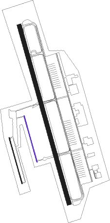
Abilene - Dyess Afb
Airport details
| Country | United States of America |
| State | Texas |
| Region | K4 |
| Airspace | Ft Worth Ctr |
| Municipality | Abilene |
| Elevation | 1789ft (545m) |
| Timezone | GMT -6 |
| Coordinates | 32.41968, -99.86207 |
| Magnetic var | |
| Type | land |
| Available since | X-Plane v10.40 |
| ICAO code | KDYS |
| IATA code | DYS |
| FAA code | DYS |
Communication
| DYESS AFB Ground Control | 118.350 |
| DYESS AFB Tower | 133.000 |
| DYESS AFB ABILENE Approach/Departure | 125.000 |
| DYESS AFB ABILENE Approach/Departure | 127.200 |
Approach frequencies
| ILS-cat-I | RW34 | 109.9 | 18.00mi |
| ILS-cat-I | RW16 | 109.9 | 18.00mi |
| 2.6° GS | RW16 | 109.9 | 18.00mi |
| 2.5° GS | RW34 | 109.9 | 18.00mi |
Nearby Points of Interest:
Abilene Fire Station No. 2
-First Presbyterian Church
-Saint John’s Methodist Church
-Shackelford County Courthouse Historic District
Runway info
Nearby beacons
| code | identifier | dist | bearing | frequency |
|---|---|---|---|---|
| DYS | DYESS (ABILENE) TACAN | 0.2 | 103° | 133.60 |
| ABI | ABILENE VORTAC | 3.7 | 359° | 113.70 |
| TQA | TUSCOLA (ABILENE) VOR/DME | 11.2 | 166° | 111.60 |
| AB | TOMHI (ABILENE) NDB | 11.9 | 123° | 353 |
| BWD | BROWNWOOD VOR/DME | 55.8 | 120° | 108.60 |
Disclaimer
The information on this website is not for real aviation. Use this data with the X-Plane flight simulator only! Data taken with kind consent from X-Plane 12 source code and data files. Content is subject to change without notice.

