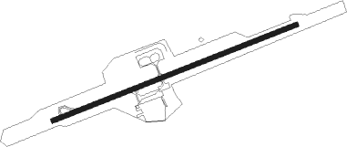
Blairsville
Airport details
| Country | United States of America |
| State | Georgia |
| Region | K7 |
| Airspace | Atlanta Ctr |
| Municipality | Union County |
| Elevation | 1890ft (576m) |
| Timezone | GMT -5 |
| Coordinates | 34.85444, -83.99733 |
| Magnetic var | |
| Type | land |
| Available since | X-Plane v10.40 |
| ICAO code | KDZJ |
| IATA code | n/a |
| FAA code | DZJ |
Communication
Nearby Points of Interest:
Old Union County Jail
-Old Union County Courthouse
-Raburn-Casteel House
-Blood Mountain Shelter
-Arkaquah Trail
-Walasi-Yi Interpretive Center
-Jacks Knob Trail
-John C. Campbell Folk School
-Towns County Jail
-Harshaw Chapel and Cemetery
-Cherokee County Courthouse
-Mineral Bluff Depot
-Clay County Courthouse
-Spikebuck Town Mound and Village Site
-James W. Baugh Homeplace
-Blue Ridge Depot
-Fannin County Courthouse
-Sautee Valley Historic District
-Lumpkin County Jail
-Fields Place-Vickery House
-Price Memorial Hall
-Calhoun Mine
-Burra Burra Mine
-First Baptist Church
-Gilmer County Courthouse
Nearby beacons
| code | identifier | dist | bearing | frequency |
|---|---|---|---|---|
| HRS | HARRIS VORTAC | 6.6 | 43° | 109.80 |
| ODF | FOOTHILLS (TOCCOA) VOR/DME | 35.8 | 103° | 113.40 |
| FKV | FLOWERY BRANCH (GAINESVILLE) NDB | 39.3 | 172° | 365 |
| DJD | CHERO NDB | 43.5 | 219° | 415 |
| TX | GWNET (LAWRENCEVILLE) NDB | 50.5 | 171° | 419 |
| BMW | BARROW COUNTY (WINDER) NDB | 58.7 | 156° | 404 |
| DTE | MARK ANTON (DAYTON) NDB | 59.3 | 304° | 394 |
| PDK | PEACHTREE (ATLANTA) VOR/DME | 60.6 | 197° | 116.60 |
| DOB | DOBBINS (MARIETTA) TACAN | 61.8 | 208° | 113 |
| AHN | ATHENS VOR/DME | 63.8 | 143° | 109.60 |
| SOT | SNOWBIRD VORTAC | 72.8 | 45° | 108.80 |
| HCH | HINCH MTN (CROSSVILLE) VOR/DME | 73.5 | 313° | 117.60 |
Instrument approach procedures
| runway | airway (heading) | route (dist, bearing) |
|---|---|---|
| RW08 | JIVIM (76°) | JIVIM 6400ft |
| RNAV | JIVIM 6400ft ZOTMI (7mi, 76°) 4200ft WUNPO (3mi, 76°) 3240ft KDZJ (4mi, 76°) 1952ft (5110mi, 113°) 2310ft ECIYU (5117mi, 293°) JIVIM (10mi, 223°) 6400ft JIVIM (turn) |
Disclaimer
The information on this website is not for real aviation. Use this data with the X-Plane flight simulator only! Data taken with kind consent from X-Plane 12 source code and data files. Content is subject to change without notice.
